‘Wearable’ devices send data to the cloud to create point cloud and 3D CAD models
Indoor Reality has released two ‘wearable’ indoor mobile mapping systems – a backpack and a handheld – that can be used to create point cloud and 3D CAD (Revit) models.
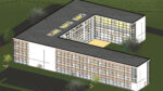
The company’s data acquisition technology is continuous rather than stop and go. According to the developer, it is 30x faster than traditional static scanners and can cover 200,000 square foot in 8 hours.
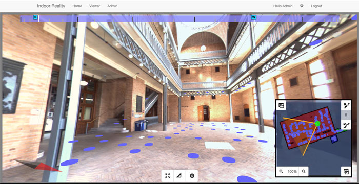
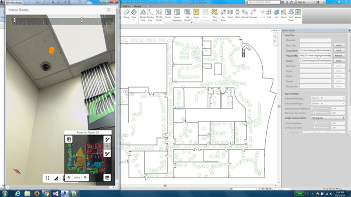
Once the capture is completed the operator uploads the collected data to the cloud for automated processing. In addition to creating feature rich point clouds and 3D Revit models it can be used to interactively visualise and virtually navigate the photorealistic 3D models via an intuitive web interface, allowing for 3D tagging of objects, and dimension measurements. Additionally, it can automatically locate assets and people inside buildings (Indoor GPS).
“The resulting data collected from the unprecedented fusion of technology enables property owners, facility managers and other stakeholders to collaborate, coordinate and communicate with each other throughout the life cycle of a property: from feasibility analysis, design, construction, and operation and maintenance,” said Founder and CEO, Avideh Zakhor.
If you enjoyed this article, subscribe to AEC Magazine for FREE