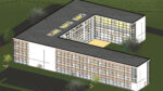
Interactive 3D models used to support planning and consultation activities for major infrastructure projects
Aerial photography and computer generated models of buildings and trees from Bluesky are helping specialist graphics company 3D Web Technologies (3DW) create interactive 3D visualisations.
According to Bluesky, the highly detailed models have been used to support planning applications and consultations for some of the UK’s largest infrastructure projects.
The models are designed to help improve communication and enhance the understanding of the impact of projects such as wind and solar farms, power lines and power stations, as well as housing and regeneration projects.
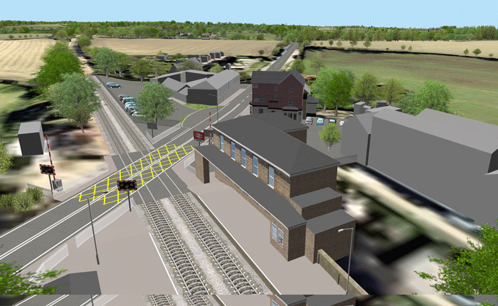
“By using Bluesky’s high resolution aerial photography, National Tree Map data, 3D Building Models as well as Ordnance Survey map data we can efficiently create models of a proposed development,” commented Kangjie Zhao, Development Director at 3DW. “The Bluesky data helps us to better represent the real world environment or site to its true likeness, which in turns helps our clients communicate their plans more effectively and efficiently.”
3DW uses the Bluesky data within its proprietary 3D modelling software. Terrain models are used to generate a 3D mesh of the earth’s surface onto which the Bluesky aerial images and Ordnance Survey map layers are overlaid. 3DW has also developed a specialist tool that allows Bluesky’s unique National Tree Map data and 3D Building Models to be read directly into the 3D model.
If you enjoyed this article, subscribe to AEC Magazine for FREE