A consistent, accurate, verifiable and uniform London model, accessible by all and managed by a single entity, has tremendous benefits for the whole industry – visualisation companies, architects and developers alike, says Gareth Munro, Managing Director, Designhive.
Why do we persist in developing our own independent models of London in a keeping-up-with-the-Joneses style race to better each other? There are at least four known London models, each owned and developed by separate visualisation companies, each with varying degrees of complexity and accuracy.
Almost certainly, whoever has the most detailed and accurate model of London has the competitive edge. The ability to create a 3D model of a building or other development and simply Ùdrop itÝ into an accurate model of London quickly and efficiently will inevitably win the support, backing and perhaps more importantly the business of architects and developers in the future.
However, the creation of multiple London models may provide competitive advantage to some and an instant win for those that ÙhaveÝ, but in the long-term does little to save time and cost for architects, developers and the wider industry.
It is firstly very difficult for an architect or developer to be absolutely certain that the London model used by their appointed visualisation company is the most current and accurate model available. For example, at this moment in time, online, there are four to five different models of Canary Wharf Tower and surrounding area. To be certain that the model selected is the most current and accurate is almost impossible when simultaneously other visualisation companies are adding to and enhancing alternative models.
It is also unlikely that any one visualisation company would maintain a complete model of London, but more likely to maintain key areas, Docklands or Greenwich for example. The knock on effect is a simple case of inefficient work duplication. For visualisation companies without access to a complete London model it is often necessary to create a model of a specific area from scratch, even though it is possible that area is already in existence with an alternative visualisation company. For the ÙhavesÝ, this is competitive advantage at its best, for the Ùhave notsÝ this is a poor use of resources. For developers and architects, this is a costly and time consuming exercise.
Single London model
It may sound altruistic, but in the grand scheme of things, I believe that the world of architecture and design would benefit from a single London model freely accessible to all. It is no secret that Google Earth hosts SketchUp, a product that many might say is fast becoming a common software platform for architects and developers to use from the early stages of a project onwards. With this common platform, designers and architects could easily work together to develop a single London model, available for all to download and update. In this way, all developers and architects could quickly and easily develop a simple 3D model of their own buildings using SketchUp or any other modelling software such as Studio Max and drop it into the Google Earth London model, providing a single point of reference for the industry.
{mospagebreak heading=Page 1}
This would clearly be a step in the right direction, but it is also important that any single London model developed is the most accurate and up-to-date model available. The model must therefore be controlled and managed by a single entity that can ensure best practice and accuracy before allowing a 3D model building to be submitted to the London model.

Dr. Andrew Hudson-Smith, Research Fellow from the Centre for Advanced Spatial Analysis (CASA), part of London University, has recently launched an initiative that will drive forward the development of such a single accurate London model.
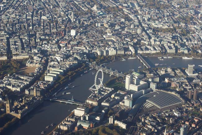
The model is within the boundaries of the M25, transferable to the Google Earth platform and fully supported by The London Mayors Office. It is designed for a number of purposes from pollution monitoring to a basis for location-based computer games. However, it also has the potential to become the desired single point of reference for developers, architects and visualisation companies.
In practice, only architects, developers and other companies submitting plans in London have access to the model and then only with the permission of The Mayor of LondonÝs Office. Access will be granted on an ad hoc basis and per project. It is hoped that through CASA, The Mayors of LondonÝs Office and a stringent approach to submitting to the model, the UK will have for the first time, a single model of London accessible by all, accurate and up-to-date.
Dr. Andrew Hudson-Smith obviously supports our philosophy. ýOur aim is to make a single accurate model of London freely available to all,¯ he says. ýThe more people now contribute to this model the quicker it will grow, the more accurate it will become and the more benefit it will deliver to the entire industry.
Designhive is one of the first visualisation companies to recognise the need for a single accurate London model and I now hope that other visualisation companies and key architects and developers from the industry will follow.¯
He adds, My thanks also go to London Connects for helping to coordinate the modelÝs development to date and assisting the roll out to the London Boroughs.¯
Benefit
It is now time for visualisation companies to come together, leave the competitive edge behind and begin contributing to Dr. Andrew Hudson-SmithÝs model, for the sake of the industry.
Architects and developers also have a roll to play. They must now push visualisation companies to ensure that any models developed are submitted to Dr Andrew Hudson-Smith at CASA and The Mayors Office to ensure that duplication of work, starting models from scratch and poor use of resources is a thing of the past.
ýIf a single London model will ensure faster turnaround time on the creation of 3D buildings and verifiable images then ultimately it will help us to get through planning more quickly. A single London model is a concept that we fully support,¯ says Andy Costa from London architectural practice, Jestico & Whiles.
Conclusion
New York has done it, with a great model that allows you to look down Fifth Avenue and fly around the Empire State Building. LetÝs not be left behind the times and work together to build the most accurate model, of any city on Google Earth. I believe that this is the way the industry is moving.
Research examples can be found on Dr Hudson-SmithÝs blog: www.digitalurban.blogspot.com
Contact asmith@geog.ucl.ac.uk to be involved with the London model.