
Greg Corke reports on a new 3D dataset from the creators of NextMap Britain that has the potential to bring digital terrain modelling into the hands of the CAD masses.
Off-the-shelf 3D terrain data is becoming increasingly important to engineers and architects. For highway, railway, and site design it is used to balance cut and fill volumes at the tender stage, plan construction sequencing, or perform environmental impact studies. For building projects it is used to assess the topography of sites, form the backdrop for 3D visualisations and help assess the impact of projects on the surrounding area through line-of-sight and acoustic studies.
There are many different terrain data products available, each of which varies in terms of accuracy, suitability to the task at hand and of course price. A new product to recently hit the market is OTM (Optimised Terrain Model) from Intermap Technologies, the developer of the NextMap Britain dataset. OTM is an off-the-shelf product that is available for all 244,000 square kilometres of the UK, but most importantly it has been designed specifically for use with CAD and design visualisation software.

Optimised TIN models
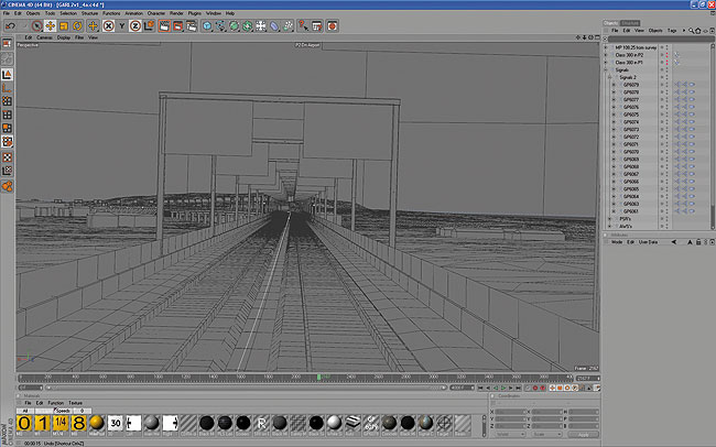
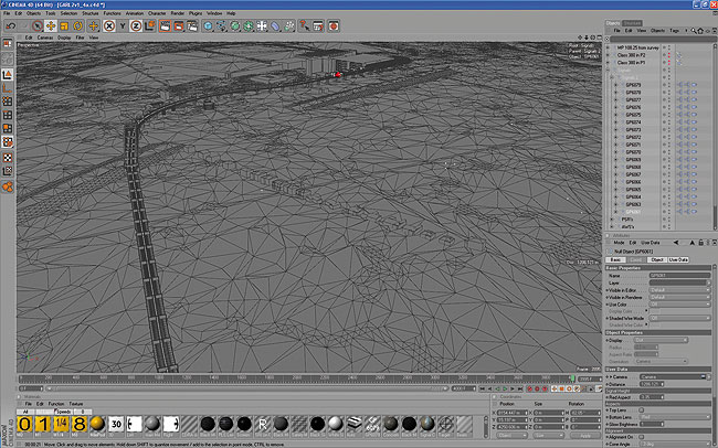
To represent a terrain inside a CAD application requires a TIN (Triangular Irregular Network). These are vector-based surfaces, made up of nodes and lines that form a mosaic of triangles. However, a lot of 3D terrain data comes formatted for use in Geographic Information Systems (GIS) in the form of a Digital Elevation Model (DEM). This is a gridded dataset where every point on the grid has a height value (or elevation point).
TINs can be created from DEMs, and dedicated terrain modelling software such as AutoCAD Civil 3D can deal with the conversion process. The problem is most TIN datasets are huge in terms of MB and while high-performance workstations can cope with the loads they can grind to a halt when files reach a certain size.
The obvious solution is to optimise the data, whereby the TIN is simplified while retaining critical data. This can be a complex process and finding the right balance between file size and which data to keep is not easy, particularly for the inexperienced user.
With a view to providing an off-the-shelf product for CAD use, Intermap’s OTM product is pre-optimised so approximately 15 percent of the most important raw TIN data is retained. This results in a relatively lightweight data format that can be used on moderately specified computers and also be accepted by virtually all CAD systems.
Putting the size of data in perspective, an average 100 square kilometre dataset is only approximately 45MB and AutoCAD or MicroStation can quite happily handle this in 3D, even on a moderately specified laptop. With the equivalent area in raw TIN format the same machine would struggle.
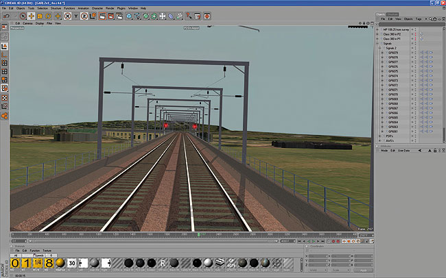
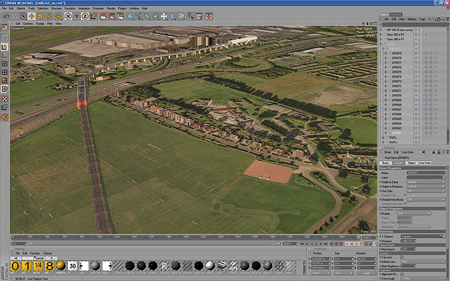
OTM data is readily available in the 2007 DWG format, which is widely supported in many products including Revit, 3ds Max, SketchUp, MicroStation, Cinema 4D and, of course, any AutoCAD-based product, such as Civil 3D or Map 3D. Other formats are available on request and the data can also be geo-referenced to a variety of mosaic gridded aerial photography formats. These can then be easily draped over the terrain to create an instant 3D model for design visualisation.
Accuracy of data
OTM is derived from Intermap’s NextMap Britain DEM (Digital Elevation Model) data, which was created in 2003 and offers a vertical accuracy between 0.7m and 1.0m. With this in mind it is not the most accurate data available in the UK. Some LiDAR (Light Detection And Ranging) data can offer up to 10cm accuracy, but this is reflected in the price.
Of course when it comes to 3D terrain data it is all about choosing the data most suitable to the task at hand. For design visualisation and site appraisal the accuracy of Intermap’s OTM data should be more than enough. This is also true for tender stages of earth moving projects, where engineers can use the data to help cost jobs without having to invest time and money in expensive ground surveys.
Some firms may find a combination of datasets suits their requirements. For highway design, a detailed ground survey could be used at the heart of the project, then as you move away from your area of interest photogrammetric or LiDAR data could be used with the backdrop being formed from OTM data.
www.g-vr.co.uk
www.gioconda.co.uk
How OTM data is made
Intermap’s NextMap Britain Digital Elevation Model (DEM) is first converted into a raw TIN (Triangular Irregular Network), a process that simply involves triangulating the nodes. With over 244,000 square kilometres of data to optimise, the translation process from raw TIN to OTM needs to have next to no human intervention, but a ‘one size fits all’ algorithm is not practical.
The system analyses the fall of the ground, identifies any flat spots and large areas of open water and then removes data that is not 100 percent necessary, while still retaining the essential characteristics of the terrain. To illustrate this with an analogy, consider a kitchen table. There is little point in using thousands of points to define each sub-mm crack when the whole thing can be approximated very well with four points.
To manage the conversion process, Intermap started off by chopping the data into tiles of 500 square metres. Each tile was given a target face count, which roughly equates to keeping 15 percent of the raw TIN data, but the algorithm is allowed to deviate above and below this value depending on the complexity of the terrain. For example, if the terrain is flat the data can be optimised more but if it is hilly then it is optimised less so vital information is not deleted. In order to retain a perfect seam between each tile, only 495m out of each tile’s 500m was optimised on this first round. Adjacent tiles are then stitched together automatically so there are no overlapping triangles, or problems with faces overlapping each other.
Optimising the raw TIN data in order to produce the OTM also has an impact on accuracy, but according to Intermap, while small inaccuracies are to be expected, it is almost identical to the raw data. Intermap can also supply raw data or run the data through different optimisation routines to find the balance between the degree of optimisation and file size. The 15 percent optimisation is deemed to be the best fit for most AEC users, but Intermap also has plans to offer the data on-demand through a web portal at customer-specified levels of optimisation.
The cost
OTM data is sold in tiles and depending on the quantities bought cost between £24-£70 per kilometre tile. As with any tiled data, you end up paying a premium if your area of interest lies on the corner of four tiles, as realistically all four tiles will be required. Ring-fenced areas may be possible in the future but any system would need to be able to stitch these user-defined boundaries together should they be extended.
Conclusion
While 3D terrain data is becoming increasingly popular in the AEC sector, there are still many architects and engineers that are simply not aware of how cost effective and easy to use off-the-shelf data has become. Available in the widespread DWG format, Intermap’s OTM is ideal for CAD users who want to get up and running with their data straight away. Also, because of its lightweight optimised format, it doesn’t need a particularly powerful workstation to run. Subsequent processing with the data, such as rendering, is also more efficient.
OTM is by no means suitable for all types of projects. It is about choosing the right data for the task at hand, but when you need a readily available source of 3D terrain data for anywhere in the UK it is a very cost-effective solution for instantly putting your projects into a real world context.