Web-based application converts static laser scans into immersive 360° walkthroughs
Laser scanning professionals can now automatically convert E57 point cloud files into interactive, realistic 360° walkthroughs, using the latest release of NavVis IndoorViewer.
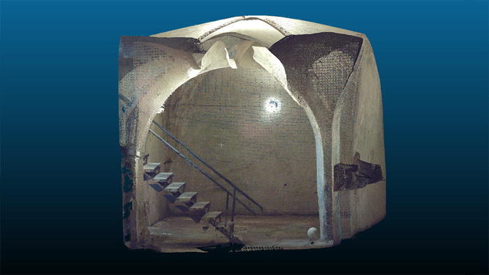
NavVis IndoorViewer is a web-based application that displays ‘realistic’ digital twins using 360° panoramic images, point clouds and maps generated by 3D scanning devices. Users can move around digital twins of scanned spaces as if they are on site and use the interactive functionality to add, search for and route to geo-tagged information and take accurate measurements.
NavVis IndoorViewer is designed for laser scanning professionals who want to extend the use of point clouds beyond BIM models and building plans to a wider range of building stakeholders who would also benefit from 3D scan data. According to NavVis, this is particularly relevant for stakeholders working on complex projects or properties, such as manufacturing facilities and construction sites, where IndoorViewer enables remote access to the site and is used as a platform for collaboration and exchanging information.
“IndoorViewer was originally developed to display the data captured by our indoor mobile mapping system in a way that is accessible to every user. In recent years, we have seen that making scan data available to every building stakeholder is fulfilling an unmet need. Many of our partners using a NavVis indoor mobile mapping system for conventional scanning projects are offering IndoorViewer as an additional deliverable to increase the number of stakeholders who can make use of this data,” said Felix Reinshagen, NavVis CEO.
“To meet the growing demand for extending the use of valuable 3D scan data, we developed a feature that automatically renders 360° immersive images from structured E57 point cloud files. The latest software release brings the full functionality of IndoorViewer to E57 point cloud files and therefore marks an important step towards our goal of making scan data meaningful for every building stakeholder.”
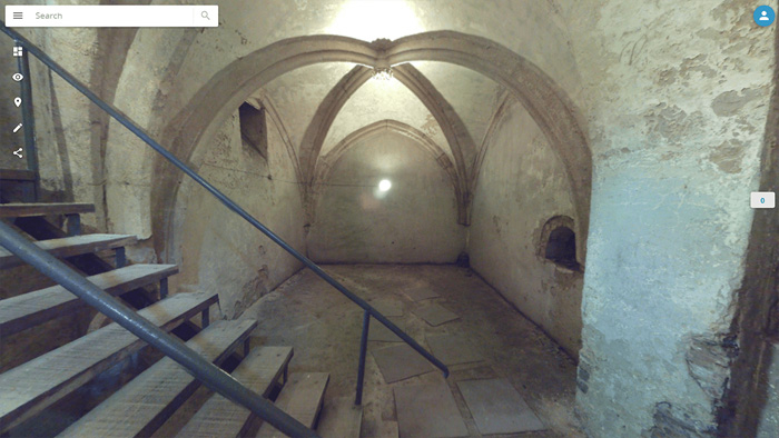
NavVis IndoorViewer currently supports third party point cloud files in most standard formats. However, a key component of the immersive experience that NavVis IndoorViewer provides is the 360° panoramic images. The new IndoorViewer feature bridges this gap for structured E57 files by automatically rendering 360° immersive imagery from E57 point cloud files. This means data collected by terrestrial laser scanners can now also be used to create realistic, immersive 360° walkthroughs that can be published and shared online without the need to download or install software.
If you enjoyed this article, subscribe to our email newsletter or print / PDF magazine for FREE