Continuing the theme of previous articles, James Cutler, eMapSite, aims to further demystify OS MasterMap, by explaining how to use it and why for so many commercial users new systems need not be sought, contrary to advice in some quarters.
For the Ordnance Survey, GIS professionals and others the continuing demand for “OS Land-Line like” large-scale data remains something of a mystery given the now well-established presence and availability of OS MasterMap. As discussed elsewhere the slow take up and suspicion can be put down in part to indifferent understanding of markets, poor communications, a conservative market place and an initial technical emphasis that raised the barriers to uptake. Attitudes change, understanding improves yet still OS MasterMap is low on the RADAR of many a CAD professional and their engineering colleagues.
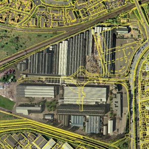
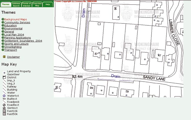
Land-Line and SuperPlan have retained significant market share alongside their spaghetti-like structure, innate absence of attribution and other productivity-denting features. Years ago these were also seen as a hindrance but by their very longevity have become the de facto face of large scale mapping owing in part to the efforts of OS and the Options outlets in establishing and maintaining a common means of representation in graphical form. This achievement today means that some 70% of you use OS large-scale data solely as a backdrop to your own activities be they CAD or GIS or in the more prosaic but equally demanding area of presentation, be it for planning, consultation or other purposes.
Through a series of drawing objects and other technical features linked to seed points, the “old” products provide a template by which new products are gauged. Even if the new products offer enhancements, they still have to “look like” the old ones to establish their credibility. Most people don’t think like this when it comes to cars, phones, appliances and such like – even retro items contain modern features!
Many suppliers have sought either to replicate the appearance of Land-Line/SuperPlan in their OS MasterMap based offerings and/or to adhere to the initial display style/schema adopted by OS (the latter, with its pastel colours, to the surprise of some both in the OS and the wider community). The maintenance of Land-Line styles within OS MasterMap products does allow a reduced set of its advantages to this user base by the back door (in the form of DXF).
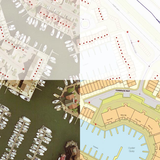
In the case of Land-Line and SuperPlan the key ingredients by which traditional large scale data users have been assessing alternative products seem to be road centre-lines, grid lines, symbology (especially bench marks) and perhaps slope representation. However, a more thorough investigation reveals that many users do not use road centre-lines (they are neither the geometric centre of the road or associated with road markings) and create their own grid lines according to the map to be printed. With benchmarks of diminishing importance owing to modern GPS equipment and with the capability within most CAD systems of applying user-selected symbol libraries to seed points even these aspects fall well down the modern CAD professionals’ demands.
Added to which is the fact that large-scale vector mapping has long been the backdrop map of choice for CAD users; as such it provides the basis for defining new AEC activities and projects, for the creation of new features and structures, for the measurement of distances between and areas of existing features and for the production of output for a diverse user base from project managers to public consultation.
" Land-Line and SuperPlan have retained significant market share alongside their spaghetti-like structure, innate absence of attribution and other productivity-denting features. "
The perverse reality is that, tradition and familiarity aside, Land-Line and SuperPlan do not actually satisfy these requirements very effectively – users cannot measure areas directly, there is little structure and inadequate attribution for creating informative output easily, symbols are actually drawing objects or blocks, polygon features have to be created manually and multiple line segments often have to be assembled to create a single entity for project specific use.

With additional pressures to produce colourful, informative maps rapidly from source data, “like the GIS people” also on the agenda, focus is very much on productivity, value, re-use and collaboration. OS MasterMap serves all these demands elegantly owing to an inherent structure that enables easy manipulation by supplier and users alike.
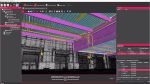
OS MasterMap: the new backdrop
Planners, developers, architects, engineers and others face a number of barriers in bringing their proposals, concepts and innovative ideas into being or to market. The regulatory environment demands a map-based (or spatial) element at all stages of development. Such maps need to be informative, consistent and equally capable in colour or black and white while at the same time conforming to anticipated content and appearance (i.e. with grid lines, annotation and so on).
In other sectors, such as insurance, emergency services, civil defence and local government, the drive both for compliance with e-government objectives but also for greater efficiencies continues to underlie the emergence of customer-facing information capture and reporting systems in which spatial information is one (critical) component. The “customers” equate in this instance to consumers, frequently less “map”-aware than their planning counterparts but equally (if not more) in need of simple, informative mapping to enable them to effectively communicate the desired information to the requesting authority, usually for a specific location at a very local or detailed level.
And so to the Desktop
For these and other scenarios a small but growing band of service providers, recognising the accelerating integration of GI into BI (business information or intelligence) and using server-side technology (i.e. usually invisible to the user) is breaking down the high-cost, client-side software-centric model of map access, utilisation and sharing.
Modern enterprise applications bring together components from a variety of systems, typically in a web browser environment, to provide (in different combinations) the customer facing and back office solutions to make business processes efficient and businesses profitable. With its application interfaces, inter-operability, W3C/OGC compliance, database-centricity and functional components that adhere to common technologies (XML/GML, .net, SOAP, UDDI etc), the map provisioning community is now very much a part of this model.
The result? For the medium-term no one is suggesting (as yet) that CAD and GIS applications are being replaced or even made redundant, in fact quite the contrary. With maps being the primary “killer app” used in many telecoms/3G advertising, Google maps, Microsoft MapPoint, census maps, election maps and location based services (LBS), the common or garden map has never been so visible or so critical. Platform independent mapping components that integrate map data, its associated information and its behaviour are already bringing large scale mapping to wide swathes of the public in a web browser.
An increasing familiarity with what is in essence a large, rich and complex map database (OS MasterMap) through such services broadens awareness of mapping in general and of the important if not critical role played by those who use it to serve us (notably the CAD and GIS users who support or indeed are the architects, civil servants, planners, engineers, utilities etc charged with planning, building and maintaining national infrastructures).
With an explicit consistency in presentation essential to build user confidence in web based applications paralleling CAD and GIS based large-scale digital data use and representation, an unconscious “twin-track” approach has emerged that is to be embraced.
Definitive (as in ubiquitous), intelligent (as in you get what you want and can if necessary find out more) and accessible (as in when you want and how you want), OS MasterMap is beginning to live up to its promise, with nary a GIS or CAD system in sight.
This article was written by James Cutler, CEO at eMapSite, a platinum partner of OS