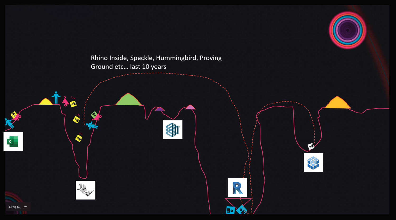
Collaboration BIM is bust: how should AEC data work? Posted by Martyn Day - February 10, 2022 HOK’s Greg Schleusner on the cause and the cure and how we could free data…
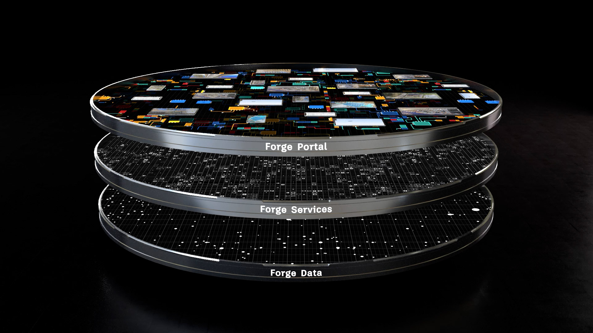
Cloud Autodesk Forges its future Posted by Martyn Day - February 8, 2022 We explore the hype and reality of Autodesk’s cloud-based development platform.
Construction What next for AEC software? Posted by Martyn Day - February 7, 2022 How far have we come in 20 years, where are we going, and how a…
BIM Exploring BIM’s hidden past Posted by AEC Magazine - February 8, 2022 We don’t hear much today about Rucaps or Sonata or Reflex - but all three…
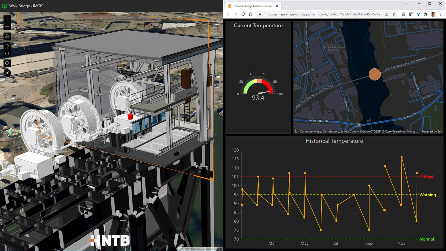
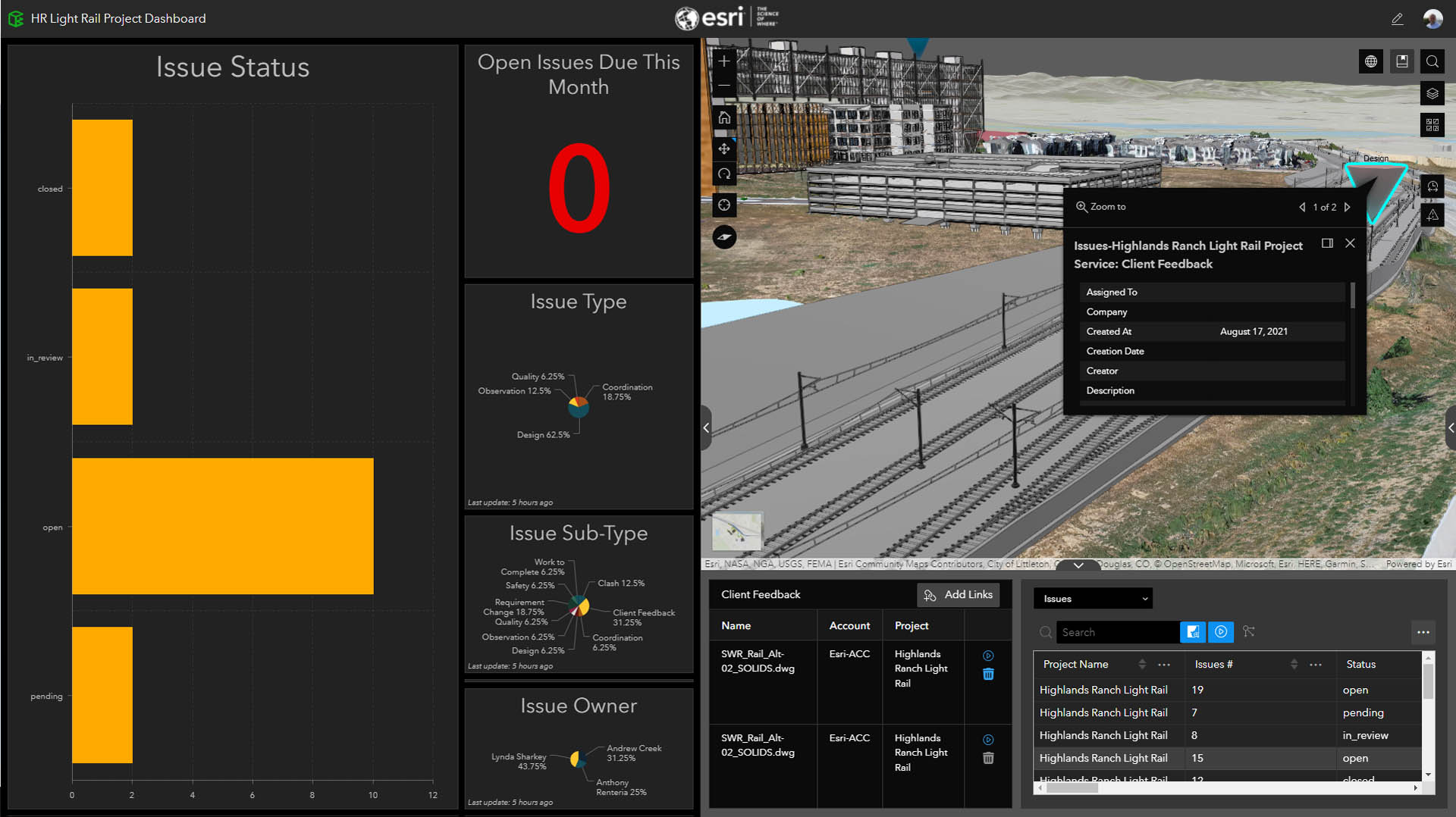
Geospatial Beyond construction: geospatially enabled BIM Posted by AEC Magazine - February 7, 2022 To replace a complex rail bridge HNTB put ArcGIS GeoBIM to the test
Cloud Towards an open future: Keith Bentley interview Posted by AEC Magazine - February 7, 2022 In this frank interview, Bentley’s CTO talks cloud, subscription, digital twins and the future of…
AI Data as a tool for the architecture of the future Posted by Havard Haukeland - February 7, 2022 Håvard Haukeland explores what the ‘digital toolkit’ of architects might look like in the near…
Geospatial Esri ArcGIS GeoBIM – the link between GIS and BIM Posted by Martyn Day - February 3, 2022 After four years of development, the Esri-Autodesk Partnership has finally delivered its first offspring
Reality modelling Open Design Alliance kick-starts scan-to-BIM SDK Posted by AEC Magazine - January 17, 2022 Software Development Kit will convert point cloud datasets into Revit and IFC models
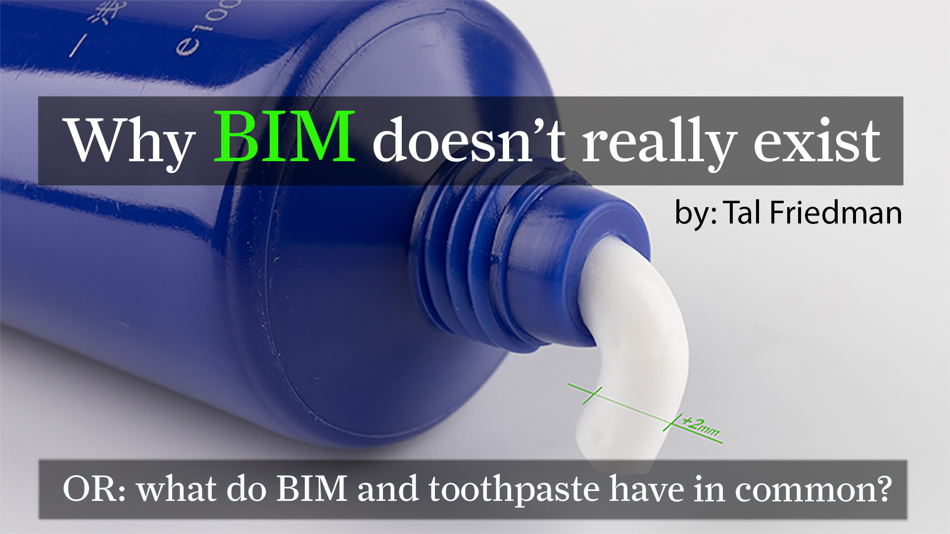
BIM Power to the planners (and why BIM doesn’t really exist) Posted by Tal Friedman - November 30, 2021 The BIM software sector has five steps to take if the technology is truly to…