Building BIM-ready models from point cloud requires considerable manual construction, a skill level developed by working with and understanding fully the nature of the data. Plowman Craven’s Peter Folwell explains.
The profile, awareness and capabilities of 3D laser scanning have grown exponentially over the last couple of years. With the UK government mandate to deliver level 2 Building Information Modelling (BIM) by 2016 for publicly funded work, and an increased market trend towards refurbishment and retrofit, there has been a greater emphasis on the use of 3D laser scanning technology and the ability to deliver BIM-ready models of the existing environment.
There has been an increased awareness of the benefits that this powerful technology can bring through the whole project lifecycle — from the ability to collect a lot of up-front accurate information for feasibility studies and planning, through to wall alignment checks at demolition, clash detection, design comparisons and monitoring during construction. Other advantages include an accurate solution for off-site manufacture, pre-fit out surveys and asset recording for facility management.
One result is an increase in the visibility of scanning manufacturers extolling the virtues of their products and ease of use for all, plus a surge in development of software abilities to handle large volumes of point cloud data. This, coupled with a decrease in costs and barriers to entry, is starting a possible trend away from the traditional surveying expertise route for delivery.
The emergence of 3D laser scanning opens up other professional’s minds to the benefits on offer but without a full understanding of the complications, limitations and considerations that need to be taken fully into account, success can be limited.
There is an increasing number of users in the market, but many have limited experience and understanding of the full range of operational issues and what needs to be considered and addressed in order to achieve accurate and useable information.
Plowman Craven has been associated with 3D laser scanning technology for over 14 years now, both utilising it and helping to develop it. In recent years, we have completed numerous high profile BIM associated projects within different market arenas, delivering both laser scan data and BIM-ready models. We are now in a position where we have a highly experienced understanding of the full technical applications, workflows required, issues and a comprehensive catalogue of lessons learned.
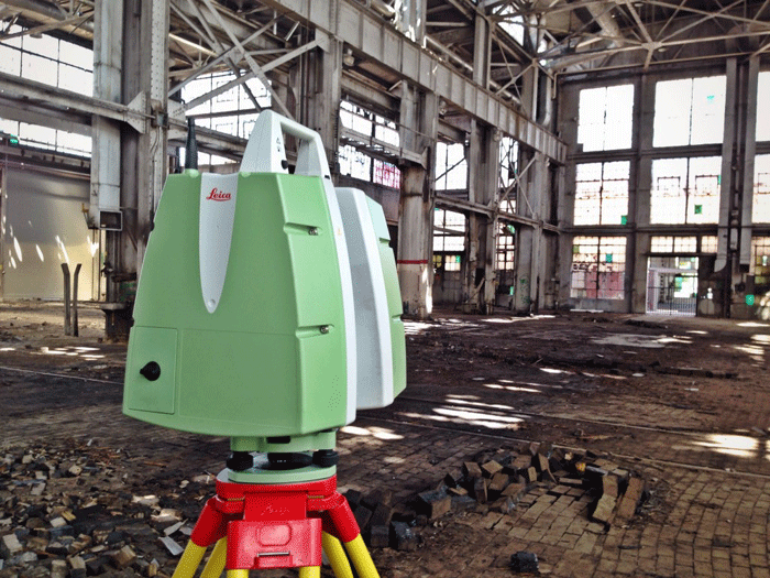
3D laser scanning technology provides a number of considerable advantages and benefits when collecting data in an existing environment, particularly in complex, architecturally challenging and safety restricted situations. Collecting data rapidly, in 360 degrees, with speeds of up to 1,000,000 points a second provides an instant record and a complete data set in order to extract 2D information or build BIM-ready models.
However, it is a line of sight technology and, contrary to popular belief, it does not go through walls or ceilings. It sounds a great solution but what needs to be considered in order to achieve the desired outcome?
Right tools for the job
There are many scanners on the market at different cost prices and capabilities. These could be static, airborne, vehicle mounted and even handheld. It is critical to understand what each can deliver and the most appropriate use. The right choice of tool can have a profound effect on the project cost and also accuracy of the data.
Quality control
The real black art of 3D laser scanning is knowing what is likely to be going on ‘under the bonnet’ and understanding how to achieve optimum performance and the required results.
Angles of incidence: Geometric considerations and location to reduce glancing
Surface reflectivity: Different surfaces and conditions produce a varied quality
Scanning speeds: Gauges the intensity and volume size of the point cloud
Quality settings: Filter settings that influence the level of noise in the data
Target ranges: Consideration of distance to target features related to instrument capability and geometrical baseline/control
Calibration: Continuous monitoring of instruments set up and operational state
Operational procedures: Workflows/continuous training to ensure efficiencies and accurate/usable data.
The above are all quality considerations but data control is key. ‘Cloud to cloud’ registration of a number of data sets is appropriate for certain scenarios but for complete integrity, target control and relation to a control network is essential for overall accuracy and data confidence. The importance of this methodology is not always recognised outside of particular professions.
Capabilities, capacity and liability
Data collection utilising laser scanning technology is a measurement surveyor’s core activity and skill set. Workflows and training are aligned to continually provide information in many varied formats to ensure the understanding on how best to represent ‘real’ geospatial scenarios within a design environment. Ultimately, there has to be considerable responsibility, reliance and trust to deliver accurate information that will provide the platform for designs, construction and manufacture processes.
Surveyors are becoming more ingrained into the BIM process and are beginning to play a larger role, in collaboration with other stakeholders, outlining and assisting employer’s information requirements and BIM execution plans. Data collection expertise, and having a real understanding of capabilities, can bring additional valued knowledge to the table, reducing risk on the projects.
Data management
We are all aware that software and hardware capabilities are developing at a rapid rate and the ability to handle large data sets is improving exponentially, especially on the cloud, but it is hard to keep pace, and with cross-business IT demands, it is difficult to justify having the most appropriate or latest software or hardware.
Raw point cloud data can produce enormous file sizes which need to be manipulated and managed. Giga-bytes of point cloud data from a single setup will contain erroneous and unwanted data that needs to be cleaned and registered. This is not an automatic process!
The use of these very large datasets can often be a real burden to the design team and on more than a couple of occasions we have heard horror stories of abandonment of the data altogether. In order to avoid this scenario CAD software capabilities are important, but key will be how the data is broken down into manageable portions for efficient handling.

Peter Folwell is a director at Plowman Craven with responsibility for survey deliverables within the BIM environment. He is involved in Survey4BIM and a founder of BIMnet.
Building BIM-ready models from point cloud is not yet an automated process and requires considerable manual construction — a skill level developed by continually working with and understanding fully the nature of this data. Effectively, the dataset is a powerful archive of information that can be accessed and enhanced continuously throughout the lifecycle of a project. Understanding its history and make-up provides the ability to manage the information more effectively and be of greater use to all stakeholders. It allows for more cost effective solutions. For example, it may be more efficient to build a less detailed model at the start of the process, but have the capacity to return to the data to model in greater detail in critical areas at a later stage.
Having managed and gained a full understanding of the true nature of the point cloud, real value can be gained in utilising the data for other purposes, such as heritage recording or obtaining asset information, particularly when the detail can be enhanced with digital photography.
3D laser scanning and delivery of BIM-ready models can provide a data solution for many aspects of the BIM process. As the awareness of 3D laser scanning continues to grow so does the misinformation about its capabilities and where its applications lie. It can be a powerful tool in the right hands and answers a multitude of scenarios but you have to be sure you know what you have, and what you are doing. Just because the data may look right, it does not mean it is right.
In order for 3D laser scanning technology to have a major influence in BIM development and deliver what can realistically be achieved, it is necessary to have a comprehensive understanding, not just in relation to the real benefits of the technology itself, but also to the ‘black art’ of using it.
If you enjoyed this article, subscribe to AEC Magazine for FREE


