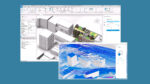
With more AEC collaborative design solutions available, employees in disciplines that once worked in silos are increasingly connected and sharing information with their colleagues. Martyn Day caught up with Marc Goldman, director of AEC industry at Esri, to discuss the company’s focus on BIM integration
Since 2017, Esri and Autodesk have pursued a strategic partnership to bridge longstanding divides between GIS (geospatial) and BIM (building/infrastructure design) data.
The shared ambition of executives at the two companies is to enable engineers, planners and asset owners to author, analyse and manage projects in a unified, spatially aware environment, from design through to operations.
Initially, the two companies announced plans to build a ‘bridge’ between BIM and GIS, so that Revit models could be brought into Esri platforms and to support enhanced workflows in ArcGIS Indoors and ArcGIS Urban.
Find this article plus many more in the September / October 2025 Edition
👉 Subscribe FREE here 👈
Over time, this partnership has evolved, to include Connectors for ArcGIS – tools for Civil 3D, InfraWorks, and AutoCAD Map3D – that support live linking of GIS data into BIM software with bidirectional updates.
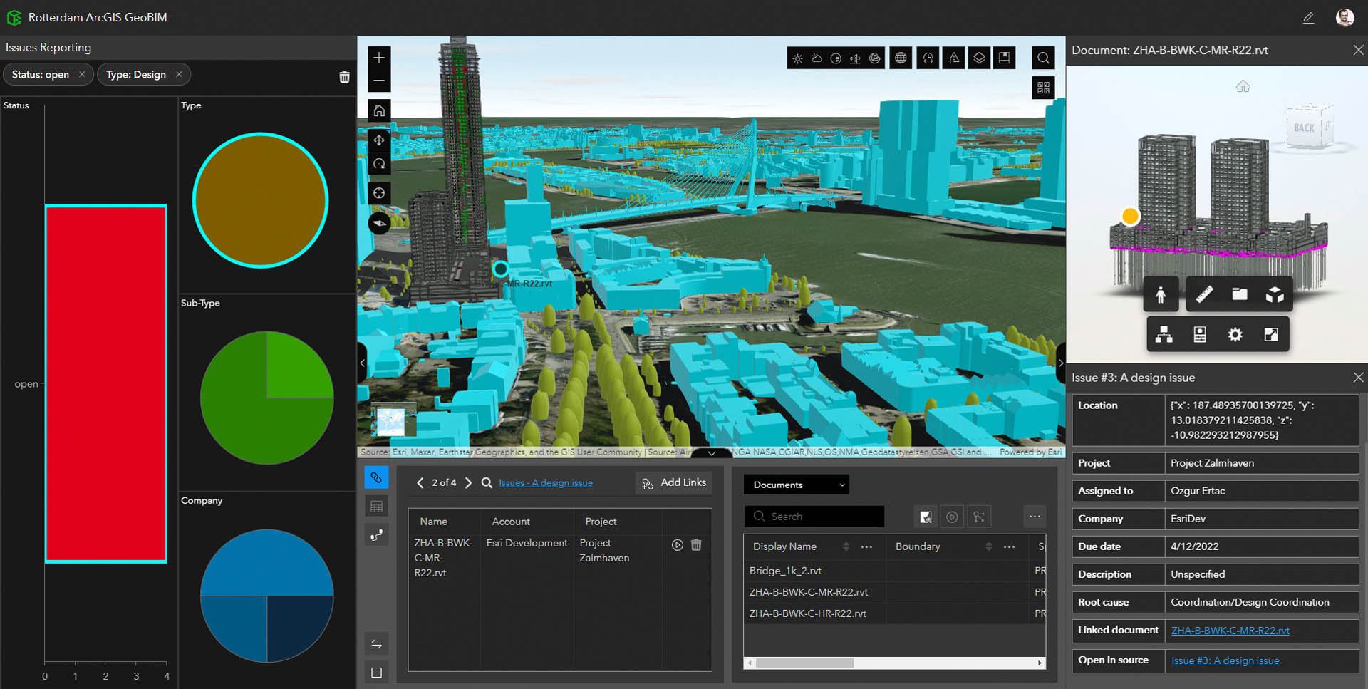
Today, that integration is embodied by ArcGIS GeoBIM, a web-based platform linking Autodesk Construction Cloud (also known as ACC and previously named BIM 360) to Esri’s ArcGIS. This enables project teams to visualise, query and coordinate BIM models within their real-world geographic context, according to Marc Goldman, director of AEC industry at Esri.
“GeoBIM provides a common dashboard for large-scale projects, allowing AEC firms and owner-operators to visualise GIS context alongside BIM content and object properties, even though the source files may reside in ACC,” he explains.
The technical integration now takes two distinct forms, tailored to project needs.
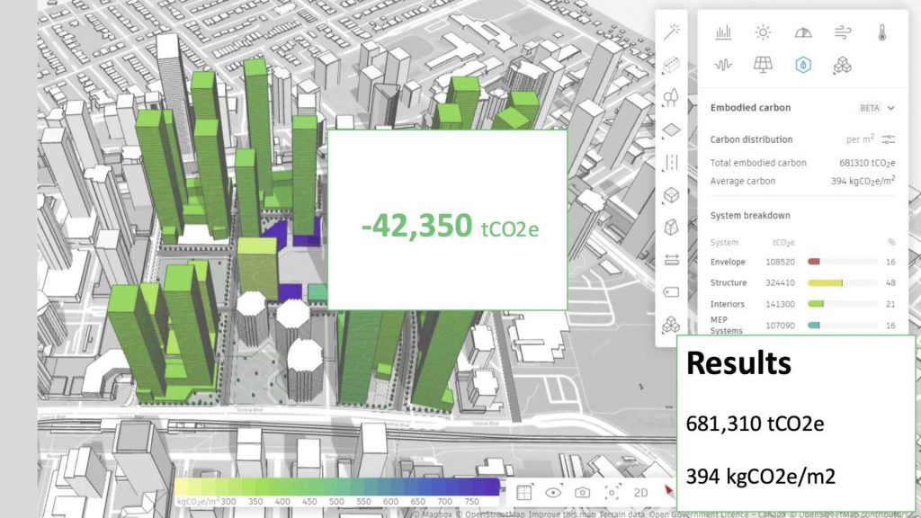
The first is Building Layers with ArcGIS Pro, to support detailed, element-level analysis, design review and asset management. Models retain full BIM structure, including geometry, categories, phases and attributes, enabling precise filtering by architectural element or building level.
The second is Simplified 3D Models with ArcGIS GeoBIM, introduced in June 2025, to optimise performance and agility for construction monitoring, mobile workflows and stakeholder engagement. The Add Document Models tool generates lightweight, georeferenced models from Revit and IFC files while preserving links back to their source.
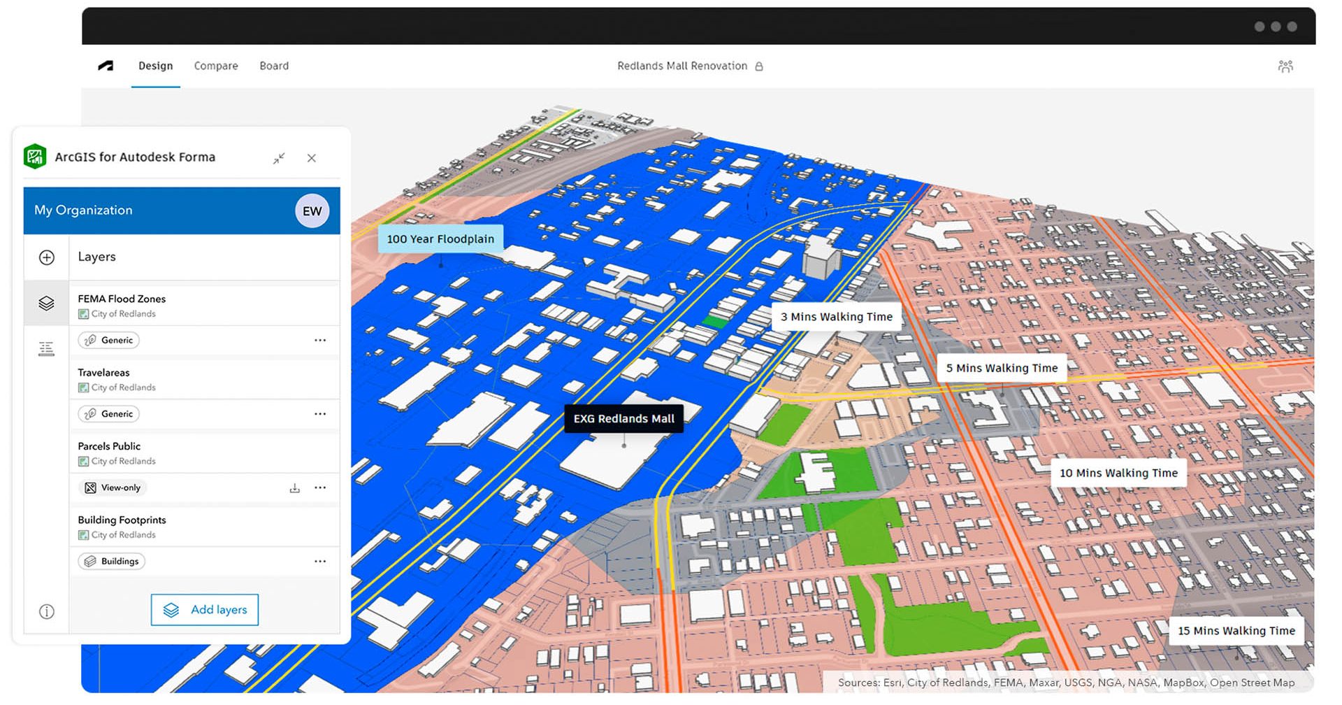
Esri has also extended its partnership with Autodesk with ArcGIS for Autodesk Forma, embedding geospatial reference data directly into Autodesk’s cloud-based planning platform. Forma users can now draw on the ArcGIS Living Atlas, municipal datasets and enterprise geodatabases, all natively georeferenced. This allows environmental, infrastructure, zoning and demographic layers to be overlaid onto early-stage conceptual designs.
GeoBIM provides a common dashboard for large-scale projects, allowing AEC firms and owner-operators to visualise GIS context alongside BIM content and object properties, even though the source files may reside in ACC Marc Goldman, director of AEC industry, Esri
As Goldman notes, “Designs created in Forma inherit coordinate systems and spatial metadata, ensuring that when they move downstream into Revit, Civil 3D or ArcGIS Pro, they remain consistent and location-aware. Beyond visualisation, ArcGIS for Forma supports rapid scenario testing, such as climate risk or transport connectivity, within the context of a live GIS fabric.”
Autodesk Tandem and the broader world of digital twins have also caught the attention of executives at Esri, he adds: “Esri is working with the Tandem team to serve GIS context for customers managing clusters of buildings. This could enable Tandem to evolve into a multi-building digital twin platform.”
AI, NLQ et al
According to Goldman, Esri has been using AI technology internally for years – long before the recent surge of hype around the technology. Now, he says, AI is being deployed to automate complex GIS tasks for users, lowering the barrier to entry for non-specialists.
One example of this can be found in reality capture and asset management. Esri’s reality suite, based on its 2020 acquisition of nFrames, uses geosplatting and computer vision to create high-quality 3D objects from 360-degree cameras or video inspections.
“AI enables automated feature extraction from reality capture data, such as LiDAR,” he explains. “Organisations like Caltrans can process hundreds of miles of roads overnight. Segmentation automatically recognises barriers, trees, signage and more, making the data assetmanagement ready.”
Meanwhile, natural language query (NLQ) capabilities in ArcGIS are also paving the way for the democratisation of GIS With more AEC collaborative design solutions available, employees in disciplines that once worked in silos are increasingly connected and sharing information with their colleagues. Martyn Day caught up with Marc Goldman, director of AEC industry at Esri, to discuss the company’s focus on BIM integration Explorations in GeoBIM Technology data. Users can now perform advanced analysis without specialist training.
“Say I need a map of central London, showing the distance between tube stops and grocery stores, overlaid with poverty levels,” Goldman illustrates. “The system generates the map and suggests visualisations, making spatial insights accessible to anyone.”
Urban planning remains a hot topic. That was certainly the case at our recent NXT BLD event, where innovations were showcased by Cityweft, Giraffe, GeoPogo and, of course, Esri.
It’s a domain in which Esri has long contributed and continues to do so, with technologies to enable scenario evaluation and parametric city modelling.
As Goldman puts it: “Architects and planners need to evaluate scenarios, like population growth, by bringing in demographic and visual context. Esri’s tools ensure design choices are made in the right place, with the right influences. And with AI, the possibilities for urban planning expand even further.”
In summary, Esri’s partnership with Autodesk continues to transform the relationship between GIS and BIM data, with AI set to drive the next great wave of integration. As both companies continue to expand their cloud portfolios and ecosystems, Esri is embedding spatial intelligence, predictive analytics and automated decision support directly into AEC workflows.
The convergence of ArcGIS, GeoBIM and Forma with AI-driven insights offers the AEC industry a significant opportunity to move beyond static models towards dynamic, learning digital twins. In this way, says Goldman, the Esri and Autodesk partnership will help that industry “create a more sustainable, resilient and contextaware built environment.”