New Cintoo 360 Edition converts 360 video walkthroughs into 3D data to accelerate decision-making
Cintoo, a cloud-based platform for the management, visualisation and analysis of reality capture data, has launched a new 360 Edition for capturing, processing and navigating Ricoh 360 data.
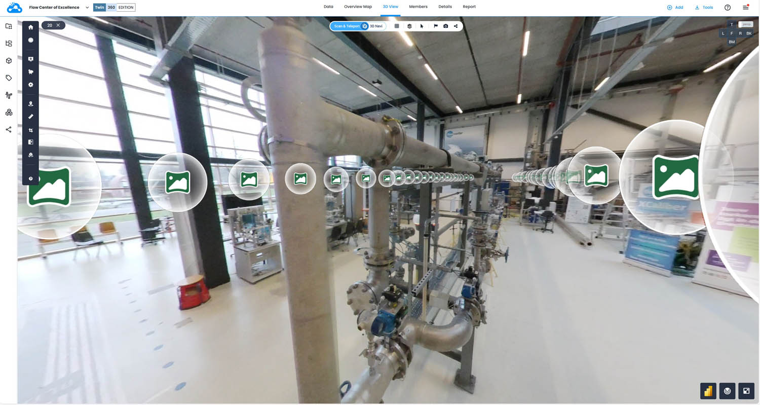
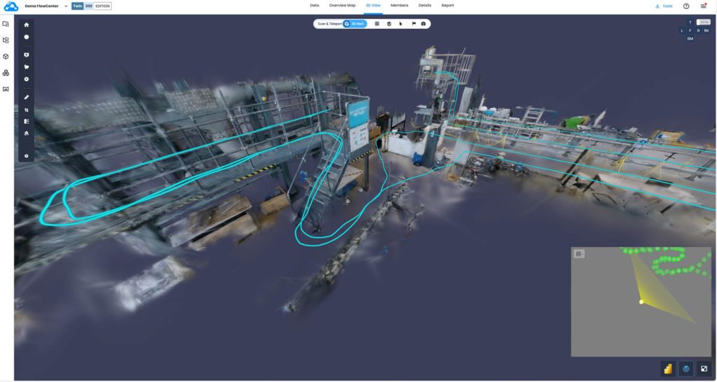
The new solution is designed to integrate 360-degree videos with 3D scans and BIM or CAD models in a ‘single, synchronised 3D environment’.
Features include unlimited, automatic camera path processing, 3D manual alignment to existing scan and/or model datasets, 3D visualisation of panoramic images and 3D data using Gaussian Splats, and access to established tools for 3D annotations, 3D crops and 3D measurements.
According to the company, the new 360 Edition makes it easier for non-experts to assess brownfield conditions, inspect job sites, understand the spatial context of tagged equipment, and prepare for laser scanning work. As a result, says Cintoo, the solution is particularly well suited to asset owners and operators.
“The 360 Edition bridges the simplicity of using lightweight 360 cameras with the precision of a full 3D workflow,” said Dominique Pouliquen, CEO of Cintoo.
“By bringing Ricoh 360 data, scan data and design models together in one integrated 3D environment, we’re enabling broader teams to adopt advanced 3D workflows without added complexity.”