Emesent GX1 said to deliver “survey grade precision” with 5-10-millimetre accuracy, at mobile scanning speeds
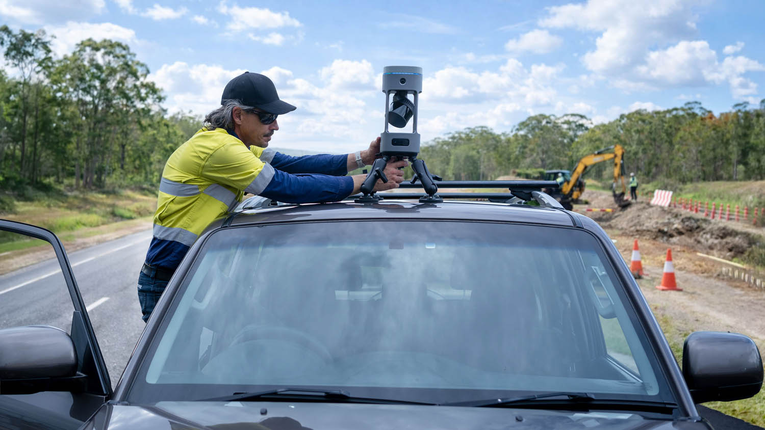
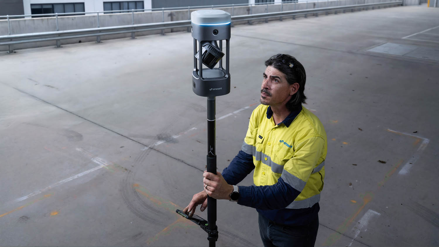
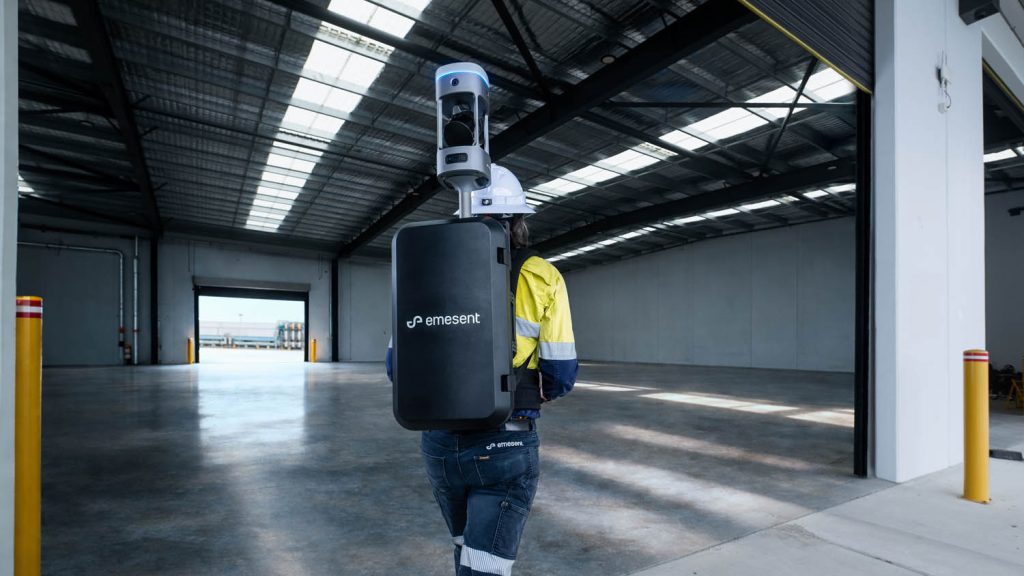
Emesent has launched the GX1, a mobile scanner that integrates SLAM, RTK and 360-degree imagery capture in a single handheld or backpack-mounted unit.
The company claims the device achieves 5-10-millimetre accuracy, positioning it as the first SLAM-based mobile scanner to deliver what it describes as survey-grade precision at mobile scanning speeds.
The system incorporates the company’s proprietary SLAM algorithm, originally developed for its Hovermap drone-based scanner and tested in GPS-denied underground environments, combined with integrated RTK georeferencing and real-time quality monitoring.
The GX1 is probably best positioned against higher-end handheld SLAM scanners such as Leica’s BLK2GO and GeoSLAM’s ZEB series, though Emesent’s claimed accuracy figures would place it closer to static terrestrial scanning tolerances. The company says the accuracy has been independently validated, though it has not specified by whom or under what conditions.
Discover what’s new in technology for architecture, engineering and construction — read the latest edition of AEC Magazine
👉 Subscribe FREE here
The device supports four deployment modes: backpack, survey pole, vehicle mount and handheld. It features four twenty-megapixel cameras for panoramic imagery capture and includes integrated batteries to eliminate cable management. Surveyors can georeference data using RTK in the field or apply ground control points during post-processing, offering what the company describes as flexibility when field RTK conditions prove unreliable.
Emesent is positioning the GX1 for topographic survey, road survey, scan-to-BIM applications and construction progress tracking. The company suggests the system is simple enough for junior surveyors to deploy within days, addressing what it characterises as a surveyor skills shortage facing the industry.
“With the introduction of the GX1, we’ve answered the call we’ve heard echoing throughout the surveying industry to end the tug-of-war between fast and accurate,” said Dr Stefan Hrabar, chief strategy officer and co-founder of Emesent. “By putting the power of SLAM into the hands of the everyday surveyor, the GX1 raises the bar for mobile scanning accuracy and keeps critical projects on track.”
The claim that SLAM-based systems can now match survey-grade accuracy would be a significant market positioning shift, as mobile SLAM scanners have traditionally been accepted for asset documentation and visual inspection rather than precise topographic work where total stations and static terrestrial scanners have dominated. Whether the GX1’s claimed tolerances prove consistent across varied site conditions and whether they satisfy the validation requirements of survey regulatory bodies remains to be demonstrated in field deployment.
Emesent’s processing software, Aura, generates what the company describes as rapid accuracy validation reports, allowing surveyors to verify results without returning to site. Pricing has not been disclosed, though competing handheld SLAM systems typically range from £15K to £40k depending on specification and software licensing.