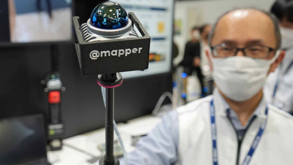
@mapper portable 3D scanner targets low-cost, rapid indoor mapping
Panasonic has introduced a portable indoor mapping device designed to reduce both the cost and time involved in creating 3D models of existing buildings.
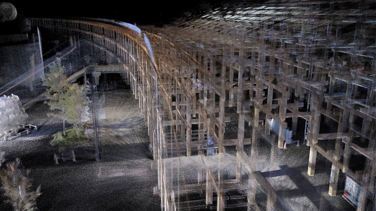
The system, branded @mapper, is intended to generate a digital representation of interior spaces by walking through them, rather than relying on tripod-mounted terrestrial laser scanners and repeated static set-ups.
The core of the system is a Lidar-based laser scanner with a reported range of up to 60 metres, paired with a tablet used to visualise the captured data. As an operator moves through a building, the scanner continuously records spatial geometry and assembles a three-dimensional map of the environment.
Discover what’s new in technology for architecture, engineering and construction — read the latest edition of AEC Magazine
👉 Subscribe FREE here
Panasonic claims that a building with a floor area of around 5,000 square metres can be mapped in approximately one hour of walking, compared with the half day or more typically required using conventional scanning workflows that involve stopping every 10–20 metres to reposition equipment.
The company plans to release @mapper commercially at the end of January 2026 at a price of around ¥2 million (approximately US$12,600) per unit. Panasonic says this places the device at roughly one-fifth of the cost of standard professional scanning equipment, but it’s probably best compared to the Leica BLK360 and some SLAM scanners which are around $20k.
Panasonic is positioning the device primarily at owners and operators of industrial facilities. In older factories, hospitals and commercial buildings, as-built conditions often diverge substantially from original drawings, if any documentation exists at all. Creating a usable digital model of such spaces is typically a prerequisite for refurbishment, retrofit or layout optimisation, but is often skipped or delayed because of the cost and disruption associated with full laser-scanning surveys.
By lowering the barrier to interior capture, Panasonic is implicitly targeting that documentation gap. Rapid, lower-cost scanning could make it more practical for organisations to maintain current digital records of their facilities and to generate base models for upgrade and re-use projects. The company has also suggested applications in heritage and conservation contexts, where non-invasive, rapid documentation can support preservation work.
Panasonic has not yet published detailed technical specifications covering accuracy, resolution, drift behaviour or output formats, nor has it clarified how @mapper data will be exported for use in CAD or BIM environments. For AEC practitioners, those details will be critical in determining whether the device is suitable for design-grade documentation or better understood as a rapid capture tool for visualisation, planning and asset inventory.
Although @mapper is being positioned as a facilities documentation tool, the underlying technology has wider implications. Low-cost laser scanning sensors are a core component in mobile robotics and autonomous systems, and improvements in compact lidar price-performance ratios are likely to have spill-over effects beyond building mapping.
For now, the key question is whether Panasonic’s claims around speed, cost and coverage translate into data quality that is good enough for real-world design and retrofit workflows. If so, @mapper could occupy an emerging middle ground between consumer-grade depth cameras and high-end terrestrial laser scanners.