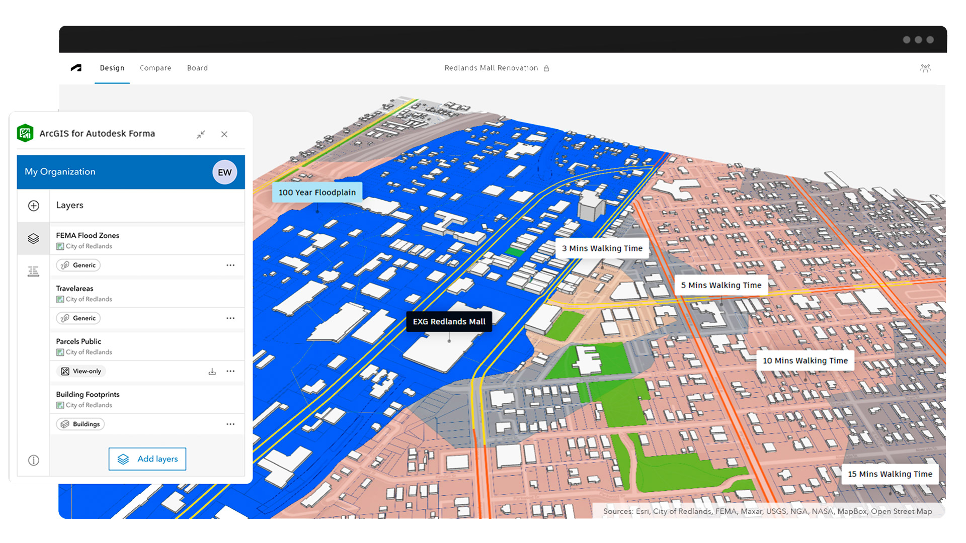
Geospatial Esri launches ArcGIS for Autodesk Forma Posted by AEC Magazine - July 7, 2025 New integration makes GIS data directly accessible in concept design phase
Civil engineering Sensat and Transcend forge strategic integration Posted by AEC Magazine - May 22, 2025 Automation meets visualisation as firms deliver new infrastructure design workflow for the water and energy…
Geospatial Cityweft gears up for public launch Posted by Greg Corke - April 22, 2025 Web-based platform brings spatial context into CAD / BIM software for early-stage design
Technology AEC Magazine Sept / Oct 2024 Edition Posted by AEC Magazine - September 22, 2024 We put the spotlight on Bentley's Cesium acquisition, find out why AI is hard (to…
Geospatial Geo whiz: Bentley acquires Cesium Posted by Martyn Day - September 22, 2024 We explore the surprise deal that promises to bring the worlds of digital twins and…
Digital twins Bentley Systems: the promise of data freedom Posted by Greg Corke - October 14, 2024 Many AEC software firms talk openness, but as the industry shifts from file-based systems to…
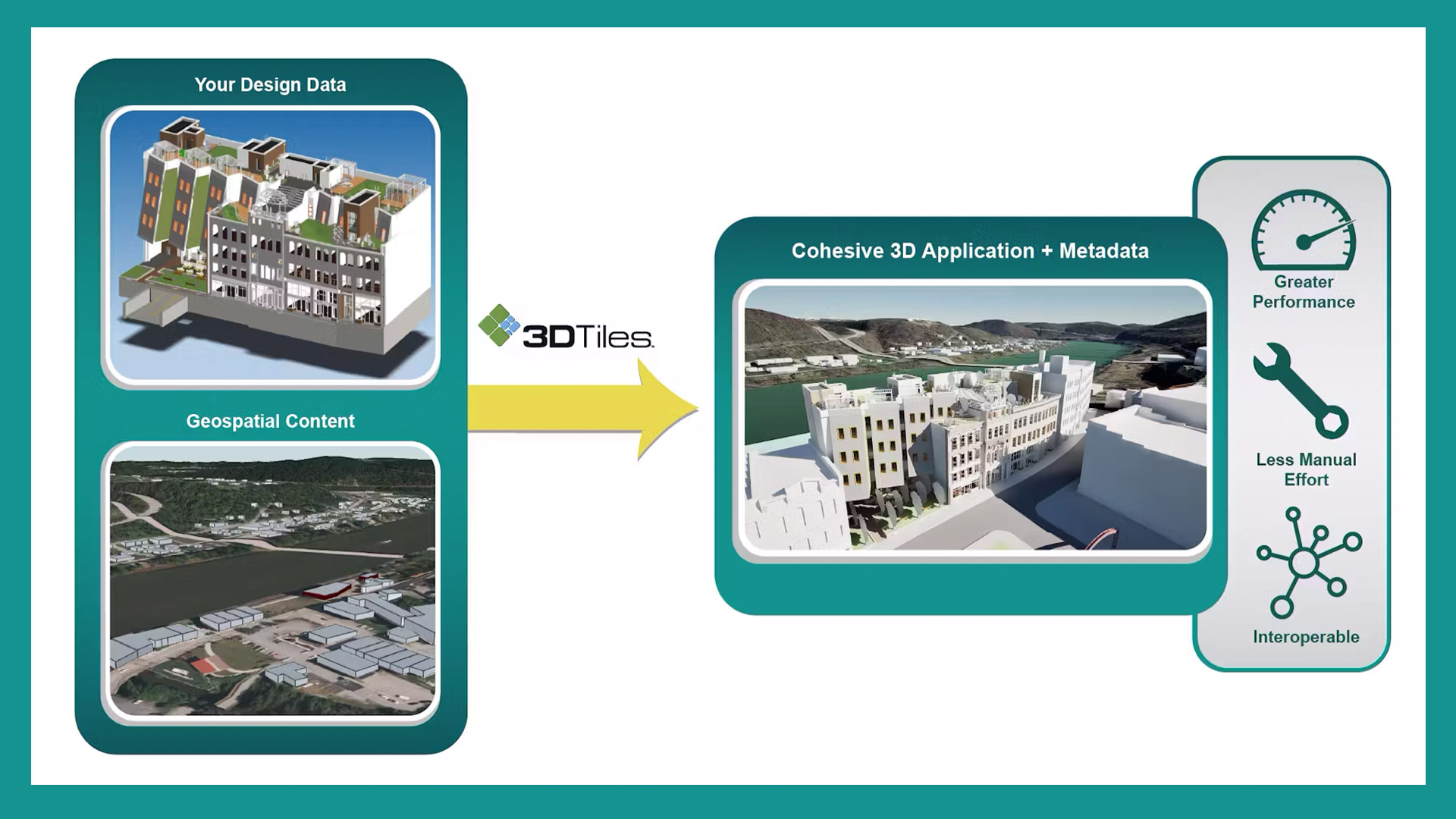
Geospatial Cesium to connect AECO with 3D geospatial Posted by AEC Magazine - September 5, 2024 Geospatial specialist streams IFC and Revit files as 3D Tiles to place AECO data in…
Geospatial Generative AI for urban simulation Posted by Federico Fernandez - July 25, 2024 How Urbanly integrated Large Language Models into its CityCompass platform to enhance household location models
Geospatial ArcGIS Basemaps integrated into Civil 3D / AutoCAD Posted by AEC Magazine - May 9, 2024 Provides AEC professionals with geospatial reference data within Autodesk tools
Geospatial London Gatwick creates new geospatial platform Posted by AEC Magazine - April 19, 2024 Platform uses Esri GIS technology to support multiple operational areas, including engineering and environmental services