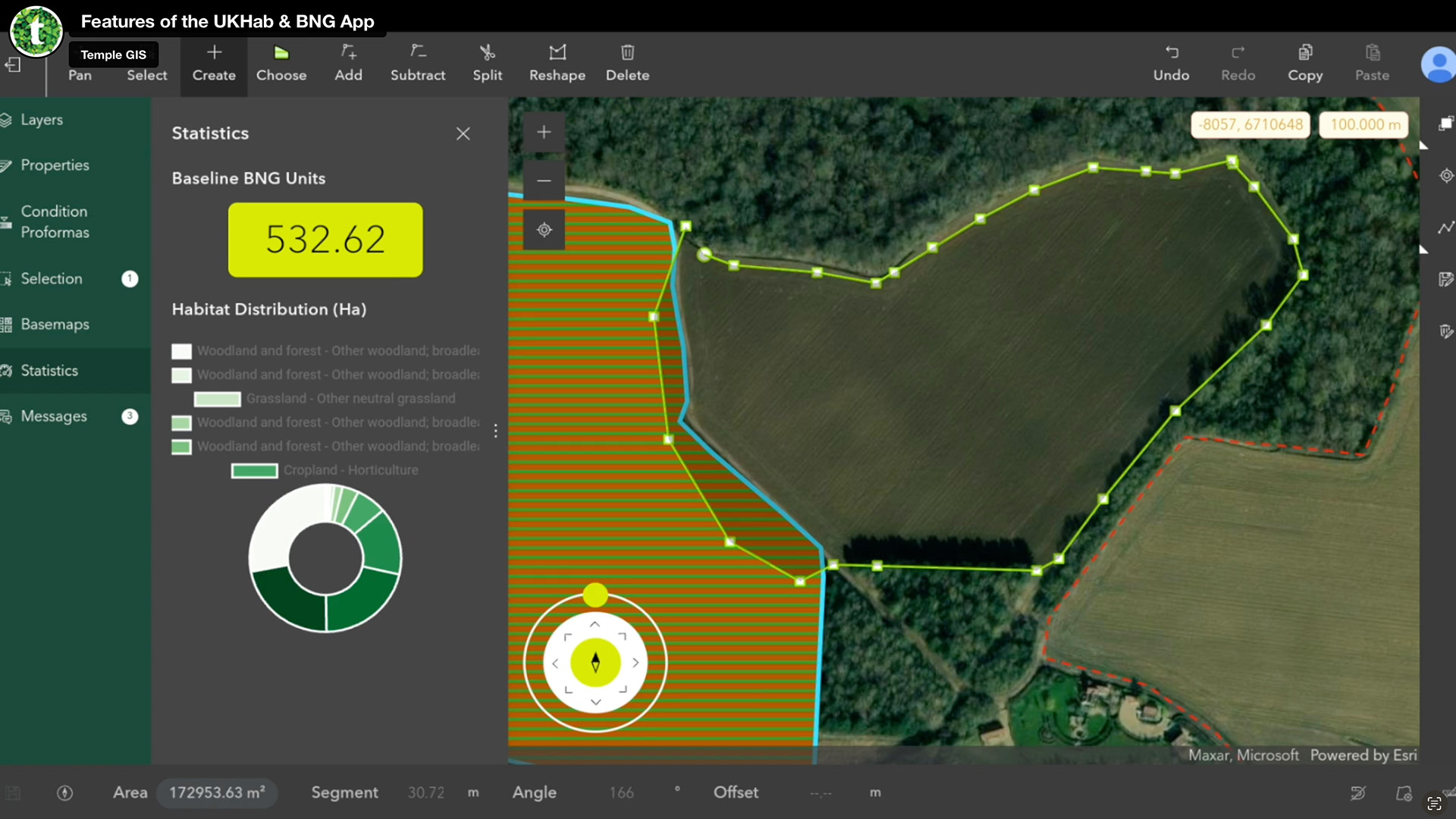
Sustainability Temple launches biodiversity net gain assessment tool Posted by AEC Magazine - February 29, 2024 Streamlined workflow, powered by Esri GIS technology, helps AEC firms meet new legislation
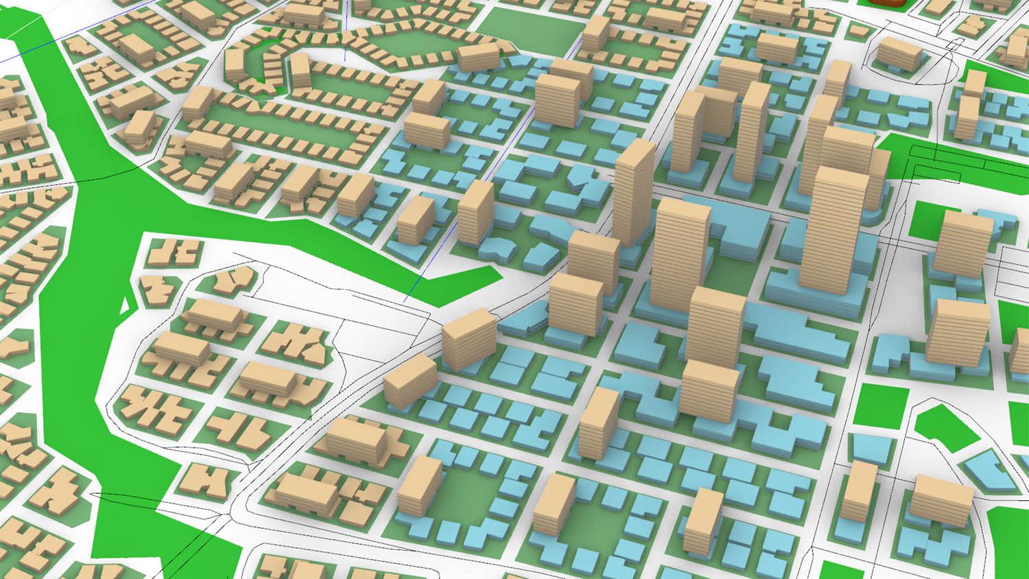
Concept Design Giraffe for urban planning Posted by Martyn Day - November 29, 2023 This early-phase design suite of tools connects spatial building and city design models with GIS…
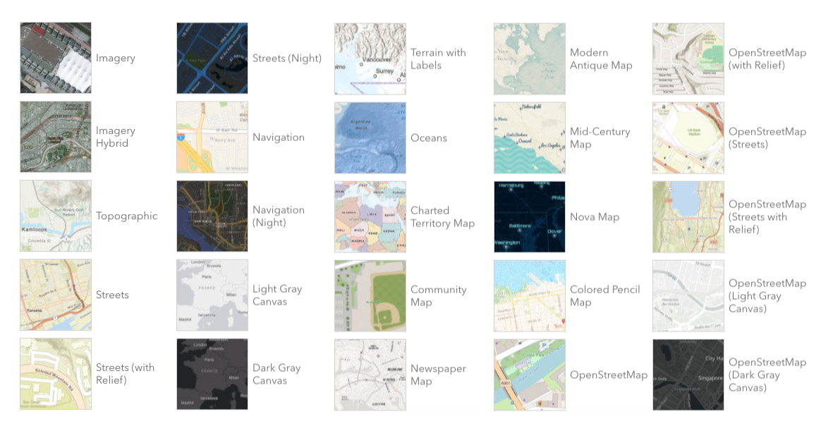
Geospatial Autodesk tools to get wider access to GIS data Posted by AEC Magazine - November 19, 2023 Esri ArcGIS Basemaps and Living Atlas Data to be integrated into Autodesk software
Geospatial National Highways advances Digital Roads strategy with GIS Posted by AEC Magazine - November 8, 2023 Single digital model of England's Strategic Road Network provides staff with same real-time view
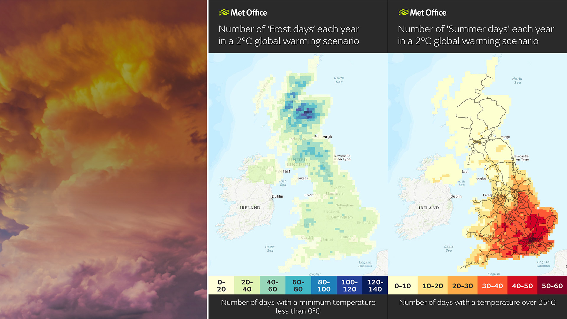
Sustainability Met Office makes climate data more accessible Posted by AEC Magazine - July 4, 2023 Geospatial technology extends reach of data to help AEC users better respond to climate change
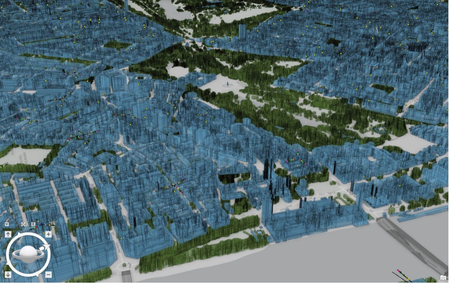
Reality modelling Esri introduces ArcGIS Reality for reality modelling Posted by Martyn Day - February 8, 2023 Esri releases ArcGIS Reality, a reality capture extension to its flagship GIS platform
Digital twins Digital twin helps Vodafone plan network Posted by AEC Magazine - January 11, 2023 Helps engineers make ‘smarter and faster’ decisions on 5G and capacity increases
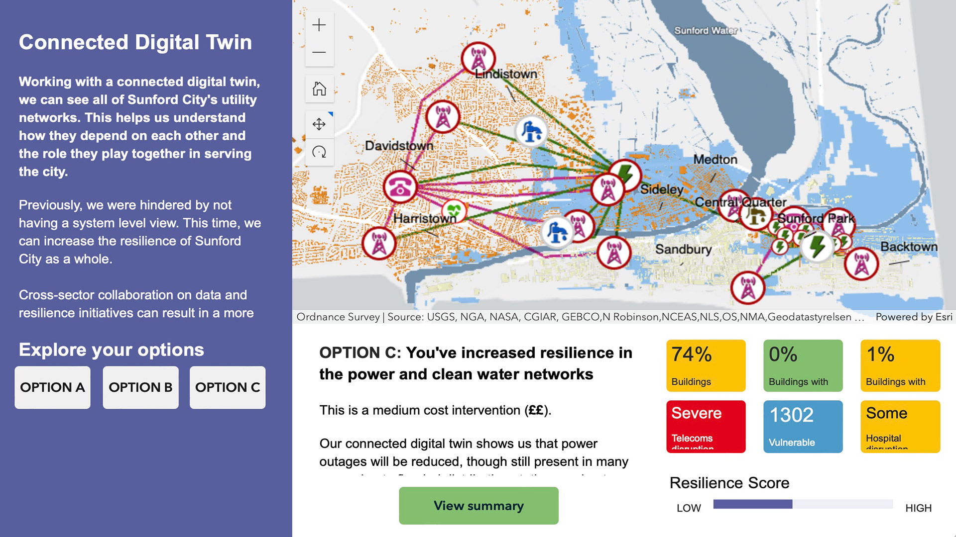
Digital twins Climate resilience planning through digital twins Posted by AEC Magazine - August 4, 2022 Fictional city helps National Digital Twin programme communicate benefits of connected digital twins
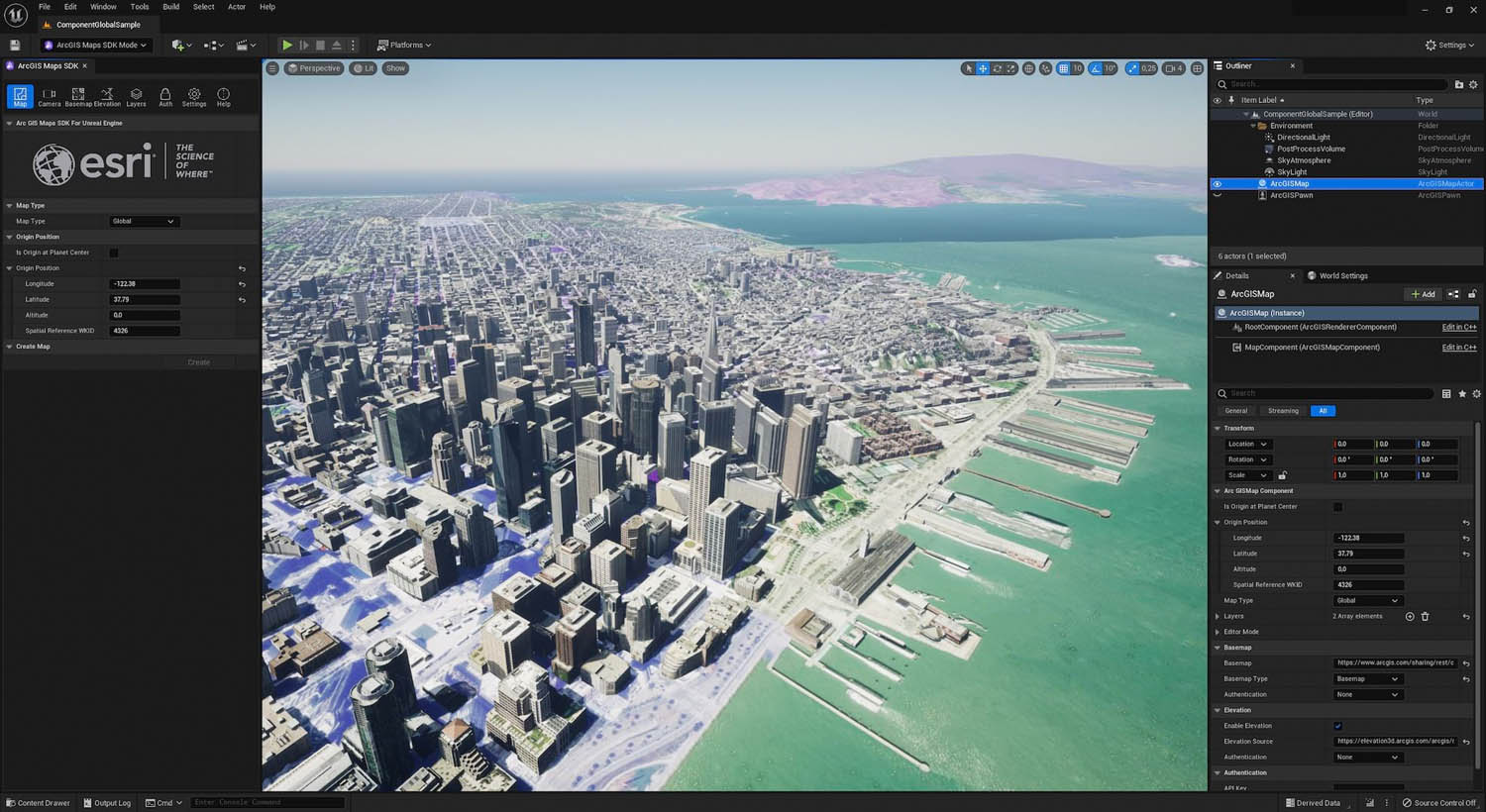
Geospatial ArcGIS Maps SDK for Unreal Engine launches Posted by AEC Magazine - July 21, 2022 SDK offers tools for bringing data from ArcGIS directly into the Unreal Engine 5 development…
Geospatial Esri UK conference returns to London on 17 May 2022 Posted by AEC Magazine - April 3, 2022 Speakers include National Highways, Argent Related, Arcadis, Mott MacDonald and more