Newcastle University’s high-res flood risk modelling combines LiDAR and oblique aerial photography with AI
Newcastle University is developing advanced computer modelling to assess the flood risk of individual properties using LiDAR data and oblique aerial photography.
The project will use Artificial Intelligence (AI) to extract information from other datasets, including old reports and flood asset registers, and bring this together with weather and traffic sensors, for example, to provide a ‘dynamic online platform’ for hyper local, near real time flood risk assessments.
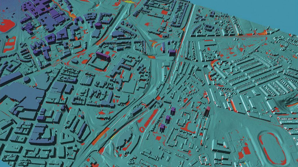
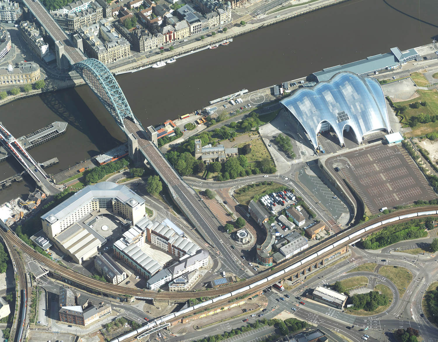
Data from Bluesky provides the real world context and accuracy, and enables visualisations of evolving events that will enable flood risk managers to employ just in time maintenance and alleviation methods, such as clearing blocked drains or setting up mobile defences.
“In 2012 Newcastle experienced the worst flooding in living memory,” commented Dr Luke Smith, Lecturer in Data-Centric Civil Engineering and Deputy Director of the Urban Observatory at Newcastle University. “Referred to as Thunder Thursday and ‘Toon Flood’ this exposed a number of weaknesses in our existing flood modelling. We are, it would appear, incredibly good at predicting what roads will flood but not always its consequences for infrastructure, transport, and individual homes.
“The Bluesky MetroVista data combines LiDAR and photogrammetry, providing accuracy and detail that enable us to include information that is simply not available from a single source,” he continued.
“For example, as part of this project we will consider the impact of property age and type of construction, we can look at the permeability of a house’s front garden and sometimes even door thresholds – all important considerations in flood risk assessment and mitigation at this scale.”

The Bluesky data is part of the MetroVista product range, which uses new aerial mapping technology to simultaneously capture vertical and oblique photography together with laser scanned height measurements.
In addition to the Bluesky data the PYRAMID (Platform for dYnamic, hyper-resolution, near-real time flood Risk AssessMent Integrating repurposed and novel Data sources) project will use brand new information from a range of sensors deployed as part of the University’s Urban Observatory.
The project will also use Artificial Intelligence and Machine Learning to automatically extract information from other data sources.
The MetroVista datasets also include geographically accurate, phototextured, mesh models ready for use in 3D GIS, CAD and other modelling software as well as visualisation, gaming and VR workflows.