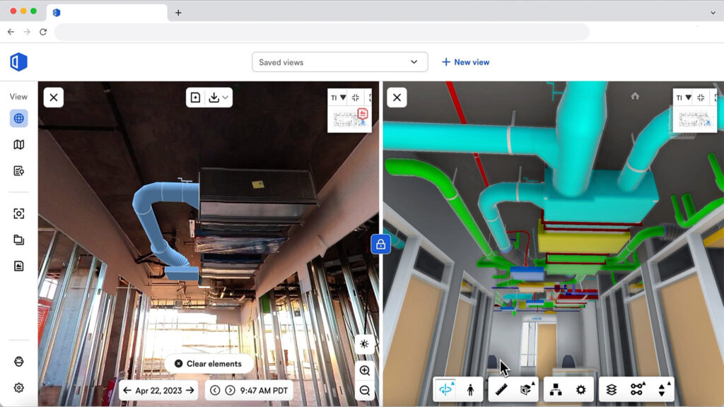
Software can be used to compare as-built conditions to design intent
OpenSpace, a specialist in 360° reality capture and AI-powered analytics, has introduced OpenSpace BIM+, a suite of 3D tools designed to accelerate BIM and field coordination workflows.
OpenSpace BIM+ is an add-on product to OpenSpace Capture, for ‘fully documenting’ construction sites. It includes BIM analysis tools, BIM coordination tools and offers ‘seamless’ model management
For BIM analysis, the software allows site teams to work in the BIM model and compare that to what they are building. Any project team member can click and navigate to saved views in the BIM model, review model elements overlayed within the 360° photos, and access the model from any iPhone, iPad, or Android device when offline.
Point cloud data can also now be stored, viewed, analysed, and shared in OpenSpace from mobile and terrestrial laser scanners and OpenSpace’s 3D Scan feature, bringing reality capture data to one central location.
For BIM coordination, the software includes features designed to help teams quickly solve problems by aligning design intent with on-site conditions to speed up responses, approvals, and project schedules. OpenSpace Capture’s field note feature is now part of BIM workflows with OpenSpace BIM+, allowing field teams to add detailed images and notes during site walks or back at their desks. BCF file export is also included, enabling streamlined workflows with leading BIM coordination tools like Revizto, Navisworks, and BIM Track.
“We recognised that many of our customers were seeking more powerful, yet easy-to-use BIM tools from OpenSpace,” shared Neel Sheth, vice president of product at OpenSpace. “Our customers’ BIM usage in OpenSpace was outpacing the industry’s overall rate of BIM adoption. That told us that OpenSpace might be able to help drive BIM utilisation for those teams that are adopting and investing in BIM.
“With OpenSpace BIM+, we have partnered with VDC leaders and their project teams to help them work with BIM as easily as navigating a Google Street View.”