Single digital model of England’s Strategic Road Network provides staff with same real-time view for first time
National Highways, which operates, maintains and improves England’s motorways and major A roads, is using Esri enterprise GIS to support its Digital Roads strategy.
The government-owned company made the move to an Esri enterprise GIS over a year ago, and has since consolidated all geospatial data and applications into one spatial portal, adding new capabilities and making GIS more accessible at lower cost.
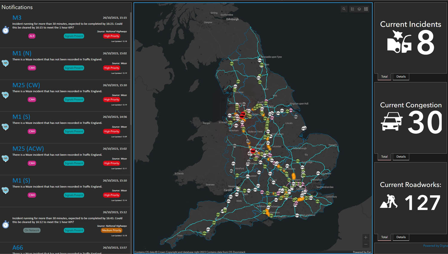
One of the major projects has been the creation of a single digital model of the Strategic Road Network (SRN) to provide staff with the same real-time view for the first time.
Control rooms across the country are now using a Single View of the Network (SVN) dashboard which has incident alerts, details of roadworks, weather updates and the location of traffic officers available on an interactive map.
According to Esri, benefits to date include being able to predict problem locations and deploy traffic officers more quickly, better coordination of roadworks to reduce disruption and optimising traffic flows to reduce congestion and emissions.
It also removes the need to maintain multiple road models within multiple systems. Through these efficiencies, National Highways has reportedly decreased its total cost of GIS ownership by more than 10% compared to two years ago.
“We are always looking for new ways to make people’s journeys smoother and safer on our roads and we are now able to react more swiftly to incidents to get traffic moving again as quickly as possible,” said National Highways Chief Data Officer, Davin Crowley-Sweet.
“Meanwhile, our vision for the digital roads of the future will incorporate new capabilities, such as digital twins, predictive planning, single view of assets, and connected autonomous vehicles. Each of these initiatives will require a common, trusted representation of the network to be successful.”
Spatial data in the SRN model includes information on over 4,000 miles of highway, bridges, tunnels and other assets including road signs and cameras.