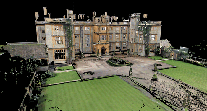
Latest release of Pointfuse allows users to create 3D models, 2D line work and scaled ortho images ‘automatically, quickly and easily’.
Arithmetica has enhanced its Pointfuse automated point cloud processing software by simplifying the integration with CAD software. The new release of Pointfuse Pro also automatically textures the generated 3D models by using RGB, Intensity or statistical derived values. The UK firm says that by using the original RGB values from the point cloud the software can now automatically add real world context to the generated models.
Other new functionality allows users to ‘quickly and accurately’ generate 3D models and then produce 2D plans, elevations or sections for use in project documentation. The software also includes the ability to create scaled ortho images from the point cloud data that can be used to draw measure or take dimensions from.
“The latest version of Pointfuse makes it even faster and easier to visualize large point cloud as textured vector models,” commented Mark Senior, Pointfuse Development Manager, “but, more importantly we have simplified the workflow allowing users to create 3D models, 2D line work and scaled ortho images automatically, quickly and easily. These are then fully compatible with CAD software and modelling packages. The models can also be made to look photorealistic with automatic and accurate texturing.”
Another new feature in the latest Pointfuse release is the ability to create scaled ortho images from the point cloud data. These can be used alongside Pointfuse generated vectors, or independent workflows, to produce 2D images using third party CAD and modelling software. Using a range of new selection tools within Pointfuse these ortho images can be created from any angle and direction and can be used to draw, measure or take dimensions from.
Pointfuse is a modelling engine designed to give engineers, architects and construction professionals a ‘fast, precise and flexible’ way of converting cloud datasets generated by laser scanners or photogrammetry into high fidelity vector models, which can then be manipulated by CAD software.
If you enjoyed this article, subscribe to AEC Magazine for FREE


