Five ways rugged tablets with 3D technology are transforming BIM
Architecture, engineering and construction (AEC) firms are continually challenged to deliver successful projects on budget and on schedule—in a very tight labour market. While BIM has greatly improved traditional building design, the use of BIM throughout construction has lagged. One obstacle is keeping the BIM up-to-date in order to reconcile site changes, errors, equipment substitutions and owner-driven scope change. Traditionally, this means getting professional survey crews, either specialty service providers or in-house teams to deploy specialised equipment to capture the as-built state of a project and then updating the model. This can be costly as well as challenging to schedule.
But recent technology innovations are transforming BIM in more ways than one. Newly developed rugged tablets with 3D scanners and software can be used by a broad range of workers for instant digital data capture with survey-grade positioning accuracy. Construction workers can now use highly durable, yet simple-to-use mobile devices in the field to efficiently document the as-built state of a project and this documentation can be used to keep the BIM current and allow data to be shared with the owner, general contractor and subs. Here are five ways rugged tablets with 3D technology are transforming BIM processes:
1) Non-specialists capture as-builts
The foremost way rugged tablets with 3D technology are redefining BIM processes is by enabling non-specialists to document the as-built state of a project. Professional surveyors are still needed to establish survey control networks – but decoupling the surveying process from the subsequent as-built documentation process improves efficiency and shortens schedules. A collateral benefit is that instead of deploying senior engineers to walk down the site, organisations can use non-specialists to quickly capture this information and transmit it back to the senior engineers in the office, thereby allowing them to supervise multiple projects.
2) Single device for capturing / geo-referencing point cloud data & HD Images
The ability to use a single device for capturing and geo-referencing 3D data, and high-resolution photography enables better coordination with subcontractors. Fast and accurate construction validation is also key to shortening payment cycles. The compute power of the rugged tablets and the digital deliverables of the point cloud software ensure the captured data can be integrated with CAD, BIM traditional survey and tripod-based laser scanning. The same device can also generate georeferenced, high-resolution photographs that are equally vital for field walk downs and documentation. Georeferenced HD images complement 3D scan data and can be readily communicated to non-specialist stakeholders.
3) Precision improves safety
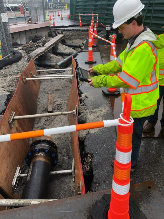
Precision accuracy for measurements is pivotal for the safety of workers and the public—especially when mapping complex networks of fibre optic cables, gas lines, and other equipment affecting underground utilities. Non-specialist workers can easily generate sub metre accuracy to centimetre level accuracy measurements in real-time using rugged tablets with 3D software coupled with Real Time Kinematics from GPS, GLONASS and GALILEO satellites.
A recent explosion in San Francisco that ignited after workers installing fibre optics struck a gas line, exemplifies the importance of having accurate digital measurements available for underground utilities.
4) Expedited retrofits and revamps
Brownfield work, such as revamping an existing structure, often means working with incomplete or out-of-date 2D drawings— if the drawings exist at all. Rugged tablets with 3D technology are also an efficient means of capturing the assets in order to produce design documentation and BIM. Mobile devices provide a rapid, portable way to capture the 3D data required to generate CAD/BIM models and to identify elements that will be demolished for new construction.
5) Risk mitigation for asset owners and contractors
Using rugged tablets with 3D technology for BIM processes shortens project cycle time, which is desirable for owners because it gets their infrastructure running quickly, while simultaneously expediting payments for contractors. The highly accurate digital measurements with photographic images combined with quick data transfers to IT systems are ideal for mitigating any risks associated with discrepancies—especially once assets and construction are covered up underground.
The 3D and 2D images with data are ideal for establishing the condition of the assets and their surroundings before and during implementation. If something goes awry, this data can be isolated to determine how best to address the issue and contractors can revisit how building assets were delivered at the point of installation as proof against any claims or issues. The ensuing protection is critical in what can be the tenuous world of BIM and building asset construction.
The bottom line
Organisations that use rugged tablets with 3D technology for BIM allows companies to leverage a single investment multiple times. This innovative technology enables a broad range of workers to generate high-accuracy measurements in the field, capture data in multiple ways, improve safety, simplify retrofitting, and mitigate risks for asset owners and contractors.
By Mario Gosalvez, business development manager at DT Research and Tom Greaves, chief marketing officer at DotProduct.
■ dtresearch.com ■ dotproduct3D.com
If you enjoyed this article, subscribe to our email newsletter or print / PDF magazine for FREE


