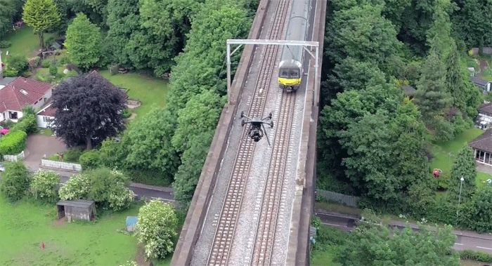
Plowman Craven Vogel R3D system offers ‘faster & more accurate’ way to capture rail data
Plowman Craven has launched a new system that uses unmanned aerial vehicles (drones) to survey rail infrastructure to sub-5mm accuracy. The Vogel R3D system has been successfully trialled by Network Rail and the survey accuracy results approved.
From a working height of 25m, the Vogel R3D system can also capture busy and inaccessible areas of the rail network during traffic hours, removing the need for possessions and line blocks and reducing the exposure of workers to risk.
“The application of the Vogel R3D system is a real game-changer for Network Rail and helps us to satisfy many of our survey requirements in a safe manner without the cost implications or potential programme delays associated with multiple possessions,” said Chris Preston, senior engineer, Network Rail.
Malcolm Donald, Director, Plowman Craven added, “The Vogel R3D system really does represent a step change in the surveying of the rail environment. Not only does it massively reduce risk, cost and timeframes compared to traditional surveying methods, but the data accuracy is also superior to traditional laser-scanning systems, making Vogel R3D a very attractive proposition with a wide range of applications. It can also be deployed on any infrastructure project that requires remotely-captured, engineering-grade data such as bridges or oil rigs.”
Plowman Craven’s system uses a drone mounted 100-megapixel camera to capture overlapping aerial images of an entire site. Bespoke workflows and software algorithms are then used to convert the imagery into 3D point cloud data that can be used to create a range of client deliverables ranging from track alignment to interactive site visualisations. According to Plowman Craven, the accuracy is superior to any other method of data capture, including static laser scanning and train or trolley-based kinematic scanning systems.
If you enjoyed this article, subscribe to AEC Magazine for FREE


