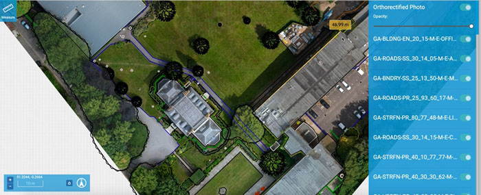
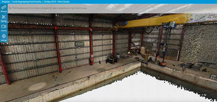
Cirrus Insite handles data collected from drones and laser scanners. Future AI capabilities could include defect detection and automated mapping
Atkins has launched a new cloud-based digital twin survey platform, Cirrus Insite, which enables clients to access, analyse and further develop ultra-high-resolution 2D and 3D digital models of their assets.
The ‘digital twin’ can be measured, marked and annotated by multiple users, with a view to facilitating improved collaboration between clients and stakeholders. The platform enables users to connect data from external sources, to ensure the digital twin remains a ‘true and connected replica’ of their asset.
According to Atkins, the platform tackles the sheer size of data collected from drones and laser scans; a common barrier to the adoption of modern surveying techniques.
Brian Gibbs, product director at Atkins, said: “Cirrus Insite is an invaluable tool in democratising access to high-quality data of the built and natural environment. One area we’re already exploring is the addition of AI for tasks such as defect detection on assets and automated mapping of sites; helping ensure that the data arising from modern mass data capture techniques is efficiently and economically analysed and that insights are brought to bear at pace.”
The platform was built using the Gemini Principles, an approach to information management created by the Centre for Digital Built Britain to facilitate the ease of data sharing across government, industry and academia.
CIRRUS Insite joins Atkins’ large portfolio of digital capabilities, which includes aerial and terrestrial high-definition surveying and geospatial data management platforms include AtkinsGo, sCDE and WebGIS.


