Integrated solution uses computer vision, AI and a proprietary handheld device with multiple cameras and GPS, to capture infrastructure at scale
Looq AI has launched the Looq platform, a ‘one-stop solution’ for surveyors, engineers, contractors, and asset owners to capture infrastructure, in minutes, with ‘survey-grade accuracy’.
The platform is powered by what the company describes as a novel and fundamental computer vision and AI technology.
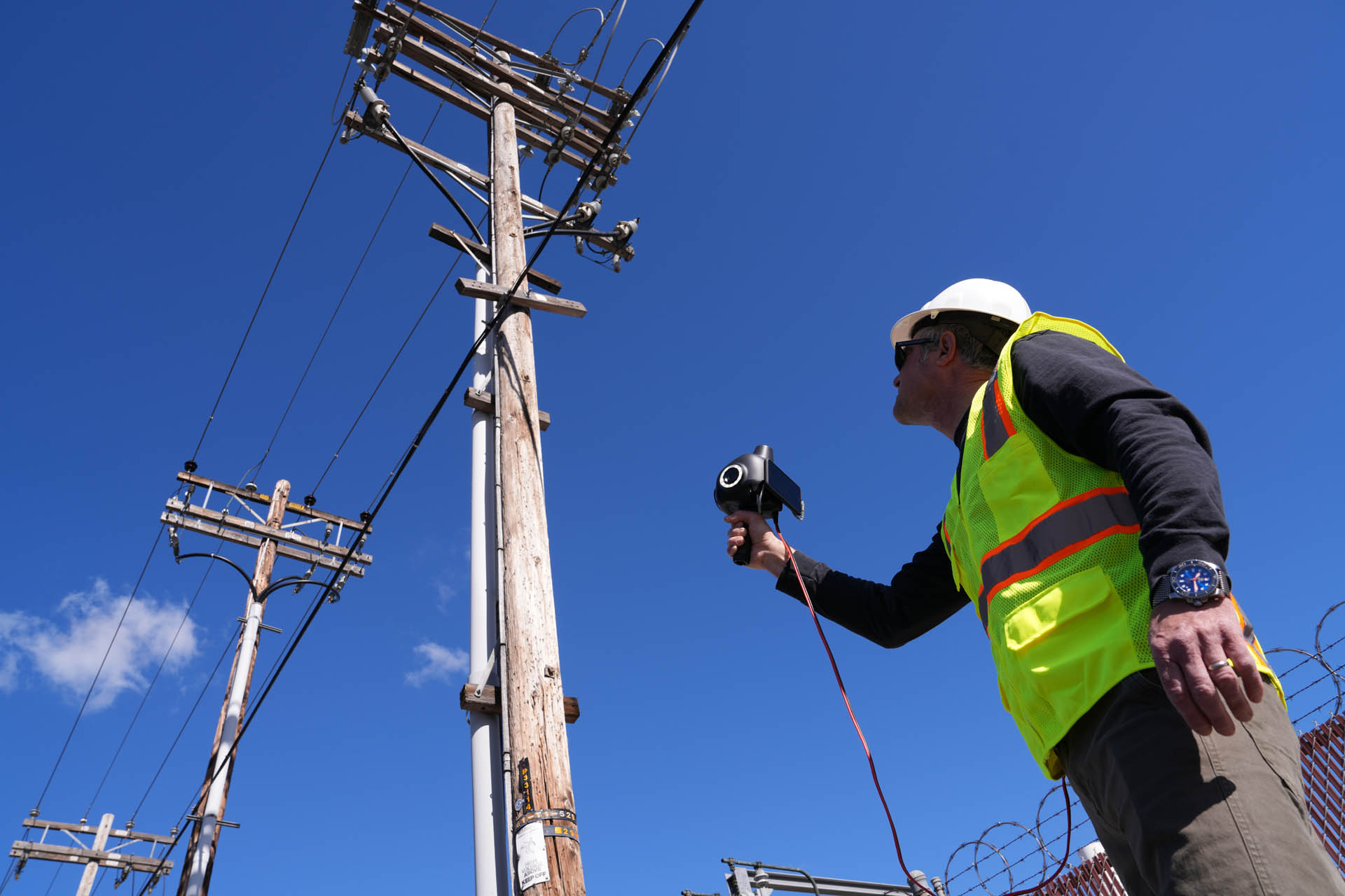
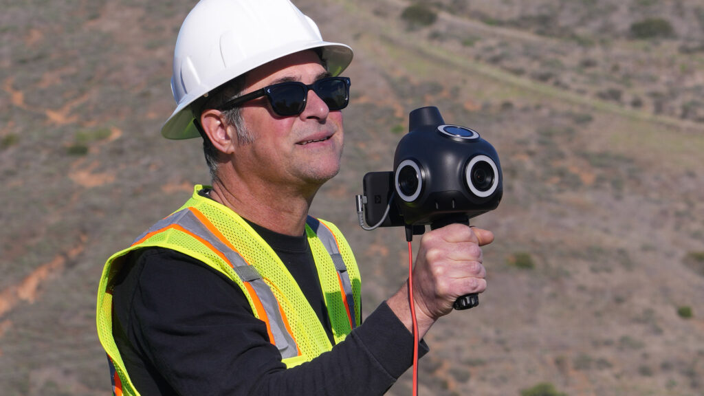
There’s also a hardware component, a handheld proprietary ‘Q’ camera, which combines four high-resolution cameras (on either side, on top and on front) with ‘survey-grade’ GPS and an AI processor. According to Dominique Meyer, PhD., CEO at Looq AI, this gives near 360-degree coverage for fast data capture. “It ensures you can see down below for ground capture, often used for topographic survey, and then also overheads for any overhead utilities and assets.”
Data from the camera is uploaded to the cloud and processed with Looq’s AI-based image-to-model software to create a high precision, sub-centimetre, and geo-referenced intelligent 3D digital twin, along with topographic maps and AI semantic information.
Through the platform project teams can then interact with the ‘digital twins’ and AI generated information to complete a multitude of engineering, surveying, analysis, and coordination tasks.
“We have developed a fundamentally different way of creating these accurate digital twins leveraging cameras instead of lasers,” says Meyer. “Our cameras offer over 100x higher spatial sampling rates compared to top-of-the-line laser systems, enabling our customers to capture the data they need within minutes, and at a scale that they previously could not do.”

Looq’s initial focus is on the utility sector, which faces pressure to maintain, expand and improve the electric grid. According to the company, across inspection of existing assets, the development of new structures, and the repair of disaster struck areas, organisations have an urgent need for timely and accurate information to power key decision making and operations.
“The use of this technology is a game-changer for us. It gives us the opportunity to capture a large amount of survey-grade data without drones or hours and hours of boots-on-the-ground labour,” said Amanda Jones, PLS, Owner at AJS.
“The Looq platform has become an indispensable engineering tool in our fielding toolkit. Their unique hardware and groundbreaking back-end processing has enabled our design teams to capture highly detailed and accurate field conditions in the absence of existing survey data,” said Blake Darling, PE, PMP, director of engineering underground programs, Aquawolf. “During all phases of design, the platform has enabled us to fill holes in our existing survey basemaps quickly and reliably with rich data which keeps design moving forward while we wait for traditional land survey.”