Integrates LiDAR, GNSS and panoramic imaging and boasts denser point clouds and longer range than CR-S2
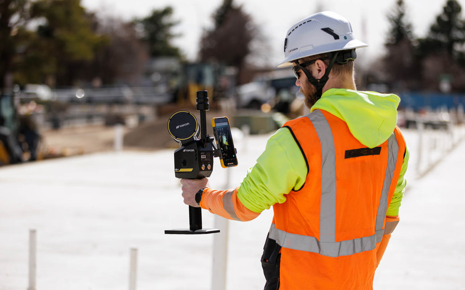
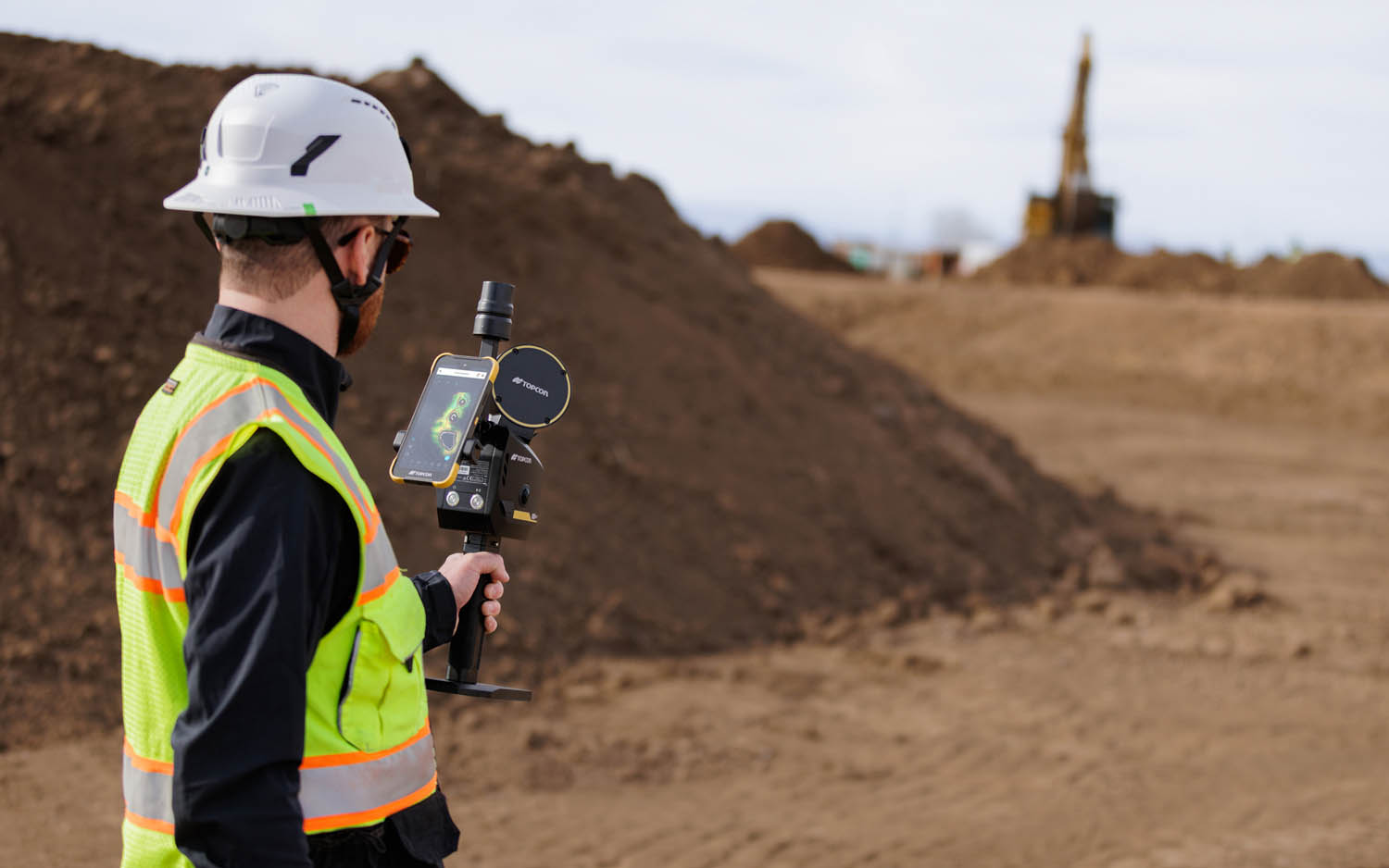
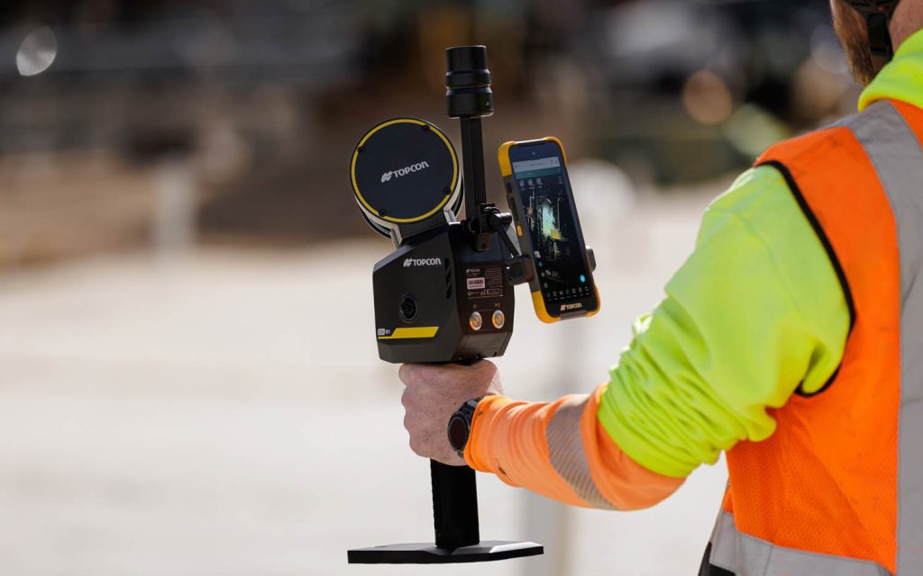
Topcon Positioning Systems has introduced the CR-S1, a handheld scanning system that combines LiDAR, panoramic cameras, visual SLAM cameras, and a GNSS antenna in a single device. The CR-S1 utilizes Topcon’s Collage mass-data software ecosystem central to a connected workflow.
The CR-S1 is a step up from Topcon’s CR-S2, delivering denser point clouds, a longer scanning range, and improved panoramic imaging.
The system is primarily aimed at surveying and construction, but Topcon says it is also well-suited for applications including land surveying, tunnel surveying and modelling, forestry analysis, mining operations, utility mapping, and power line inspection.
“Customers are looking for flexibility and efficient workflows, and our scanning portfolio and software are designed to support these needs through simplified processes, open integrations and mixed‑fleet compatibility,” said Ron Oberlander, head of the Topcon Geomatics Platform.
“With Collage serving as the central data hub supporting inputs from multiple sensors, users can obtain accurate, detailed information for decision‑making.”
Software support includes Magnet Flow for Android and iOS devices, Magnet Bridge for SLAM data desktop processing, and Collage Web.
Collage Web is a cloud‑based platform for visualisation, exploration, and sharing of 3D point‑cloud data directly in a web browser.
Through the Collage Cloud Connector desktop application, projects can be synchronized with Collage Web, allowing what Topcon describes as smooth integration with Autodesk and ClearEdge3D software.
For added positioning accuracy, the CR‑S1 can be connected to the Topnet Live RTK GNSS corrections service.
Mounting options include backpack and front‑pack configurations for hands-free, load-bearing scanning while walking, as well as rover–pole operation. An adapter for mounting the CR-S1 on a vehicle for mobile mapping is also available.