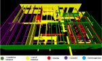
NavVis IndoorViewer extends reach of point clouds beyond BIM Posted by Admin - October 10, 2018 Web-based application converts static laser scans into immersive 360° walkthroughs
NEWS: Topcon acquires point cloud software specialist ClearEdge3D Posted by Greg Corke - February 20, 2018 Deal gives Topcon 3D modelling tool Edgewise and construction verification software Verity
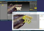
NEWS: Elysium adds VR support to engineering point cloud tool Posted by Admin - January 22, 2018 Enhancement to InfiPoints software supports virtual meetings in digital clone of plant and construction sites
NEWS: Pointfuse V2 to power point cloud conversion in Arena4D Posted by Admin - October 10, 2016 New Integration will allow users to convert all or any part of the billions of points contained within a typical…
NEWS: Murphy Surveys offers ArchiCAD-ready point cloud models Posted by Admin - May 10, 2016 Surveying firm harnesses ArchiCAD’s built-in point cloud technology to produce detailed models
NEWS: Arithmetica challenges point cloud thinking Posted by Admin - February 16, 2016 The forthcoming V2 release of Pointfuse melds point cloud and vector geometries
NEWS: Z+F’s new ‘Blue Workflow’ registers point cloud data on the fly Posted by Greg Corke - May 12, 2015 Integrated laser scanner and scout software means crews can leave the job site with fully registered point cloud data.
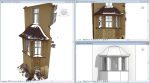
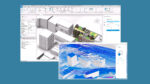
From point cloud to BIM Posted by Greg Corke - March 12, 2015 Survey software provider Kubit, recently acquired by Faro, goes back to basics with its analysis of the implications and ways…
NEWS: NCTech automates HDR point cloud colourisation Posted by Greg Corke - February 27, 2015 ColourCloud software to ‘transform’ laser scans with fast point cloud colourisation overlay
NEWS: Pointfuse Pro offers automated point cloud processing Posted by Greg Corke - November 25, 2014 New tool offers batch and simultaneous processing options to convert point clouds to vectors