Not all twins look alike — we need a better definition of digital twins for cities in 2023, writes Darrel Ronald, founder of Spatiomatics
The definition for urban digital twins is too vague — so it is important to create a clearer picture of the types of urban digital twins that are available. Not all digital twins are the same and each one comes with features and capabilities, strengths and weakness, as well as appropriate and inappropriate use cases. Based on my recent presentation of my SIMO software at the Smart Cities World Expo in Barcelona and many exchanges with clients, customers, designers and project managers, I believe it is time to create a better understanding of urban digital twins.
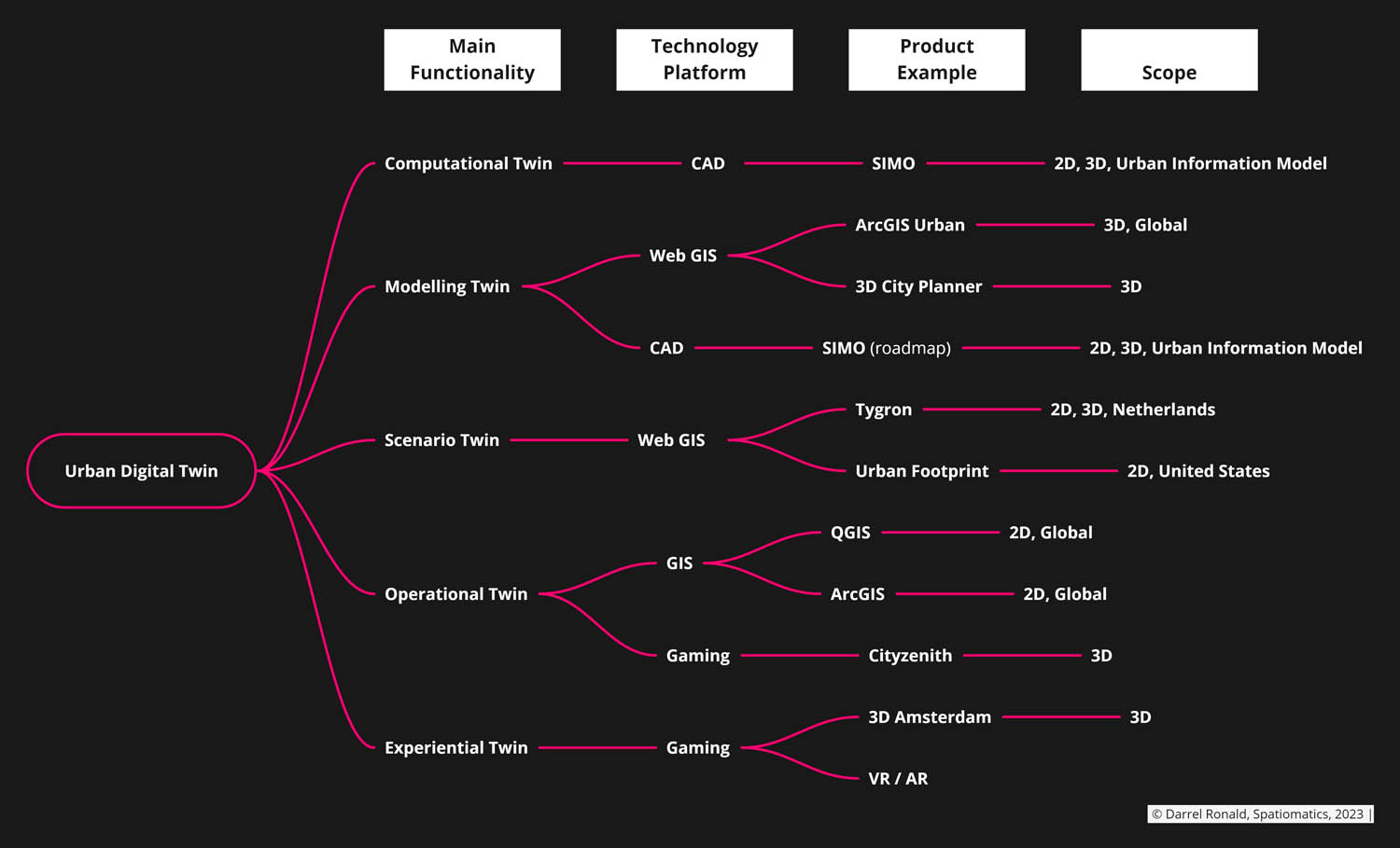
As shown in my proposed Urban Digital Twin Taxonomy above, I propose that we classify these products first based on their Main Functionality (the Use Case), then based on their Technology Platform. I highlight some of main products within the different categories and their product scope. Next, I detail the different types of twins and offer some brief strengths and weaknesses for each type. This taxonomy could apply to other industries such as architecture or manufacturing, but it is specifically applied to cities and urban development projects.
The main functionalities can be grouped by:
- Modelling Twin
- Computational Twin
- Scenario Twin
- Operational Twin
- Experiential Twin
The technology platforms can be grouped by:
- Computer Aided Design (CAD)
- Web GIS
- Geographic Information System (GIS)
- Gaming
BIM is not included since it is limited to building scale objects and does not have any data model for the broad spectrum of urban systems. Please let me know what you think! Did I miss anything?
Modelling Twin
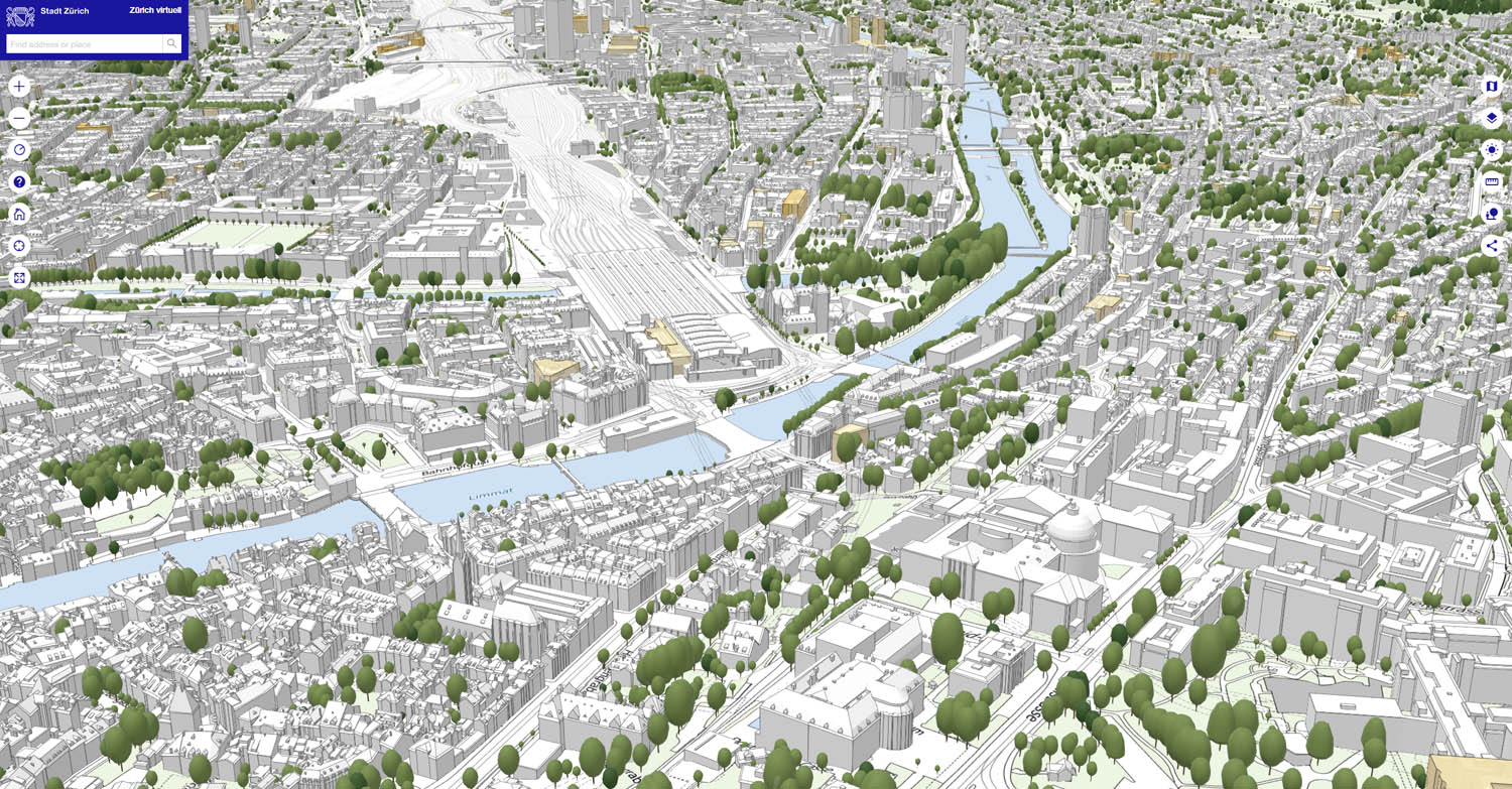
This is the most common type of urban digital twin because it provides basic functionality and workflows common to traditional CAD software. These can be based on either CAD technology (running mostly on the desktop computers) or Web GIS technology.
These products support mostly manual design modelling with automations in the background. In some cases parametric inputs and form generation algorithms are exposed so that it is more interactive.
Strengths
CAD
• High accuracy modelling and data.
• Common design process and easy to learn.
• Very powerful general purpose software readily available.
Web GIS
• Can integrate external geospatial data layers.
• Common design process and easy to learn.
• Easier for multiple users to view the twin (but does not mean collaborate in real time).
Weaknesses
CAD
• More difficult to integrate external geospatial data layers.
• Mostly limited to desktop modelling.
• Real-time collaboration is difficult.
Web GIS
• Low data accuracy for both the model and external data layers.
• Mostly limited to web-based modelling and requires continued internet connection to run.
• Risk of high (or very high) operational costs.
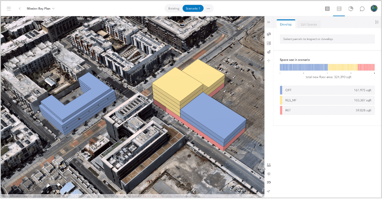
Scenario Twin
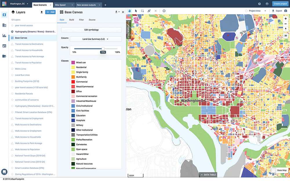
The majority of these urban scenario twins are based upon GIS or Web GIS technology. Due to their GIS origins and data sources, this is especially 2D geometry and analysis, with some products working on better 3D integration.
Due to their GIS origins they tend to implement well known geospatial tools and analysis to the product.
Strengths
• It can allow for diverse testing of development scenarios, but this depends on the product itself.
• Potential to integrate many geospatial data layers.
• Web GIS — common design process and easy to learn.
• Web GIS — easier for multiple users to view the twin (but does not mean collaborate in real time).
Weaknesses
• Limited to a specific geographical region (always).
• Limited to geospatial data sources.
• Limited geometric detail and accuracy.
• Web GIS — risk of high (or very high) operational costs.
• It is well known and documented that urban development scenarios are far more complex than any simulation can offer, so there is an illusion of control, accuracy and intelligence that is very risky to decide urban policy on.
Computational Twin
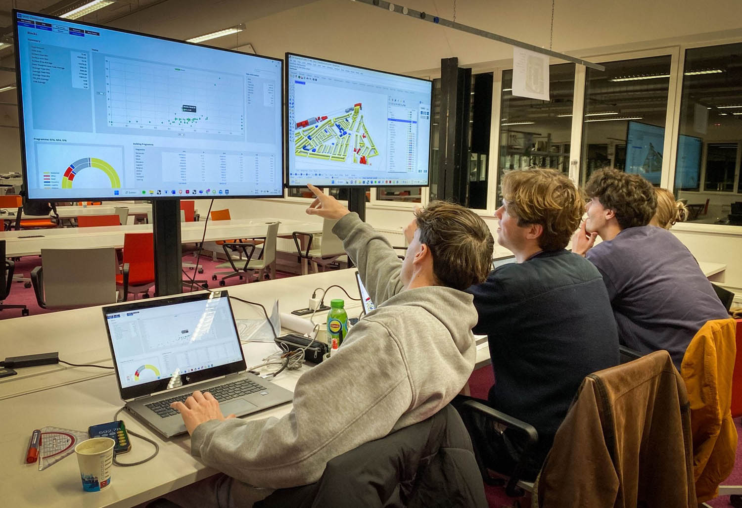
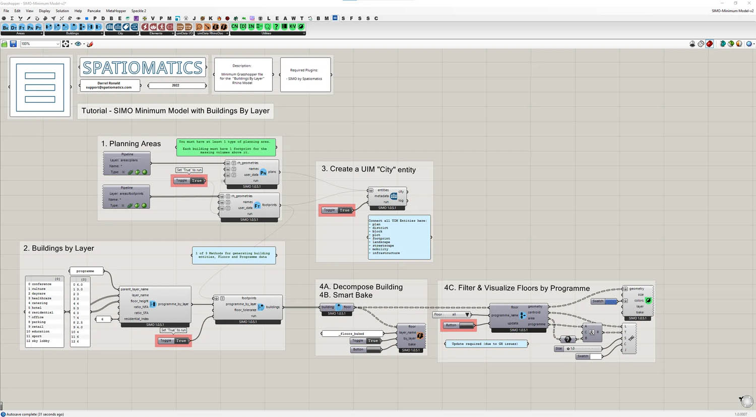
Urban Computational Twins are extremely rare and are the most exciting for us at Spatiomatics. Our SIMO software is based on CAD technology and a unique product offering in relation to the other types of digital twins. I would say that SIMO is probably the only Urban Computational Twin and the only one that provides a standardised Urban Information Model.
SIMO provides computational design workflows that fully integrate into the McNeel software platform of Rhino 3D and Grasshopper 3D. You can integrate all methods of computational design, generative design, evolutionary design and an endless amount of custom project workflows developed in-house by design teams across the globe.
Strengths
• Full control over the design process, generating form, automating tasks, full data-driven design.
• Possibility of advance coding, scripting, and data analysis.
• Speed of design iterations and evolution of the final design.
• Enormous ecosystem of extra tools, plug-ins and workflow optimisations as part of the Grasshopper ecosystem.
• High accuracy of both the geometry and data with access to very powerful computational geometry algorithms.
Weaknesses
• You need to understand how to work with computational design software which adds some extra learning to the process.
• It is more challenging to create a stable data set due to the volatile nature of computational design, but it is possible.
Operational Twin
Urban operational twins tend to be built with either GIS or Gaming technology platforms. Their main purpose is to monitor urban assets in real time based upon Internet of Things (IoT) sensor data overlaid on an urban model. These software are not intended to be modelling, computational or scenario planning tools. They are for the most part management tools for constructed elements. Operational twins are very common in buildings (e.g. manufacturing plants, sports stadia, transport hubs, etc.) and less so for urban environments. They typically contain a lot of information both in terms of geometry and data.
Strengths
Gaming
• High quality representation of models (sunlight, textures, detail).
• Possibility to see the model in VR or AR.
GIS
• Standard workflows based on decades of development.
Weaknesses
Gaming
• The technology was not intended for general purpose use and tends to be overcomplicated. Developing software on these technology platforms is challenging.
• The technology is designed for representation and not creation, so it does not support modelling, data management to general users of the software. Skilled technical teams need to build the digital twin and then deploy it for public use.
• No system for data governance, user administration.
GIS
• Legacy systems which make them difficult to modernise to current needs.
• Is not designed for general purpose modelling and data management. Skilled technical teams need to build the digital twin and then deploy it for public use.
• Has limited software providers and Esri has a monopoly on commercial tools and is not known for innovation.
• Difficult to scale to urban areas while maintaining detail and accuracy. With both gaming and GIS technologies it is challenging to combine diverse data sources, formats and technology standards.
Experiential Twin
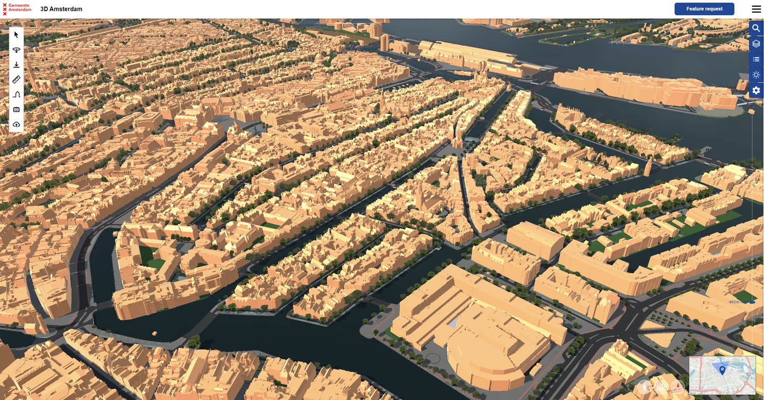
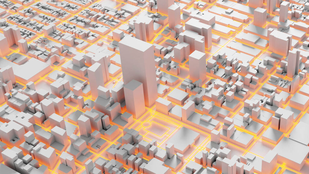
Experiential twins are fairly new to the market since they are fully based on gaming technology platforms which have only recently begun repackaging their products for more general use. They are used to create a more ‘realistic’ experience of an urban environment which is especially helpful for stakeholder communication (e.g. communication with a non-technical community affected by a project). Likewise these twins often allow for both VR and AR experience of an urban development. I teach an Urbanism studio at TU Delft where students use VR to design and analyse their projects — it is a fantastic tool. These are very helpful for assessing development and design scenarios (e.g. new streetscape design, density proposals, etc. The image right shows how Amsterdam uses gaming technology. You can zoom into the model and see more detail, depending on twin’s Level of Detail (LOD).
Strengths
• Helpful in creating a ‘feeling’ of the environment if you detail the model.
• Helpful in communicating an urban development to non-technical stakeholders.
• Gaming technology is very advanced and develops quickly, so models will become more realistic with time).
Weaknesses
• Difficult to create these models, you need lots of technical expertise.
• Limited data integrations and user interface options for seeing project data or technical analysis.
• The technology is demanding on the computer and the models which are shareable online will have some data restrictions.
• These are not made for modelling, analysis or scenario planning. They are purely ‘representational’ digital twins and have limited functionality.