In south west London the Traffic and Highways section of the London Borough of Merton is responsible for the design and implementation of traffic management schemes across 14.5 square miles of the capital. To do this it uses an application that combines the functionality of computer aided design (CAD) with the intelligence of OS MasterMap’s location-based data.
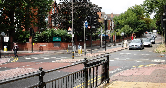
Drivers may dislike yellow lines, speed humps and width restrictions but they all play a part in a safe and integrated transport network. At the London Borough of Merton CAD manager Bader Al-Sheibani uses computer-aided design (CAD) and OS MasterMap to ensure that traffic can flow safely and efficiently through the council’s boundaries.
“Maps and AutoCAD are our spine and nerves: our way of understanding the borough and communicating with the outside world about such matters as road layout and controlled parking zones,” Mr Al-Sheibani says. For several years Mr Al-Sheibani’s team of six was using Land-Line, which was supplied as DXF or NTF files, in a simple structure of points, lines and text. Data in this CAD-friendly format could be loaded quickly and easily into AutoCAD and viewed as tiles representing 500 square metres.
The section moved from Land-Line to OS MasterMap in 2007. OS MasterMap provides consistent and up-to-date information at address, street and building level in four data layers: Topography, Address, Imagery and Integrated Transport Network.
The team found the system easy to use. “MasterMap is fully themed and styled and great to use because it shows the details of a specific site in colour,” says Mr Al-Sheibani.
However, OS MasterMap is delivered in GML [Geography Mark-up Language] files, which are much larger than their Land-Line equivalent and cover an area of 2,000 square metres. This increased level of detail was found to slow users down when working with CAD, making it harder to zoom and pan.
The solution
Mr Al-Sheibani decided to recreate the look, the feel and the lightness of Land-Line without losing access to any of the depth of intelligence that OS MasterMap provides.
Working in AutoCAD Map 3D, he took the GML file for each 2,000 square metre tile and divided it into four tiles of 500 square metres. The original file name was given to the bottom-left tile in each set of four, this name being taken from a point on the National Grid. Their geographic co-ordinates in relation to this point identified the new tiles.
Facts
Customer
London Borough of Merton
Challenge
Raise CAD data to GIS standards of intelligence without any loss of speed
Solution
Integrate OS MasterMap with AutoCAD
Benefits
Maps are always accurate because regular updating is easy to manage
Mail-merge files required for consultation process produced in one seventh of the time previously taken
Mail-merge files contain business as well as residential addresses
CAD archive files are always up to date
Duplication and double entry eliminated
Return on investment
Departmental cost-efficiency has increased
Printing costs minimised because consultation documents are always correct
“Because there is so much detail in the polygon geometry of the OS MasterMap GML files, there are lots of lines. As lines such as road markings are particularly significant in traffic management, we needed to clean them up a little,” he explains.
To go through this deletion process for about 170 files would have been very time consuming. Mr Al-Sheibani therefore developed a special application to process raw OS MasterMap data and run a program to clean it.
“I gradually did all the tiles, cleaning and saving each one.” He then created an application within AutoCAD that allows users to quickly insert the Ordnance Survey tiles. “The CAD user can insert the tile either by typing the street name or by clicking an area on the screen.”
Because the underlying data is from OS MasterMap, Crown copyright acknowledgment is required for all drawings. To ensure compliance, Mr Al-Sheibani wrote another program, so that if a user decides to plot without having included copyright details, a prompt appears reminding the user to insert the Crown copyright text.
Benefits
The Council receives OS MasterMap updates every three months. Mr Al-Sheibani looks to see where the changes are in the new GML files: then he only has to update the relevant tiles. While he spent one month on the painstaking process of creating individual tiles, it now only takes him three hours to manage each update tile by tile.
“The ability to update easily is a significant benefit. Local government departments that opt for updates once a year can be up to 12 months behind and they have to do a massive update, discarding all their information and starting afresh.
“It was a huge undertaking for us when we moved from OS Land-Line to OS MasterMap, so I know that an update of that magnitude would typically take one month.”
In contrast, four days per year is spent on updating and the Borough is only ever a maximum of six weeks out of date.
Public consultations form part of the implementation of traffic management schemes. To obtain the address points, Mr Al-Sheibani first specifies the area affected. Then, using AutoCAD Map 3D, he imports the MapInfo TAB file that is created and maintained by the Council’s GIS team.
Once in AutoCAD Map 3D, the addresses can then be exported to an Excel spreadsheet to be filtered and formatted, and then used to generate the mail merge.
The process of obtaining address points is now very speedy — one seventh of what it was. “It takes five minutes to filter, clean and export an address file. A complete mail-merge file, on average containing 500 addresses, is ready within an hour.
“It used to take one person a whole day to access various databases, export packets of information separately and create a different mail-merge file for each packet. Having done all that, the final result was not comprehensive because all the data was based on the electoral roll and excluded business addresses.” The section works on about 20 schemes each year, so this represents a significant efficiency improvement.
According to Mr Al-Sheibani, the combination of OS MasterMap and AutoCAD Map 3D has opened up a fruitful collaboration between the Borough’s specialists in Highways and Traffic and those in GIS. “The two departments have been quite separate. Because we deal with road markings and signage, we have always been CAD oriented while GIS dealt with addresses, trees, street furniture and drains.”
When the Highways and Traffic team previously created a CAD file for road markings in one area, the file would be archived after the scheme was implemented. With schemes continually being revised, it was possible that two or three years after the original implementation there might be three copies in the archive, two being out of date.
This required huge amounts of storage and created the potential for error.
“Now OS MasterMap acts as one single source for reliable geographical data; when the source is amended the CAD file is automatically revised. We always have an updated record of existing marks such as yellow lines, whereas before we often had to go out as a team to take photographs and measurements. This means that we can start new schemes much faster,” says Mr Al-Sheibani.
Return on investment
“The combination of CAD and GIS gives us accurate plans and eliminates duplication, double entry and lengthy processes,” says Mr Al-Sheibani. “This has a clear impact on efficiency, performance and the integrity of consultations.
“Obviously, it has an effect on cost. We avoid the risk of drawing schemes on old maps and printing consultation documents that are out of date, a potential problem for many councils. We regularly save time on preparing address files; and updating our master data is simple.”
www.ordnancesurvey.co.uk/oswebsite/products/osmastermap/