Plex.Earth Timeviews service gives AEC firms ‘unlimited instant access’ to premium satellite data
Plex.Earth Timeviews is a new service from Plexscape designed to make up-to-date satellite imagery easily accessible from within AutoCAD – and other CAD platforms too, with support for BricsCAD coming soon.
Following a strategic partnership with Bird.i, Plex.Earth Timeviews opens up access to ‘very recent’ satellite imagery from leading commercial satellite providers – Maxar Technologies/DigitalGlobe, Airbus and Planet.
The service features what Plexscape describes as a unique monthly or annual pricing model that gives ‘unlimited instant access’ to Timeviews’ premium satellite data
According to Plexscape, the use of commercial satellite imagery historically came with a high cost, significant delays and the requirement for a certain level of expertise for processing and analysing the data. Furthermore, the company says, free satellite images are often outdated, of low quality, and do not always provide sufficient permissions for commercial use or the creation of derivative work.
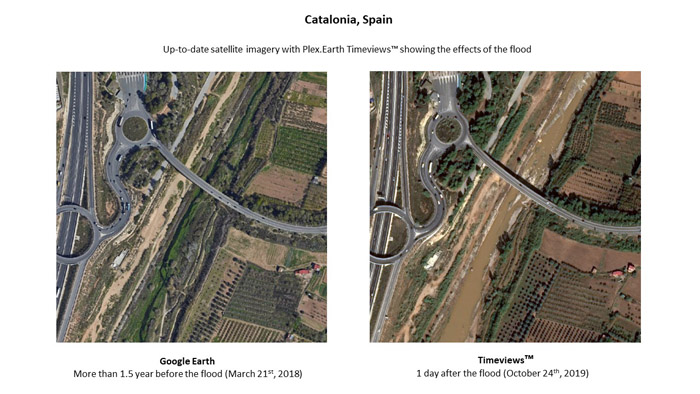
Flexscape says its service can help AEC professionals better understand their project’s environment, make informed decisions and avoid costly mistakes, from the very beginning of the design process. It can also help firms monitor the progress of their ongoing projects (and those of the competition), see how an area of interest evolves over time, or assess the actual impact of natural disasters on worksites.
If you enjoyed this article, subscribe to AEC Magazine for FREE


