A new generation of online services are now allowing diverse project teams to collaborate and manage geographic information more efficiently says James Cutler, CEO at eMapSite.
The AEC sector is characterised amongst other things by the paradox between project-specific detailed mapping requirements and contextual corporate mapping demands. Organisations face different challenges in locating, accessing and exploiting digital mapping data in these overlapping scenarios.
Day-to-day – users demand…
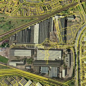
The last few years have seen the emergence of increased choice in and multiple sources for digital mapping and related products; just in terms of aerial photography, transport network and routing information, terrain data, building heights, environmental and ground stability data, there is already a wealth of suppliers over and above the core offering from the sector’s main traditional supplier, Ordnance Survey (OS).
As OS itself faces up to these and other challenges, project-centric users in the AEC sector are increasingly turning away from multiple supplier relationships and seeking out single source solutions for their enterprise.
At the most prosaic level services that provide these solutions enable users to locate these multiple sources online and provide a mechanism by which they can generate quotes, convert these to orders and quickly access/download that data from a common interface.
Enterprise decision makers have recognised this challenge and are beginning to demand that all parts of the business adopt a strategic, collaborative approach to their operations, including in digital mapping.
Most digital mapping users would acknowledge that there is an array of actual (typically CAD and GIS) and potential (typically modelling, management and marketing) users for data sets within any one project. These users are frequently widely distributed within one or more organisations and represent a potential overhead purely in terms of the distribution, licensing, management and update of data for a specific project, let alone the direct financial risk from duplicate purchase.
Secure, hosted services that through a common interface allow all users including sub-contractors to legitimately access and use the data, provide a live data library with clear licensing information and provide administrative tools for different levels of users answer the demands of both decision maker and user.
A recent European example of such an enterprise level commitment is that of The Italian Agency for Environmental Protection and Technical Services (APAT). They now have an interoperable cartographic reference system based on Image Web Server technology that allows simultaneous access to vector and raster cartography that is hosted on different remote servers. “Cart@net Mutiserver” efficiently services the land information requirements of APAT’s 21 regional offices. Built on Earth Resource Mapping’s (ERM) Image Web Server technology “Cart@net Mutiserver” provides a single point of access to different remote GIS services. GIS vector information is sourced from ESRI’s ArcIMS, as well as MapServer and Geomedia. Over 1.2 terabytes of geospatial imagery is held by Image Web Server.
While the Project Managers demand…
While discovery and acquisition of digital base mapping remains a fundamental prerequisite in the early stages of a project, for the engineer and the project manager it is the ability to quickly and easily share, distribute and publish project specific 2D and 3D design information for the duration of the project that remains a serious challenge.
In this arena Autodesk’s DWF format is emerging as a successor/alternative to Adobe’s established PDF format as a means of sharing rich data design files electronically. This has partly come about as a result of AutoCAD’s decision to make the DWF format specification open and to enable its wider adoption through the release of the Autodesk DWF Toolkit free of charge. Users can work with DWF files without having to understand the complete underlying data format while various viewers enable anyone to electronically navigate, view, and print both 2D and 3D design information.
Bentley has recently announced that MicroStation users will be able to include 3D models and animations in PDF documents, enabling AEC professionals and their clients to benefit from interactive 3D visualizations with a single click. Using the PDF files created with MicroStation, professionals, their partners and clients, and the public need only Acrobat Reader 7 to view animations and interactively explore 3D models of engineering projects.
Such enhanced access to drawing data by CAD, GIS and management highlights the need for good auditing and version management within and across the enterprise.
Year-to-year – the enterprise demands…
These organisations thus look to their single source solution provider not only for the actual data but also for a hosting facility that outsources all these overheads and ensures that no user within the organisation (re)licenses project specific data for those data sets. This level of data access and sharing maximises collaboration across the enterprise and adds real value to what might previously be seen purely as an overhead.
In the meantime, larger organisations are facing up to the need for regional, country or national coverage of medium and small scale digital mapping as a necessary overhead in the day to day management of the business, proposal preparation, research and development, marketing and much more. Such data sets are typically raster data sets (although both terrain models and vector data sets come into this category too) and as such can have a high cost of ownership in relation to the annual license fee as a result of managing updates, distribution, archiving, backup, licensing and so on.
Some may recall that in September 2003 Autodesk, Intergraph, Laser-Scan, MapInfo and Oracle introduced a real-world interoperable spatial data management platform to leverage and advance the spatial capabilities of an open spatial enterprise that enables customers to use critical location information in any IT environment and, through compliance with Open GeoSpatial Consortium (OGC) standards, with multiple applications. This “open spatial enterprise concept” continues to gain momentum, with data increasingly recognized as an organization’s most valuable asset and data sharing as a critical requirement for all applications. The gradual take up of this technology is indication (if it were needed) that this is an idea whose time has come. As David Sonnen, Senior Analyst with sector pundits IDC says, “An open spatial enterprise approach enables all users and applications to share spatial data with the security, scalability and manageability of an enterprise database. This is an essential step to maximize business value in spatial information management.”
And for the customer…
Some readers may have come across developments in Web or Internet map services as the related software market seeks to extend the reach of its various tools into the AEC domain; indeed DWF goes some way to enabling this. There is no doubt that these do provide a number of publishing, search and visualisation tools but they do not as yet provide a substitute for the high end analytical and processing tool sets of the CAD or GIS professional. However, as these technologies evolve enterprises across the AEC sector will look to such tools to provide internal and customer facing digital map publishing environments complete with query, retrieval and display functionality. In this role there seems little question that as the total cost of ownership of such tools falls that enterprises will see them as the final piece in the collaborative jigsaw, working with the customer!
This article was written by James Cutler, CEO at eMapSite, a platinum partner of OS – www.emapsite.com


