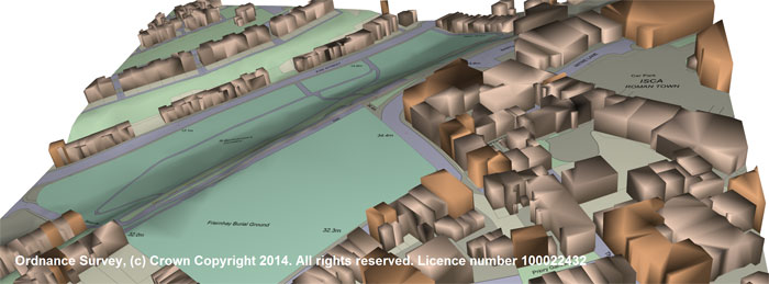
The ‘OS Detail 3D Data Bundle’ via Promap provides immediate 3D view of land and building topography
Landmark is offering a new 3D mapping data bundle designed to remove the need to source and combine individual datasets in order to produce 3D models in PDF and DWG formats.
The OS Detail 3D Data Bundle, available on the Promap platform, combines OS MasterMap detail mapping, OS Terrain 5 height data and OS Building Height Attribute information to provide a full 3D representation of both the natural and built topography of a site.
The data bundle is designed for developers, planners, surveyors and architects that want to review accurate site data as part of the survey and due-diligence process. Models can be viewed, incorporated into existing CAD or GIS applications for further detailed analysis or 3D printed, says Landmark.
Carole Ankers, Product Development Director at Landmark Information Group, said: “We are excited to introduce the 3D Height data bundle to the market, which incorporates OS Building Height Attribute data. Based on new and existing Ordnance Survey datasets, this provides models and data to help visualise the landscape and topography of a site for a range of applications, including line of sight planning, right to light, fly-through sequences, planning applications and to support overall development projects. It can also be used for urban planning and signal propagation analysis.”


