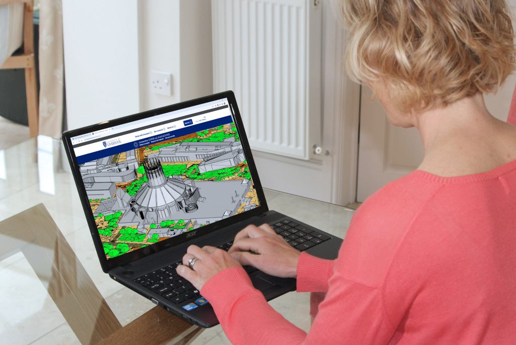
Bluesky 3D models derived from stereoscopic aerial photography offer students at Liverpool School of Architecture an alternative to physical site models during lockdown
Liverpool School of Architecture is using 3D building models, derived from the latest aerial photography, to help teach students online during the pandemic lockdown.
Created by aerial mapping company Bluesky, the geographically accurate simulations provide real world context so students can understand a location and set their architectural designs within an existing site.
The Bluesky models will also be used within the final submissions by second year students to create street views and communicate how their designs interact with the existing context.
“We would normally ask students to work together to create group site models using the workshop,” commented Anna Gidman, Second Year Lead in Architecture at the University of Liverpool. “However, due to lockdown, we are not in the studio, let alone in close proximity with each other, which is necessary for group model making. In fact, many of our students are not even in Liverpool at the moment.
“A member of our part time staff had used the Bluesky 3D building models in architectural practice and suggested this as a solution,” she continued. “The models give remote students a better understanding of the site; they can then talk to students who may have visited the location and use Google Street View to interact with the existing infrastructure and buildings.
“The students have also been using the 3D models to create site sections and elevations, undertake 3D site analysis and create concept and massing models.”
Liverpool School of Architecture is an internationally recognised centre for architectural and built environment research. At the start of the 20/21 academic year the necessity of working online was turned into an opportunity to experiment with new forms of creativity and foster a sense of community among geographically dispersed students.
In addition to the use of the Bluesky 3D building models to underpin project work the School ran The City of Fragments Lab: a three-day collective design studio which saw over 400 students come together to design fragments of a larger city addressing issues such as COVID, climate change and social justice.
Photogrammetrically derived from stereoscopic aerial photography, the Bluesky models are fully rendered and are provided as either wireframe or block models in a format suitable for use in both CAD and GIS software. All Bluesky 3D models are supplied complete with a Digital Terrain Model (DTM) depicting the topography of the underlying surface.


