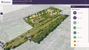
Geospatial London borough cuts maintenance costs with ‘digital twin’ Posted by AEC Magazine - April 16, 2026 High-res drone imagery allowing “faster and more cost-effective” maintenance surveys Read More
Reality modelling Esri and Pix4D build reality capture workflow Posted by AEC Magazine - February 16, 2026 Integration enables users to document subsurface assets with ‘seamless precision’. Read More
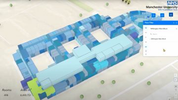
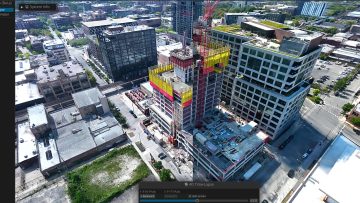
Digital twins NHS Foundation Trust creates smart estate with digital twin Posted by AEC Magazine - November 17, 2025 3D model of six hospitals supports digital transformation at one of UK’s largest NHS Trusts, Manchester University Read More
Digital twins City of Raleigh using AI to gain insight into traffic Posted by AEC Magazine - October 29, 2025 Digital twin pilot project analyses data captured by real-time cameras Read More
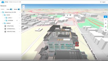
Reality modelling Cintoo launches ArcGIS integration Posted by AEC Magazine - October 12, 2025 Esri Experience Builder Widget for ArcGIS brings high-fidelity 3D scan data to into GIS environment Read More
Geospatial Explorations in GeoBIM Posted by Martyn Day - October 9, 2025 We caught up with Esri’s Marc Goldman to discuss the geospatial company’s focus on BIM integration Read More
Reality modelling Introducing Gaussian Splats for AEC Posted by Martyn Day - December 2, 2025 But what does this new reality capture technology mean for AEC workflows? Read More
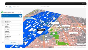
Geospatial Esri launches ArcGIS for Autodesk Forma Posted by AEC Magazine - July 7, 2025 New integration makes GIS data directly accessible in concept design phase Read More
Geospatial ArcGIS Basemaps integrated into Civil 3D / AutoCAD Posted by AEC Magazine - May 9, 2024 Provides AEC professionals with geospatial reference data within Autodesk tools Read More
Geospatial London Gatwick creates new geospatial platform Posted by AEC Magazine - April 19, 2024 Platform uses Esri GIS technology to support multiple operational areas, including engineering and environmental services Read More