Giraffe loomed into view long before the current glut of data and analytical tools for early-phase design emerged. For over six years, this Australian developer has been quietly amassing an impressive portfolio of tools, connecting spatial building and city design models with GIS data, numbers and algorithms
In the design software world, some tools are explicit, like BIM modellers, in that you get what you draw. Others do something akin to alchemy, aggregating disparate design and spatial information and delivering design insight.
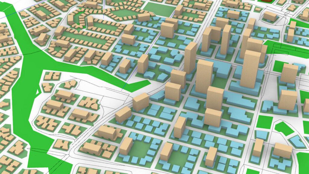
Giraffe is very much in the latter camp. It’s founded on the core concept that connecting design (drawings/models) to mathematical analysis (numbers) at the earliest stage of a project is the single best way to create a mental model of a scheme, enabling designers and clients to create better cities.
CEO Rob Asher was previously design and R&D lead at one of Sydney’s most prestigious architecture firms, Cox Architecture. There, he took the lead on the practice’s use of modelling tools, Rhino, Grasshopper and design data. He explains his journey like this: “I started off doing very, very detailed architectural modelling. I love geometry. I love curves. I love ‘unique’. But in reality, a lot of what drives architectural projects is this kind of block and stack. And you need to get the fundamentals right. As Le Corbusier said, ‘Plan is the driver of form’,” he says.
That prompted a change in direction. “I moved into doing more block and stack buildings, corridor planning, master planning, urban planning, as a design discipline. I was having to use Grasshopper in conjunction with QGIS and there just weren’t the tools. It was just this real nightmare of fusing BIM and GIS.”
A Swiss army knife for decisions
Giraffe’s origins lie within the McNeel ecosystem of apps and Asher’s use of Grasshopper. That may well explain his use of an animal name for his company, taking its lead from McNeel’s use of Rhino, Grasshopper, Penguin and Flamingo.
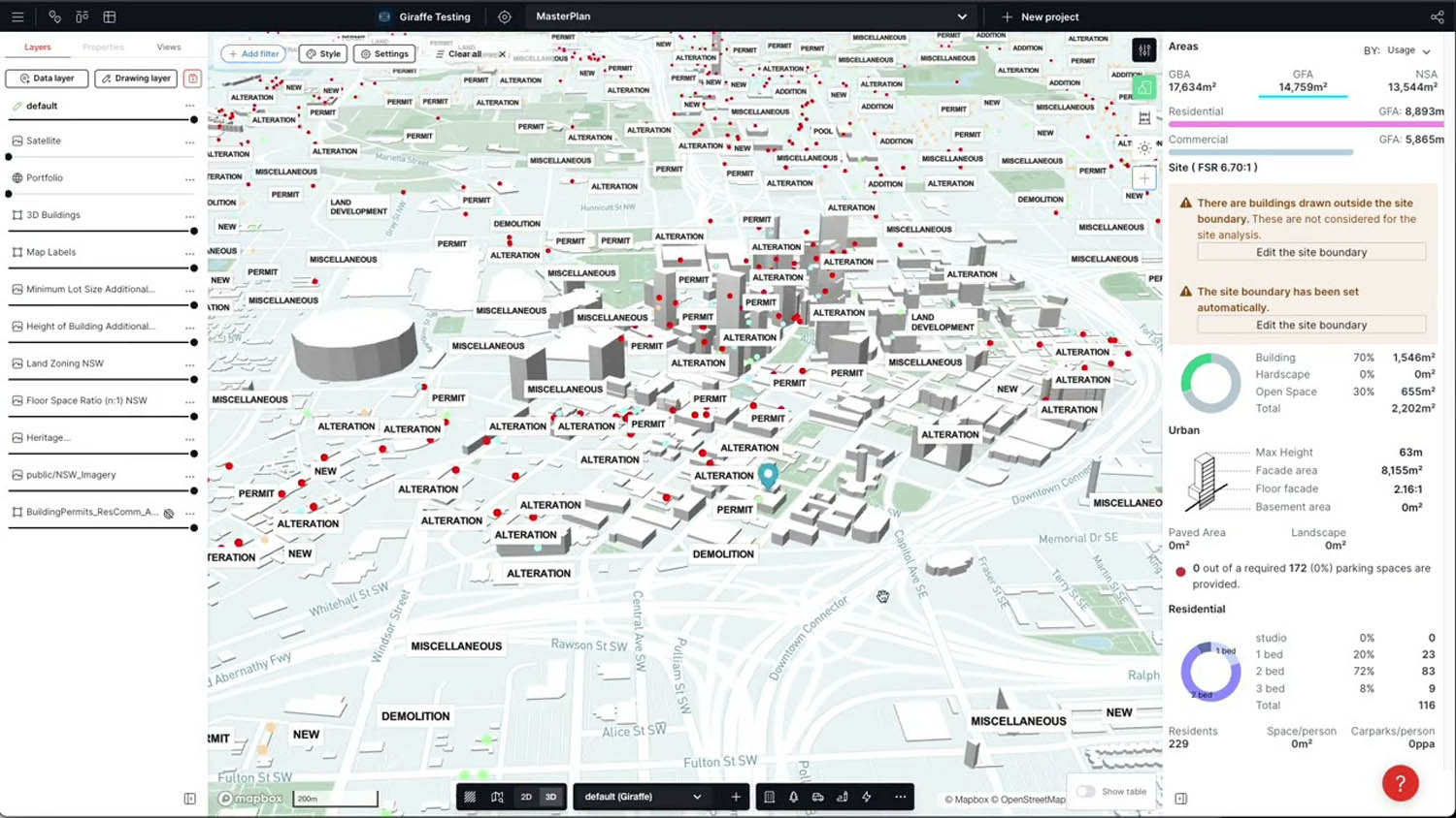
But Giraffe quickly became its own, wholly contained application, based on generative design code. It’s essentially a ‘Swiss army knife’ for project, design and site decisions, aimed at a broad cross-section of disciplines: developers, architects, quantity surveyors, cost planners, government officials, to name but a few.
Says Asher: “Giraffe can go from literally nothing, just a map, to talking to a client about overshadowing, tenancy, floor plate, context and the financials in minutes.”
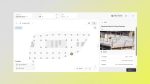
This cloud-based, real-time 3D application enables users to quickly and precisely draw massing, road networks, car park layouts, apartment floor plans or structural grids within a GIS context. It can simultaneously connect a wide number of geodatabases, both internal and external.
Find this article plus many more in the November / December 2023 Edition of AEC Magazine
👉 Subscribe FREE here 👈
While many conceptual modellers tend to be blocky, Giraffe features a range of generative design tools for modelling buildings that offer a lot more detail, including mullion, transoms, roof structures and so on, enabling rapid modelling in situ. It’s the kind of tool that can be put in front of a client for real-time modelling and decisions.
Giraffe is also a venue in which disparate project data can converge and then be analysed. Typically, that data might reside in Google Earth, Bluebeam, local zoning databases, Excel and SketchUp, among others — but Giraffe provides an antidote to this data fragmentation.
Because it is cloud-based, collaboration drives co-authoring, so users can work together. It also acts as a knowledge base, where firms can capture and retain past projects and distribute their IP or develop their own apps through API access.
Already, Giraffe has been deployed in hundreds of different projects, including feasibility studies, land use planning, brokerage listings, master planning, development tracking, location intelligence and public engagement. Users use it to build layers of relevant data: GIS info, site plans, 3D data, satellite data, solar information, conceptual cost data, wind, pollution, historical weather patterns.
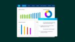
The software provides analysis and dashboards with feedback on the metrics in which users are most interested. This can be shared with consultants, general contractors, planners and architects through an easy-to-use visual front-end and dashboard metrics.
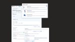
Currently there are four levels of pricing for Giraffe. First, there is a free version, which allows users to create and share one project, providing them with a taste of the platform’s capabilities. The second tier up is called Core and is priced at $1,000 per user, per year. This includes unlimited projects, access to templates and libraries, marketplace access, a kanban board for agile project management, plus in-app support.
A third level, Portfolio is priced at $3,000 per user, per year and offers additional features such as workspace properties, unlimited kanbans, teams and member roles, API access and customer support. Finally, an Enterprise tier adds customer applications, SDK access, SSO and premium support.