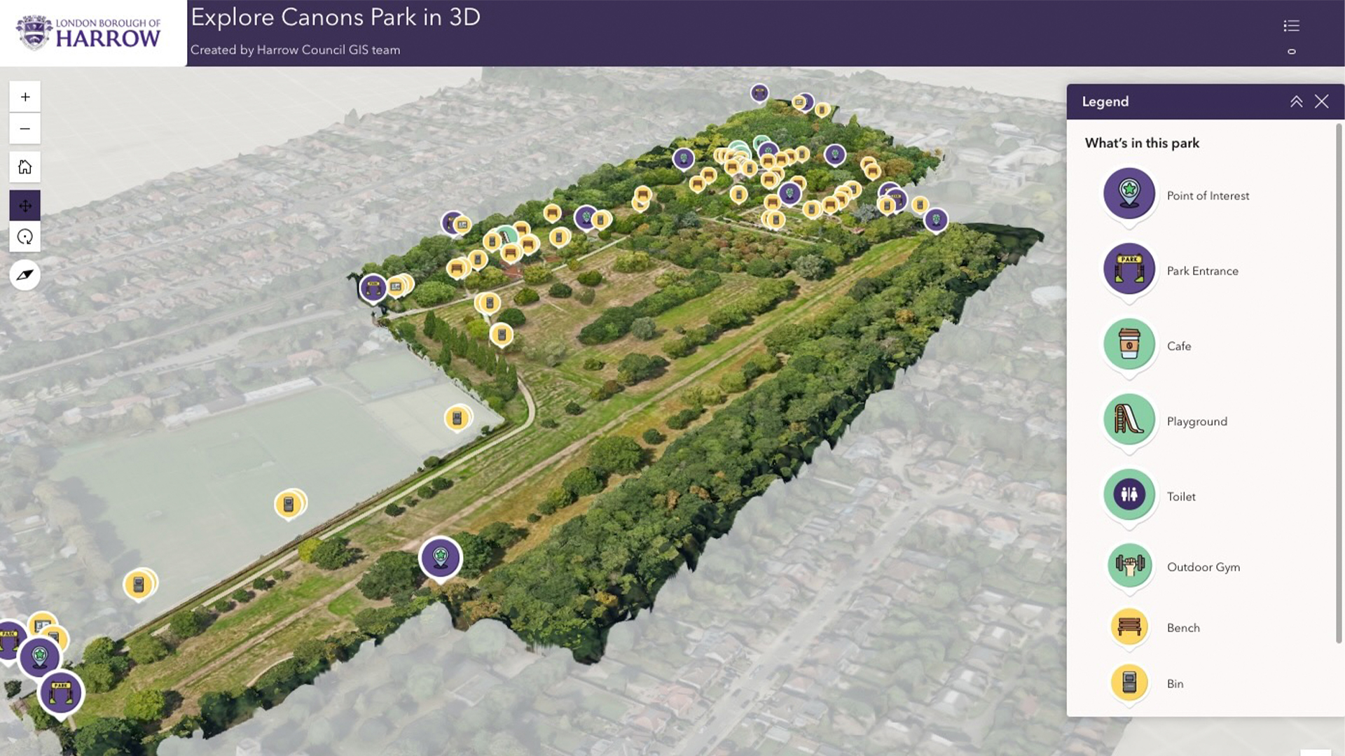
Geospatial London borough cuts maintenance costs with ‘digital twin’ Posted by AEC Magazine - April 16, 2026 High-res drone imagery allowing “faster and more cost-effective” maintenance surveys
Reality modelling Esri and Pix4D build reality capture workflow Posted by AEC Magazine - February 16, 2026 Integration enables users to document subsurface assets with ‘seamless precision’.
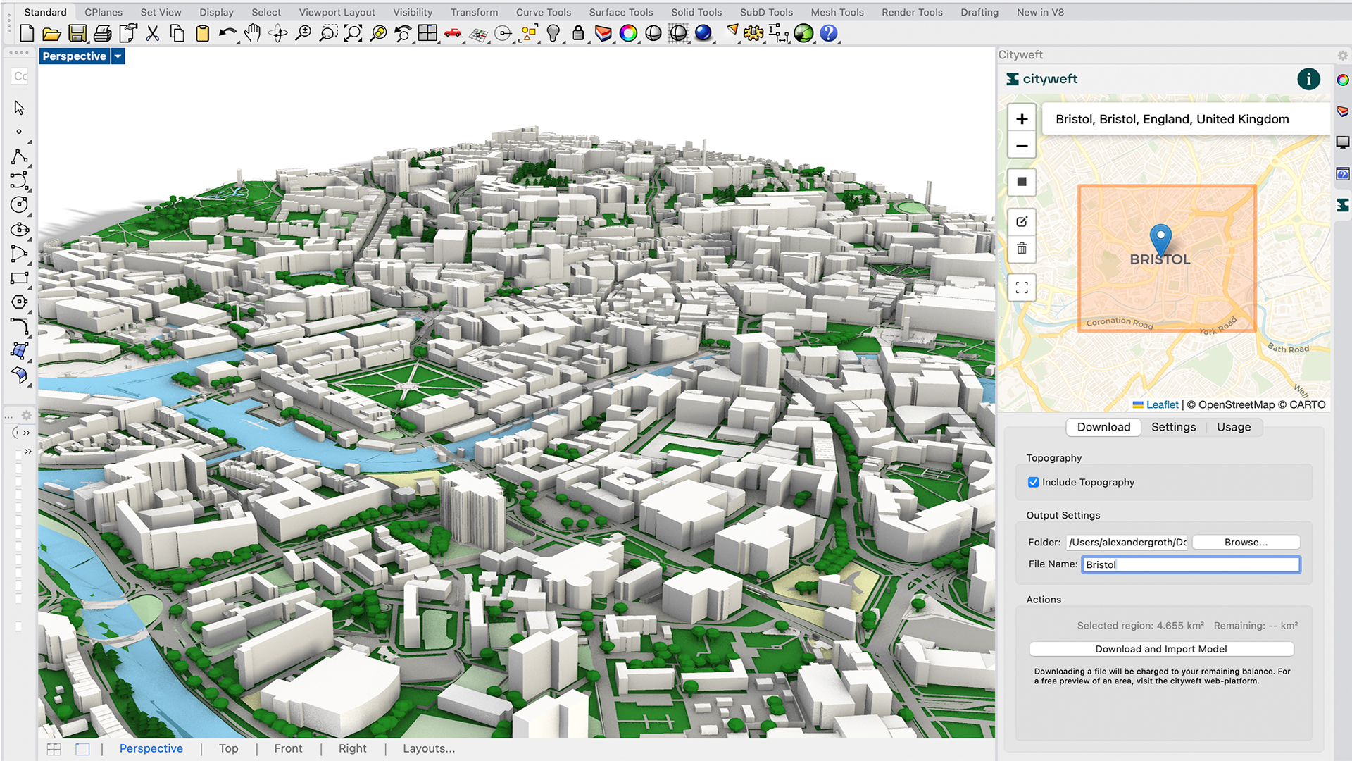
Geospatial Cityweft adds 3D building data for England Posted by AEC Magazine - January 23, 2026 Models can be brought into Rhino, via the Cityweft platform, with support for Revit and…
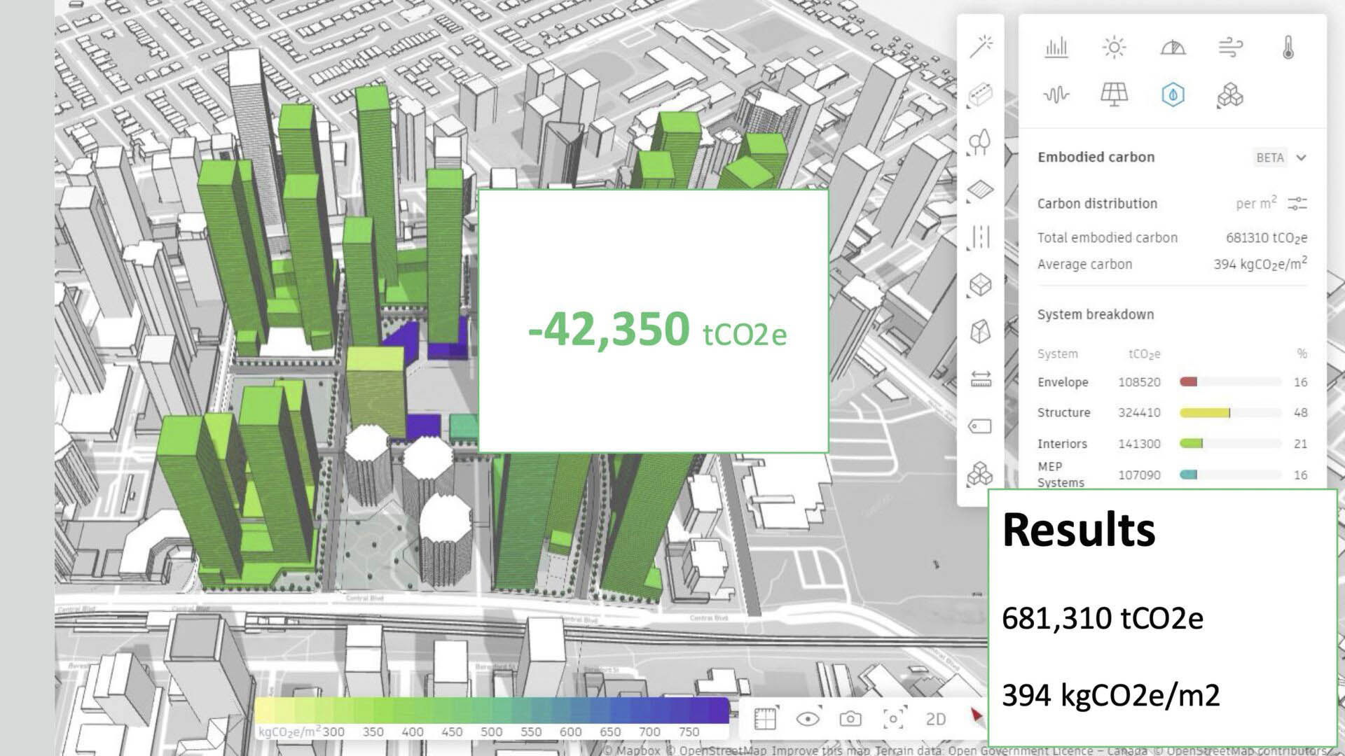
AI Bentley Systems shapes its AI future Posted by AEC Magazine - December 2, 2025 From civil site design to construction planning, Bentley is embedding AI across more of its…
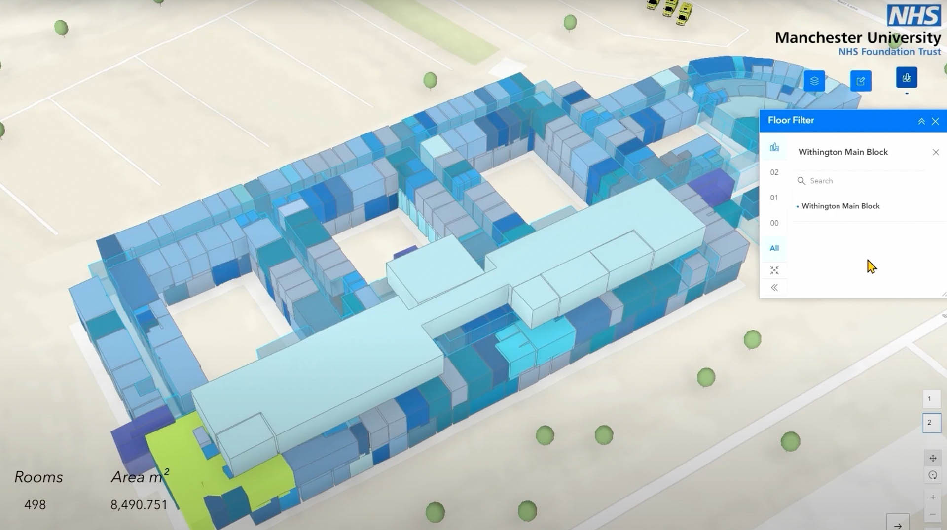
Digital twins NHS Foundation Trust creates smart estate with digital twin Posted by AEC Magazine - November 17, 2025 3D model of six hospitals supports digital transformation at one of UK’s largest NHS Trusts,…
Geospatial Vektor.io to bring visibility to Baltic States rail project Posted by AEC Magazine - November 7, 2025 E.R.B. Rail JV PS will use digital platform for managing and visualising infrastructure design information
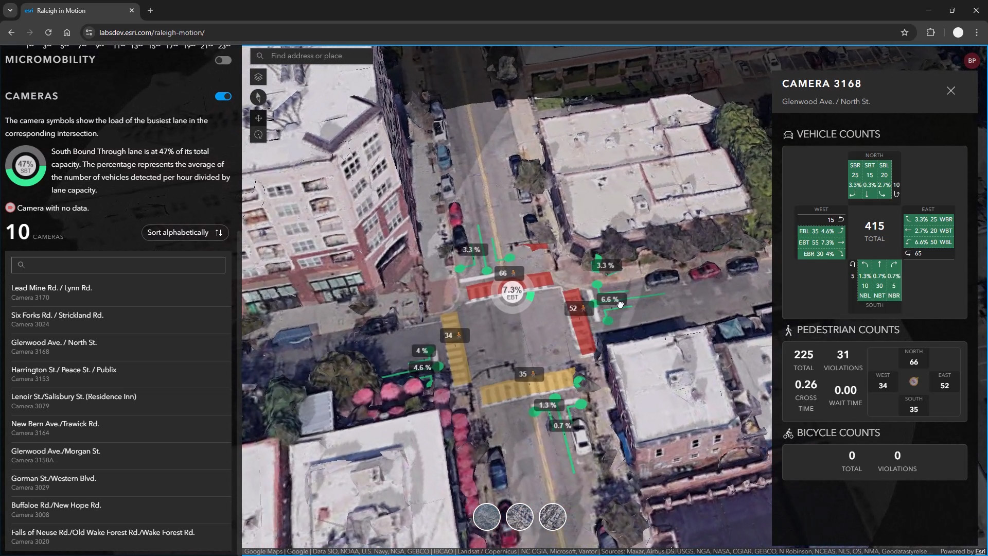
Digital twins City of Raleigh using AI to gain insight into traffic Posted by AEC Magazine - October 29, 2025 Digital twin pilot project analyses data captured by real-time cameras
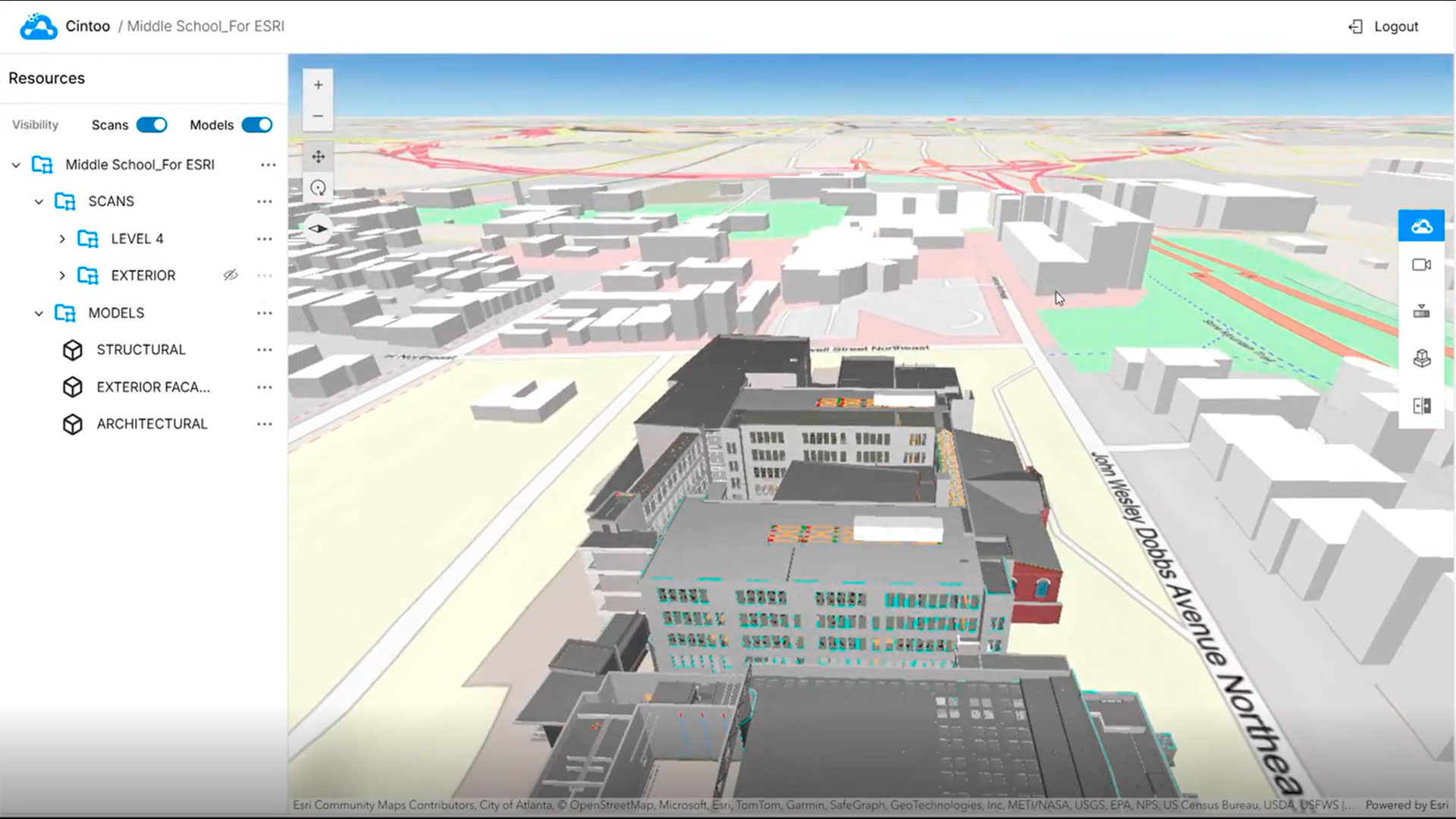
Reality modelling Cintoo launches ArcGIS integration Posted by AEC Magazine - October 12, 2025 Esri Experience Builder Widget for ArcGIS brings high-fidelity 3D scan data to into GIS environment
Geospatial Explorations in GeoBIM Posted by Martyn Day - October 9, 2025 We caught up with Esri’s Marc Goldman to discuss the geospatial company’s focus on BIM…
Digital twins Bentley introduces iTwin Platform APIs for Cesium Posted by Martyn Day - August 22, 2025 Bentley Systems introduces iTwin Platform APIs to Cesium Developers.