After carrying out a building survey, as-built plans are commonly re-created inside a CAD system. DistToPlan looks to streamline the process with the help of a handheld Leica Disto plus laser measurement device and a standard Tablet PC running AutoCAD.
The creation of building plans on site is always going to be quicker with pen and paper, but even the most experienced surveyor may not spot errors until he’s sat back at his desk. This is where DistToPlan from LatimerCAD look to streamline the process, by enabling surveyors, architectural technicians or even facilities managers to create a full set of as-built AutoCAD plans, before they’ve even left the site.
LatimerCAD has been developing a range of AutoCAD-based surveying tools for a number of years. The company’s TheoLT solution provided surveyors with a set of easy-to-use tools to capture point data on building fa?ades with a total station that feeds data directly into AutoCAD (or LT) on site. DistToPlan builds on this relationship between surveying device and CAD product but takes the ease of use factor to new levels. You don’t necessarily have to be a trained building surveyor to use DistToPlan. All you need is an understanding of the surveying techniques, a point and click Disto plus laser distance meter, and a tablet PC or notebook running AutoCAD (or LT).
Building plan creation
DistToPlan is an ARX application that creates an environment inside AutoCAD to enable a Disto plus device to be used as a real time drawing tool for the creation of building plans. As measurements are taken, data is fed from the Disto plus directly to a notebook or tablet PC running AutoCAD via a wireless Bluetooth connection.
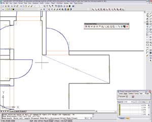
Each new room is first defined in DistToPlan’s ‘Room Manager’ where all data relating to the room is organised according to layers and description. In DistToPlan there are two key ways to draw room plans. The simplest method is the ‘rectangular room’ where the user takes distance measurements for the length and width of a room, then measures the diagonal so DistToPlan can automatically check for errors and make adjustments as necessary. This is particularly important for old buildings where rooms are often not square.
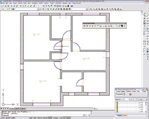
For more complex rooms the Angle mode or ‘Follow Wall’ method enables the user to take a wall measurement, and then use the arrow keys on the Disto plus device to define their direction. Once a room is closed, DistToPlan calculates the area automatically and displays it in the Room Manager.
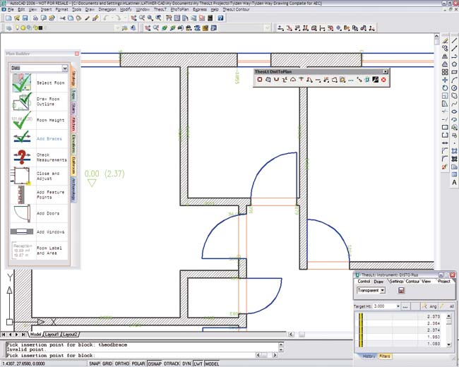
Features such as doors and windows can be added with ease using dedicated tools controlled via dialogue boxes. For example, for the creation of doors the user simply defines the distance along a wall, the door width and hinge position and DistToPlan will automatically cut back the wall and place the door complete with swing. For multiple doors and windows users can quickly measure node points along a wall and drop in doors and windows as required. Other features such as bay windows and chimney breasts can also be added with ease.
Adjusting for errors: Any surveying process is always going to be subject to errors, and DistToPlan excels in its ability to adjust for these. In addition to diagonal measurements, which can be used to check and adjust for errors in rectangular rooms, DistToPlan includes a tool which closes and distributes errors that arise when defining irregular rooms wall by wall. For these adjustments, tolerances can be defined and DistToPlan will alert the user if it falls outside, indicating a measurement error. Individual distances can then be re-measured and revised as necessary using dedicated tools. If there is a high degree of confidence that certain lines and points are positioned correctly, the user can constrain the room geometry, with any adjustments working around these fixed positions.
In addition to any adjusted data, DistToPlan automatically stores all original measurement information on a separate AutoCAD layer, so there is a complete audit trail of the plan production process.
Aligning rooms: Buildings will typically be surveyed room by room, but to fully define a building plan, individual rooms need to be aligned. For this, users simply define a reference point, wall offset and a cutback distance which will enable DistToPlan to adjust for any errors. Adjacent walls can also be aligned by door and window openings with DistToPlan automatically adjusting for errors around these fixed points.
Plan builder: Disttoplan includes an excellent Plan Builder utility that enables a company to build up a standard workflow for its staff. This not only aids those less experienced in the art of surveying, but also offers non-AutoCAD users a helping hand to step through the plan building process and avoid missing any tasks. Each individual task is accessed through the dedicated Plan Builder palette with DistToPlan automatically placing a tick by each icon as it is completed. Users are not able to move onto the next task until the previous task is finished.
Beyond plan creation: In addition to the extensive plan creation tools, those running DistToPlan on a Tablet PC can utilise a number of additional data types to enrich the survey. Handwritten notes can be taken with the Tablet PC’s Journal, voice notes can be added with the built in microphone and users can take pictures with camera phones and link back to the Tablet PC via bluetooth. All of these additional data types can then be hyperlinked from within the AutoCAD drawing to create a single reference for all survey related data.
Conclusion
Over the past few years Leica’s Disto plus has established a strong footing in the building surveying sector. What DistToPlan does is provide a simple way to get Disto plus distance measurements directly into AutoCAD for the production of building plans. However, DistToPlan does much more for AutoCAD than just replace a mouse with a laser measurement device. It enables surveyors, architects or facilities managers to clearly see and correct errors as they occur whilst giving them the confidence that all the data collected during a survey is both accurate and complete. And while the use of DistToPlan will probably mean more time on site, this will be more than offset by a minimum amount of re-work back at the office, the elimination of site re-visits, and most importantly, the subsequent acceleration of AutoCAD plan production.
Product: DistToPlan
Supplier: LatimerCAD
Price: ú795


