Topcon branded version of Bentley Systems ContexCapture turns photos into detailed 3D models
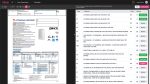
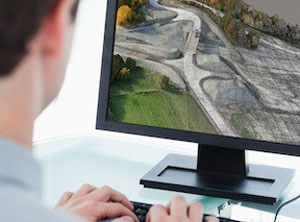
Topcon Positioning is bundling Bentley Systems’ ContextCapture reality modelling software with its Topcon UAS (unmanned aerial systems). The software is designed to enable mapping, construction and surveying professionals to quickly turn photographs and / or point cloud data into highly detailed 3D models.
Topcon’s offering will be branded Topcon ContextCapture and will be available in Standard and Advanced versions, as Charles Rihner, vice president of the Topcon GeoPositioning Solutions Group explains. “The standard package will be bundled with Falcon 8 and Sirius Basic/Pro and allows operators to process data from these UAS into textured 3D reality meshes, point clouds and orthophotos,” he said. “ContextCapture Advanced allows users to process data from any UAS. It also includes ContextCapture Editor, which enables operators to take advantage of all project data by integrating reality meshes and point clouds, into infrastructure workflows. The result is access to a wide variety of reality modelling tools to help increase productivity.”
The ContextCapture Advanced integration includes CAD, inspection, GIS, civil engineering, and survey workflows on desktop and mobile devices, in multiple formats.
“This represents the next step in the Topcon and Bentley collaboration to advance the concept of constructioneering — allowing users to start from a reality-captured survey context and leverage and update their digital engineering models throughout the construction process, and finally deliver the as-built infrastructure in real time,” added Rihner.
If you enjoyed this article, subscribe to AEC Magazine for FREE