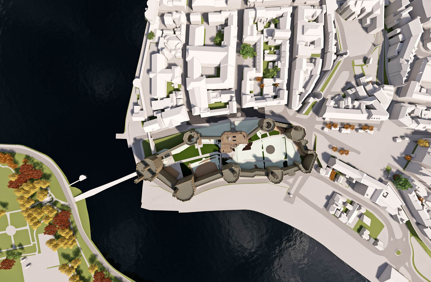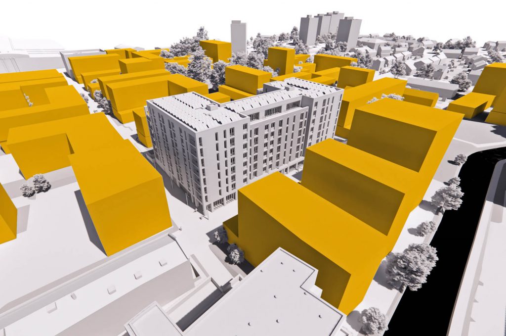
Photogrammetrically derived Bluesky 3D models of surrounding buildings and terrain provide true scale context for design proposals
Design studio Buttress is using 3D building models from Bluesky to create interactive walkthroughs and VR presentations in a dedicated design viz tool, via Revit.
Created from the ‘most up-to-date and accurate’ aerial photography, the Bluesky models are used to provide context, giving stakeholders the opportunity to explore a design in its real-world location using QR codes or VR headsets.
Buttress has used the Bluesky models on numerous projects including a pioneering redesign of the Kings Gate at Caernarfon Castle and master planning for the Ancoats area of Manchester (pictured above).
“We use Bluesky models to accurately assess the impact our proposals have on key views,” commented Paul Thornborough, BIM manager at Buttress. “This may be the effect a proposal has on the view of an historic building from across a valley or how a project relates to its immediate neighbours.
“The idea of using geographically accurate data is that anyone viewing our projects can immediately realise the true scale of the proposal and appreciate it within its real-world context.”
Created from the latest aerial photography Bluesky models provide a geographically accurate and up-to-date 3D representation of both the underlying terrain and existing properties and infrastructure.
Buttress imports the data into Revit to provide context for its 3D designs. Then, following a degree of post processing to create realistic and relatable representations, the data is exported to Buttress’s visualisation software to further enhance the realism.
The resulting presentations are then shared and accessed by any interested party via mobile devices, using scannable QR codes, or immersible VR experiences.
Photogrammetrically derived from stereoscopic aerial photography, Bluesky’s models are fully rendered and are provided as either wireframe or block models in a format suitable for use in both CAD and GIS software.
The Bluesky data is supplied complete with a Digital Terrain Model (DTM) and can be created to different levels of detail (LOD). Additional features, such as transport infrastructure or environmental features can also be added.
Buttress is a leading design studio based in Manchester which provides architecture, urban design, interiors and conservation design services.