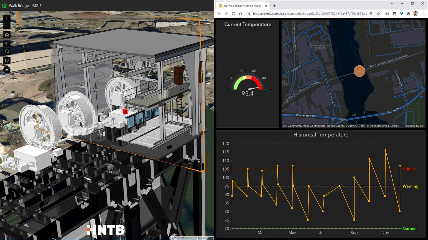
Geospatial Beyond construction: geospatially enabled BIM Posted by AEC Magazine - February 7, 2022 To replace a complex rail bridge HNTB put ArcGIS GeoBIM to the test
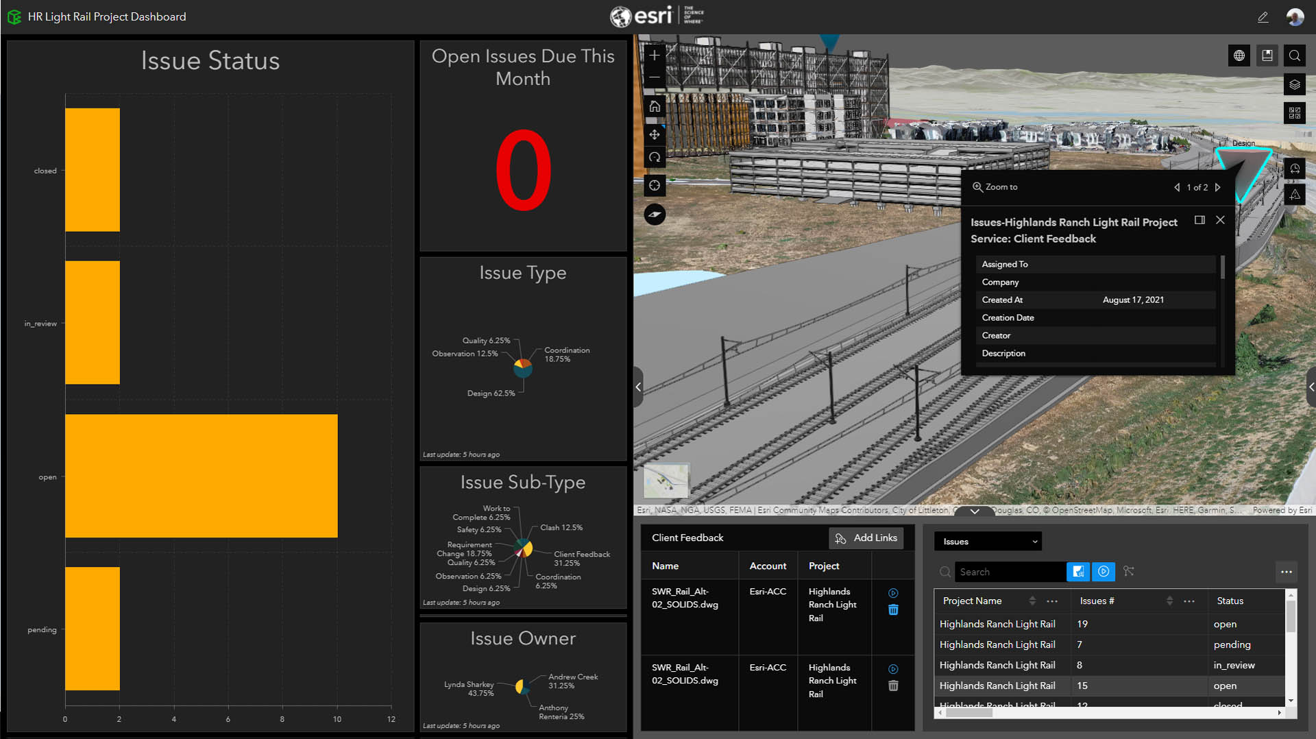
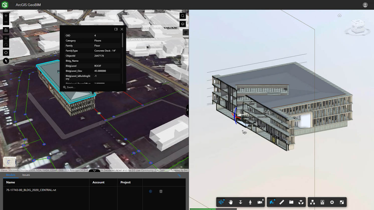
Geospatial Esri ArcGIS GeoBIM – the link between GIS and BIM Posted by Martyn Day - February 3, 2022 After four years of development, the Esri-Autodesk Partnership has finally delivered its first offspring
Geospatial Esri ArcGIS GeoBIM brings spatial context to AEC operations Posted by AEC Magazine - December 6, 2021 New GIS product connects with Autodesk Construction Cloud to bridge gap between GIS and BIM
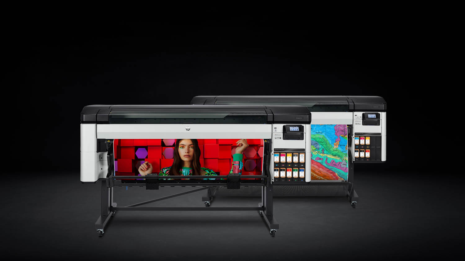
Hardware HP DesignJet Z6 Pro and Z9+ Pro large format printers launch Posted by AEC Magazine - September 15, 2021 New wide format printers focus on colour quality and precision
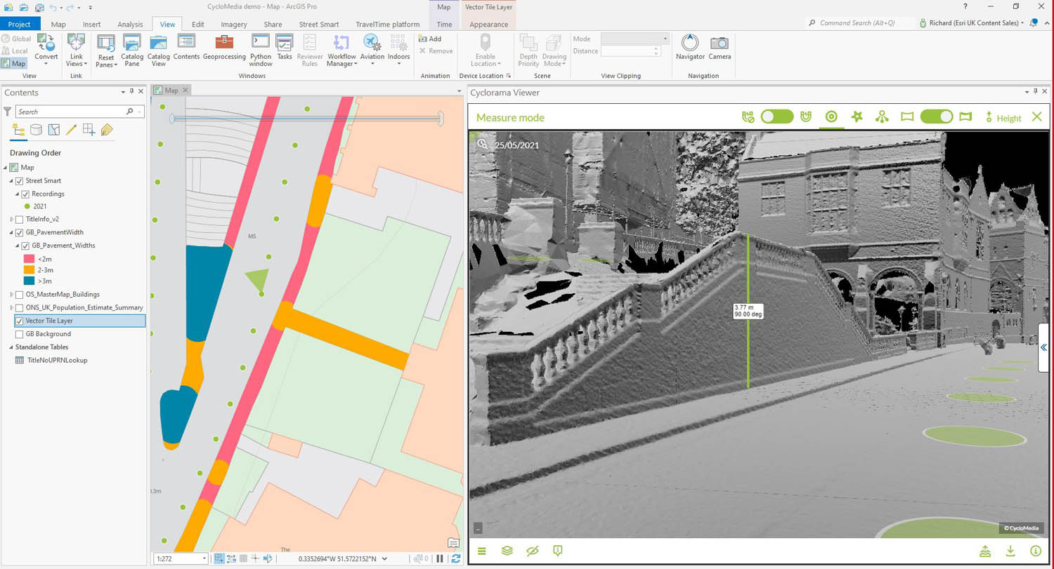
Digital twins Harrow creates ‘digital twin’ with street imagery and LiDAR Posted by AEC Magazine - August 25, 2021 New approach will help London Borough improve planning, highways and Council Tax operations
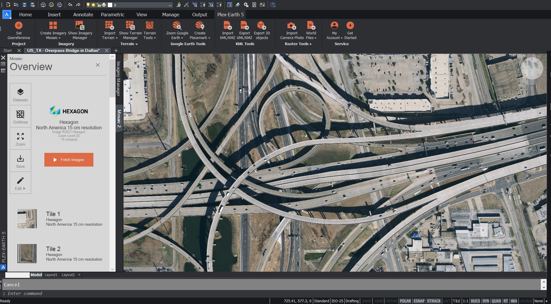
Geospatial Plex-Earth expands to BricsCAD with satellite and aerial imagery Posted by Martyn Day - April 25, 2021 Plex-Earth expands to support BricsCAD with high-quality imagery and terrain data
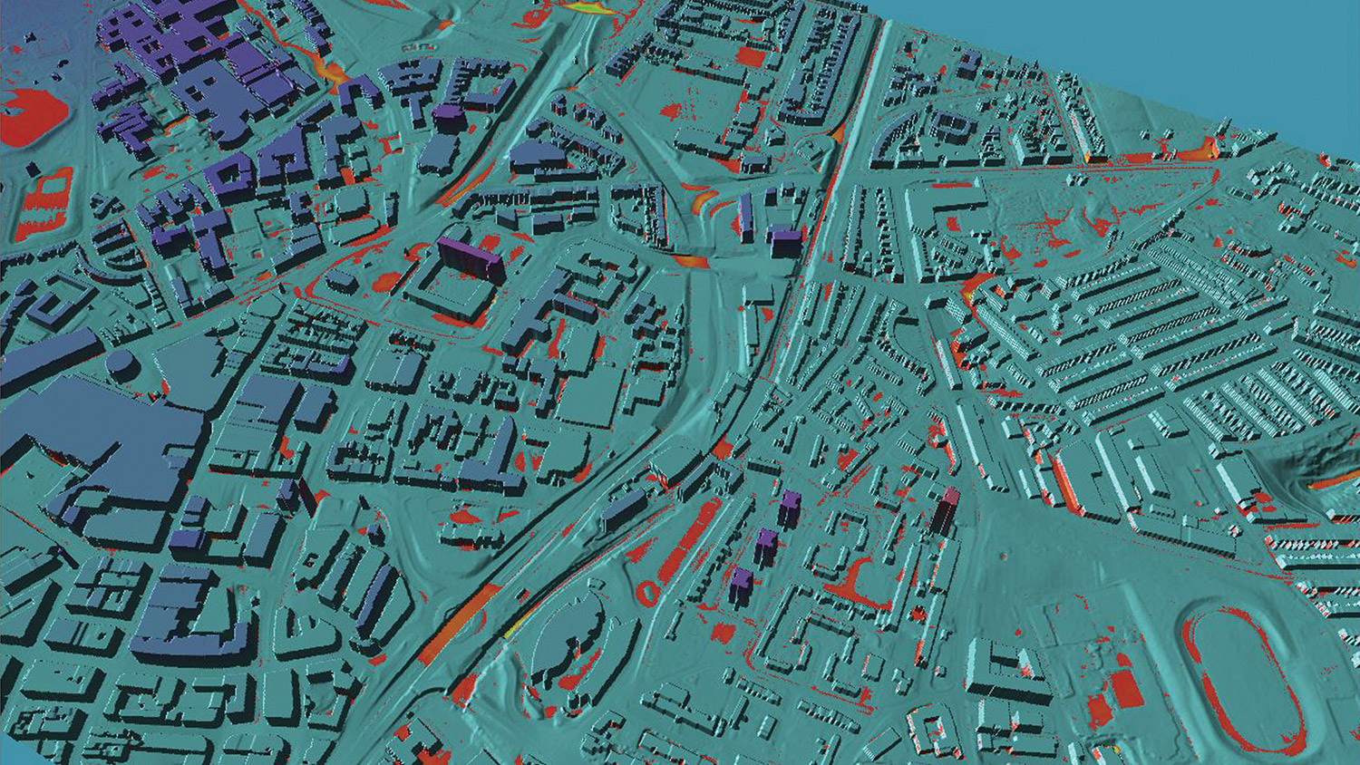
Reality modelling Mesh models underpin Bartlett dynamic map of London Posted by Martyn Day - April 13, 2021 Bluesky MetroVista Mesh Models used to produce a new Digital Twin of London
Geospatial Flood risk modelling goes under the microscope Posted by AEC Magazine - March 9, 2021 Newcastle University’s high-res flood risk modelling combines LiDAR and oblique aerial photography with AI
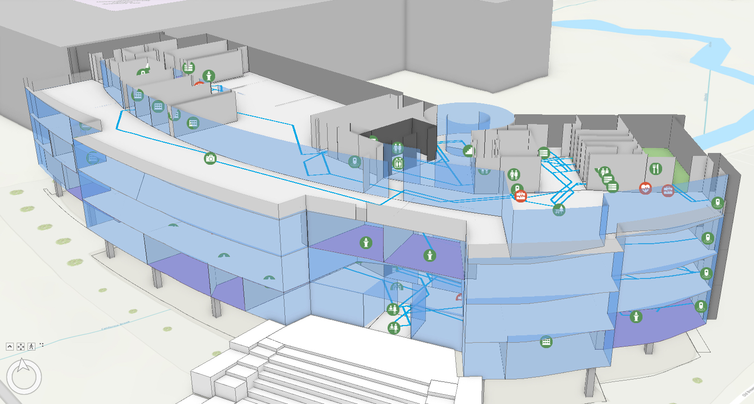
Reality modelling Esri UK partners with Tetra Tech on indoor mapping Posted by AEC Magazine - March 5, 2021 Service will use LiDAR scanning, data analytics and GIS to help support facilities
Features 20 AEC technologies that can aid social distancing Posted by Greg Corke - July 22, 2020 20 technologies that can help AEC firms and facility owners plan, function and mitigate risk…