OpenSite Designer includes analytics optimisation, links to geotechnical engineering solutions, and tools to produce ‘all required project deliverables’
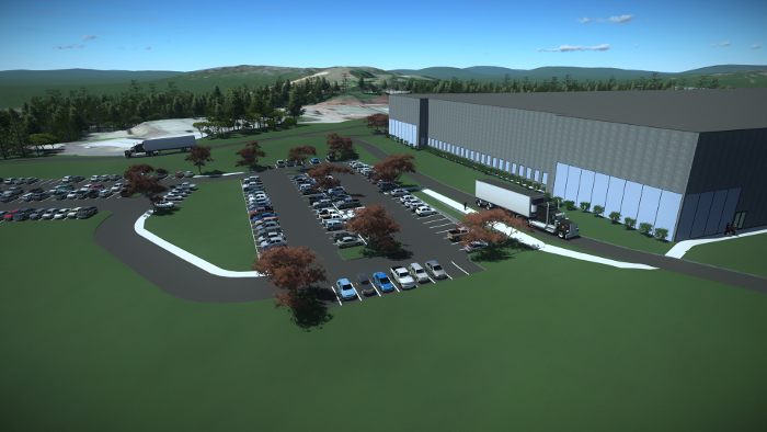
Bentley Systems has launched OpenSite Designer, an integrated tool for civil site and land development that covers the conceptual, preliminary, and detailed design phases.
The software spans reality modelling of site conditions from drone imagery and scans (reality meshes and point clouds), geotechnical analysis, terrain modelling, site layout and grading optimisation, stormwater drainage modelling and analysis, underground utilities modelling, detailed drawing production, and ‘enlivened’ visualisations.
OpenSite Designer features the analytics optimisation of Bentley’s SITEOPS technology and supports ‘rapid and iterative conceptual design’. It can link to Plaxis and SoilVision, Bentley’s geotechnical engineering solutions, so site plans can be enhanced with information about the active properties of soil.
Users can create intelligent 3D models containing site information, terrain data, parking lots, building pads, driveways, sidewalks, parcel layout, and related site features. During preliminary design, the site engineer can improve the layout while relying on further automated optimisations, which respond to the engineering changes. To complete the workflow, OpenSite Designer supports detailed design including the production of ‘all required project deliverables’.
If you enjoyed this article, subscribe to our email newsletter or print / PDF magazine for FREE


