GeoSLAM Construction Progress SLAM solution uses mobile LiDAR and automated analytics to compare point clouds to CAD
Following an extensive pilot with UK construction and property service company, Willmott Dixon, GeoSLAM has launched a new solution designed to ‘quickly and easily’ measure the progress of a construction project
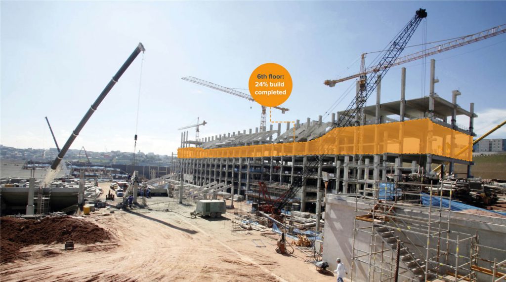
The GeoSLAM Construction Progress solution will help construction companies obtain ‘clear and objective visibility’ of progress, helping to avoid missed milestones in the build or costly delays.
The solution works by streamlining the monitoring of projects through point cloud data automatically generated by the company’s handheld SLAM (simultaneous localisation and mapping) technology.
Scans are then processed and compared against previous scans, or to CAD models. A PDF report is automatically generated and emailed to project participants or saved to a central file location. The PDF report will show the percentage of work complete or incomplete (compared to 3D model) and a simple visualisation of the site highlighting 3D change.
Results can also be synced to collaboration tools including Dalux, Autodesk BIM 360 or Viewpoint 4projects. The data can also be exported to CAD or a CDE (common data environment).
“We have always advocated for the importance of technology to any business, but even more so today, automated tools like Construction Progress are vital to the longevity of construction companies in particular,” said GeoSLAM CEO, Graham Hunter.
“This is something completely new for the sector, and we’re delighted that one of the country’s leading construction and property service companies, Willmott Dixon, is successfully using GeoSLAM Construction Progress.”