New integration makes GIS data directly accessible in concept design phase
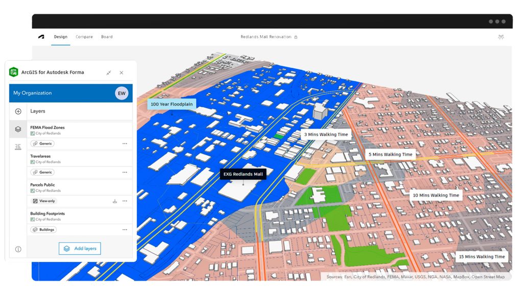
Esri has released ArcGIS for Autodesk Forma. a new integration that brings Esri’s geospatial reference data into Autodesk’s planning and design software, providing users with a single design environment without having to switch between platforms.
ArcGIS for Autodesk Forma will also streamline the sharing of designs enriched with GIS data from Autodesk Forma to Autodesk Revit.
“AECO professionals who use Autodesk Forma will now be able to quickly update projects with the most up-to-date GIS data available,” said Eric DesRoche, director of infrastructure business strategy at Autodesk. “With access to the most accurate and current geographic information during the conceptual design stage, users can design with location in mind and ultimately deliver projects that are more sustainable, resilient and can better support local communities.”
Find this article plus many more in the July / August 2025 Edition of AEC Magazine
👉 Subscribe FREE here 👈

ArcGIS for Autodesk Forma will serve as an Autodesk extension, incorporating geographic data and geospatial services to enable greater analytics and insights. According to Esri, it will give professionals a deeper, more holistic understanding of projects connected to the social, built, and natural worlds, and give direct access to maps, layers, and other spatial data.
Included are Esri’s ArcGIS basemaps and select data layers from ArcGIS Living Atlas of the World.
The combination of GIS and BIM during early design and planning stages will also bring teams advanced understanding and visualization of projects.
“Our augmented reality technology hinges on visualizations that function as counterparts to the physical world, so the seamless use of public and proprietary spatial data is critical for customers,” said Dana Chermesh-Reshef, inCitu founder and CEO. “ArcGIS for Autodesk Forma’s interface is easy to use and responsive, while accessing data is intuitive for AECO professionals with even limited to no GIS experience.”