
Reality capture platform includes AI agents that can see, understand, and act on job site data
OpenSpace has enhanced its Visual Intelligence Platform adding new features to help construction teams understand, navigate and document jobsites in real time.
The updates are said to move OpenSpace beyond traditional reality capture toward a broader vision where teams can use AI and spatial data not just to create a record of construction, but to make faster decisions while work is underway.
“Construction doesn’t need another disconnected tool or system that asks teams to manually input information into a form,” said Jeevan Kalanithi, CEO and Co-Founder of OpenSpace. “The next phase of the industry will be defined by platforms that understand the physical world and make that intelligence available wherever teams already work.”
New capabilities include AI Autolocation 2.0 with Live Location, which uses AI to pinpoint a user’s location inside buildings without GPS or additional wireless hardware, and AI Walk-and-Talk, which lets teams create daily logs by simply walking the site and describing what they see.
Meanwhile Site Mode gives field teams a Google Maps-like experience inside a project, showing their location and orientation directly on floor plans and BIM models while giving them access to relevant project information.
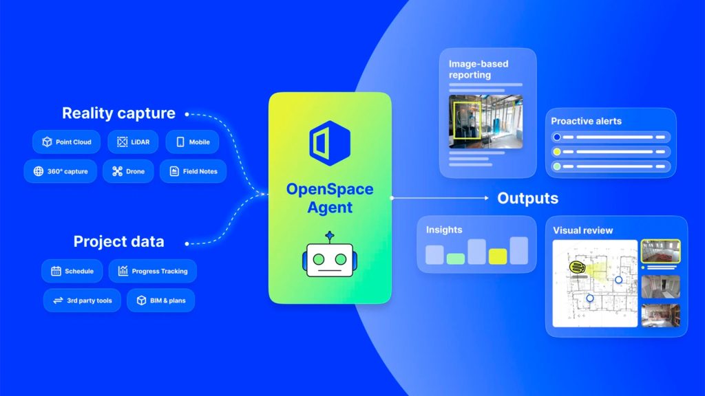
Finally, OpenSpace has introduced the Agent Ecosystem, an open AI agent platform that gives AI access to visual and spatial context from the jobsite so it can understand what is happening and tackle work that teams need to do.


OpenSpace has analysed imagery from more than 110,000 construction projects representing more than 77 billion square feet, creating a foundation for AI agents to assist with workflows such as daily logs, inspections and punch lists.
The OpenSpace platform brings together data from 360° cameras, smartphones, drones, laser scanners, BIM models, project schedules and more.