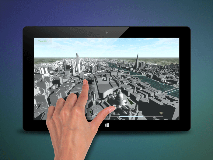
Multi-platform digital model uses standalone viewer to aid in the planning and communication process
Related articles:
Advertisement
VUCITY is claimed to be the first ever fully interactive 3D digital model of London. The developers say it could transform the planning and communication process around proposed and new developments.
It covers 80 square kilometres of Central London, from Earls Court to ExCeL, up to Old Street and down to Battersea. The entire zone is now rendered in massing block detail, and the VUCITY team will deliver more detail on specific areas as and when required.
Users can view, zoom and rotate, from a whole area right down to the detail of one building. They can pull through data streams such as transport links, shifting property prices over time, or the political composition of local authorities.
VUCITY works across all digital platforms from touchscreen, to video wall, tablet or desktop. Crucially, it is a standalone viewer that runs independently of any other software, so users do not need to already have licenses for other software such as BIM or CAD.
VUCITY is developed by Digital communications agency Wagstaffs and 3D modellers Vertex Modelling, specialists in capturing the built environment.
The team began working on the project in 2014, as Jason Hawthorne, MD at Wagstaffs, explains, “Our agency is always working on some aspect of a development in London, whether it is at the consultation, planning or marketing stage. An early stage of every project is to model the context for the development. We were doing it so often that we reached the point where it just made sense for us to model the whole of London.”
He continues, “We are in the early stages of discussing specific applications with potential partners, but the possibilities are extremely exciting. Never before have property professionals been able to use such a detailed and extensive view of London. With a click of a button they can overlay their proposed developments and see them in context.”
“We believe this sort of modelling is the future of planning,” concludes Hawthorne. “It is not that long since planning applications only required site maps and elevations. Now no planning department will accept an application without CGIs. It cannot be long before they all require interactive 3D models such as VUCITY.”
If you enjoyed this article, subscribe to AEC Magazine for FREE
Newsletter • FREE digital magazine • print magazine