The Construction Verification Initiative (CVI) Posted by AEC Magazine - May 20, 2022 Thr CVI aims to promote better work practices to verify and document what actually gets built on site
Esri UK conference returns to London on 17 May 2022 Posted by AEC Magazine - April 3, 2022 Speakers include National Highways, Argent Related, Arcadis, Mott MacDonald and more
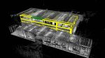
Exodigo launches subsurface imaging platform Posted by AEC Magazine - February 25, 2022 Mapping solution combines advanced sensors, 3D imaging and AI to survey underground utilities
Towards an open future: Keith Bentley interview Posted by AEC Magazine - February 7, 2022 In this frank interview, Bentley’s CTO talks cloud, subscription, digital twins and the future of 2D drawings
Enscape 3.2 streamlined with Dynamic Asset Placement Posted by AEC Magazine - December 23, 2021 Architects and designers can now place and edit assets directly inside the Enscape rendering window
The future has arrived: NXT BLD on-demand Posted by AEC Magazine - November 30, 2021 AEC Magazine's NXT BLD gives a platform for the true pioneers in our industry
Digital twins: the case for open-source Posted by Keith Bentley - October 1, 2021 In order to achieve sustainable infrastructure digital twins, it is imperative that you build your systems around open-source technology
BIM and the Notre-Dame resurrection Posted by Martyn Day - July 29, 2021 In 2019 Paris’s iconic cathedral was engulfed in flames. We explore how BIM is helping bring it back to life
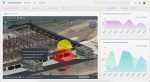
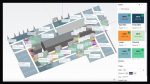
Cupix launches CupixWorks 2.0 Posted by AEC Magazine - June 15, 2021 3D ‘digital twin’ platform designed to add value across project lifecycle
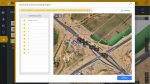
DatuBIM gets automated digital grade checking capability Posted by AEC Magazine - May 21, 2021 Process automation cuts down on labour-intensive and repetitive quality assurance work