Arvizio Immerse 3D streams drone mapped 3D models and point clouds to AR/MR devices
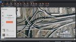
Plex-Earth expands to support BricsCAD with high-quality imagery and terrain data
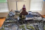
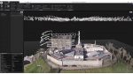
3D scanning software can now turn a point cloud into a textured 3D mesh
Signature architects among early adopters of viz-focused real time collaboration platform
Free open-source plug-in gives users of Unreal Engine ready access to 3D geospatial content
The success of Unreal Engine in gaming continues to help fund the expansion of the real-time engine within AEC
Photogrammetry software developer, Capturing Reality, has joined the Epic Games family
With a growing trend to mix and match scanning technologies, Correvate recently added support for SLAM captured data to its…
AEC Magazine launched in 2002. It is the only global publication and website to focus exclusively on Building Information Modelling…
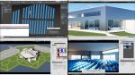
How architects can use the CAD tools they love in combination with fast real-time rendering tools like Unreal Engine and…